Chest opened
+${chestReward.xp} XP
Explorer
NOUVEAU ×${chestReward.collectible.quantity}
tapez pour fermer
Chest locked

Open chests in the app

Around Us is built for your phone — chests unlock when you walk, explore and capture nearby places.

Enable Location

We need your location to show you interesting places around you

Discover nearby places

Find interesting locations and hidden gems around you

Precise directions

Get accurate directions and distances to places

Your location is never shared with other users. It's only used when you tap the location button.

Lebanon

Log in to your account

Start exploring — it's free

Trusted by 72,881 travelers worldwide

Continue with Google
Continue with Apple
or

We will send you a code to connect

By continuing, you accept our Terms and Conditions and our Privacy Policy

Check your inbox

We've sent a pincode in your inbox. Please enter the code below.

Discussion Reviews 2 Photos
42k Popularity

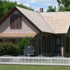
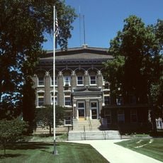
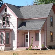
Lebanon, Municipal center in Smith County, Kansas.

Lebanon is a small city in Smith County located in north-central Kansas at an elevation of roughly 1,840 feet (560 meters). It functions as the civic center for the surrounding agricultural communities in the region.

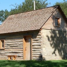
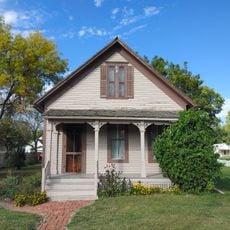
The settlement was established during the 1800s as pioneers moved westward and built communities along transportation routes through Smith County. This early founding period shaped the town's connection to agriculture.

Community life centers on farming traditions that show through local gatherings and celebrations, where residents connect over their shared rural heritage in this agricultural part of Kansas.

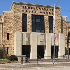
Municipal services and administrative offices are located along the main street, making them easy to find for those seeking local government support. The small-town layout means most essential services are within walking distance.

A photographer from Lebanon once traveled across the United States to visit every city sharing the country's name, including this one. This journey put the small Kansas town on an unexpected international map.

The community of curious travelers

AroundUs brings together thousands of curated places, local tips, and hidden gems, enriched daily by 60,000 contributors worldwide.

Start exploring
Location
Elevation above the sea
562 m
GPS coordinates
39.81060,-98.55610
Latest update
December 17, 2025 07:56
Around this place
Geographic center of the contiguous United States
United States of America

Geographic center of the contiguous United States

2.8 km
Willa Cather House
United States of America

Willa Cather House

31 km
Home on the Range Cabin
United States of America

Home on the Range Cabin

34.6 km
William Ducker House
United States of America

William Ducker House

31.6 km
Starke Round Barn
United States of America

Starke Round Barn

32.3 km
Jewell County Courthouse
United States of America

Jewell County Courthouse

29.7 km
Burr Oak United Methodist Church
United States of America

Burr Oak United Methodist Church

22.6 km
First National Bank Building
United States of America

First National Bank Building

20 km
Downs Carnegie Library
United States of America

Downs Carnegie Library

34.6 km
Old Cawker City Library
United States of America

Old Cawker City Library

35 km
Farmer's and Merchant's Bank Building
United States of America

Farmer's and Merchant's Bank Building

31.1 km
Auld Public Library
United States of America

Auld Public Library

31.3 km
Webster County Courthouse
United States of America

Webster County Courthouse

31.4 km
Matthew R. Bentley House
United States of America

Matthew R. Bentley House

31.7 km
Red Cloud United States Post Office
United States of America

Red Cloud United States Post Office

31.1 km
Miner House
United States of America

Miner House

31 km
Warner-Cather House
United States of America

Warner-Cather House

31.3 km
Dr. Gilbert McKeeby House
United States of America

Dr. Gilbert McKeeby House

31.4 km
Cather Childhood Home
United States of America

Cather Childhood Home

31 km
Red Cloud Bridge
United States of America

Red Cloud Bridge

28.3 km
Farmer's Bridge
United States of America

Farmer's Bridge

33 km
United States of America

Higgins Bluff

28.4 km
O.W. Francis House
United States of America

O.W. Francis House

22.8 km
United States of America

Geographic Center of the Conterminous United States

2.8 km
United States of America

Jewell County State Lake

26.8 km
United States of America

Red Cloud Golf Course

32.9 km
United States of America

Downs Golf Club

26.6 km
United States of America

Starke Round Barn

32.3 km
Show the full map
Reviews
Share your experience

No review yet

Discussions
Start a discussion...

No discussion yet

« Lebanon - Municipal center in Smith County, Kansas » is provided by Around Us (aroundus.com). Images and texts are derived from Wikimedia project under a Creative Commons license. You are allowed to copy, distribute, and modify copies of this page, under the conditions set by the license, as long as this note is clearly visible.

Discover hidden gems everywhere you go!

From secret cafés to breathtaking viewpoints, skip the crowded tourist spots and find places that match your style. Our app makes it easy with voice search, smart filtering, route optimization, and insider tips from travelers worldwide. Download now for the complete mobile experience.

Around Us App Screenshot

A unique approach to discovering new places

Le Figaro

All the places worth exploring

France Info

A tailor-made excursion in just a few clicks

20 Minutes

Around Us
Travel Guide & Maps
Download

Send to your phone

QR Code
1

Open the camera app on your mobile.

2

Point at the QR code with your camera. A notification will appear.

3

Tap the notification to open the link.