Enable Location

We need your location to show you interesting places around you

Discover nearby places

Find interesting locations and hidden gems around you

Precise directions

Get accurate directions and distances to places

Your location is never shared with other users. It's only used when you tap the location button.

Plymouth

Log in to your account

Start exploring — it's free

Trusted by 62,127 travelers worldwide

Continue with Google
Continue with Apple
or

We will send you a code to connect

By continuing, you accept our Terms and Conditions and our Privacy Policy

Check your inbox

We've sent a pincode in your inbox. Please enter the code below.

Plymouth, city in Marshall County, Indiana, United States

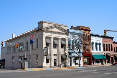
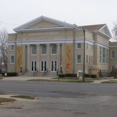
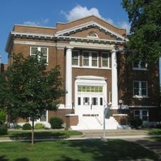
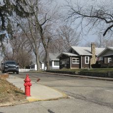
Plymouth is a city in northern Indiana along the Yellow River that serves as the county seat of Marshall County. The town spreads across a compact area with simple streets and a population just over ten thousand, making it easy to walk around and explore.

The area was home to the Potawatomi people until they were forced to leave in 1838 during a forced march over 600 miles. New England settlers arrived in the 1800s and named the town after their home region, establishing permanent communities here.

Plymouth takes its name from a town in Massachusetts, reflecting the connection to New England settlers who arrived in the 1800s. The city honors this heritage while also remembering the Potawatomi people who lived on these lands long before European settlement.

The city is laid out compactly along the Yellow River with parks and recreational facilities that are easy to reach on foot. Nearby Culver on Lake Maxinkuckee with its beaches and local restaurants is just a short drive away and complements the area for day trips.

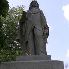
A memorial on Peach Road honors Chief Menominee and his Potawatomi companions who were removed during the 1838 forced march. This monument stands as an important place to reflect on a difficult period of American history.

The community of curious travelers

AroundUs brings together thousands of curated places, local tips, and hidden gems, enriched daily by 60,000 contributors worldwide.

Start exploring
Location
Elevation above the sea
243 m
GPS coordinates
41.34390,-86.31250
Latest update
February 7, 2026 09:31
Around this place
Chief Menominee Memorial Site
United States of America

Chief Menominee Memorial Site

6.8 km
Heminger Travel Lodge
United States of America

Heminger Travel Lodge

1.1 km
Plymouth Downtown Historic District
United States of America

Plymouth Downtown Historic District

426 m
Argos Downtown Historic District
United States of America

Argos Downtown Historic District

13.2 km
Marshall County Courthouse
United States of America

Marshall County Courthouse

120 m
Hoham-Klinghammer-Weckerle House and Brewery Site
United States of America

Hoham-Klinghammer-Weckerle House and Brewery Site

1.7 km
East Laporte Street Footbridge
United States of America

East Laporte Street Footbridge

805 m
East Shore Historic District
United States of America

East Shore Historic District

17 km
Plymouth Fire Station
United States of America

Plymouth Fire Station

336 m
Argos Izaak Walton League Historic District
United States of America

Argos Izaak Walton League Historic District

14.7 km
Plymouth Northside Historic District
United States of America

Plymouth Northside Historic District

169 m
Bourbon Community Building-Gymnasium
United States of America

Bourbon Community Building-Gymnasium

17.3 km
Marshall County Infirmary
United States of America

Marshall County Infirmary

3.9 km
Norris Farm-Maxinkuckee Orchard
United States of America

Norris Farm-Maxinkuckee Orchard

16 km
Plymouth Southside Historic District
United States of America

Plymouth Southside Historic District

169 m
Jacoby Church
United States of America

Jacoby Church

5.7 km
Lewis and Sarah Boggs House
United States of America

Lewis and Sarah Boggs House

9.7 km
Forest Place Historic District
United States of America

Forest Place Historic District

16.3 km
Ramsay-Fox Round Barn and Farm
United States of America

Ramsay-Fox Round Barn and Farm

9.2 km
Polk Township District No. 2 School
United States of America

Polk Township District No. 2 School

14.6 km
United States of America

Koontz Lake

15.6 km
United States of America

Showland Theatre

3 km
Thomson Bridge
United States of America

Thomson Bridge

1.2 km
United States of America

Culver Academies Golf Course

15.4 km
United States of America

Sprig O’Mint Golf Club

12.5 km
United States of America

Woodbury Golf Course

2.9 km
United States of America

Eppley Auditorium

15.8 km
United States of America

River Side Amphitheater

635 m
Show the full map
« Plymouth - city in Marshall County, Indiana, United States » is provided by Around Us (aroundus.com). Images and texts are derived from Wikimedia project under a Creative Commons license. You are allowed to copy, distribute, and modify copies of this page, under the conditions set by the license, as long as this note is clearly visible.

Discover hidden gems everywhere you go!

From secret cafés to breathtaking viewpoints, skip the crowded tourist spots and find places that match your style. Our app makes it easy with voice search, smart filtering, route optimization, and insider tips from travelers worldwide. Download now for the complete mobile experience.

Around Us App Screenshot

A unique approach to discovering new places

Le Figaro

All the places worth exploring

France Info

A tailor-made excursion in just a few clicks

20 Minutes

Around Us
Travel Guide & Maps
Download

Send to your phone

QR Code
1

Open the camera app on your mobile.

2

Point at the QR code with your camera. A notification will appear.

3

Tap the notification to open the link.