Chest opened
+${chestReward.xp} XP
Explorer
NOUVEAU ×${chestReward.collectible.quantity}
tapez pour fermer
Chest locked

Open chests in the app

Around Us is built for your phone — chests unlock when you walk, explore and capture nearby places.

Enable Location

We need your location to show you interesting places around you

Discover nearby places

Find interesting locations and hidden gems around you

Precise directions

Get accurate directions and distances to places

Your location is never shared with other users. It's only used when you tap the location button.

Tinton Falls

Log in to your account

Start exploring — it's free

Trusted by 72,885 travelers worldwide

Continue with Google
Continue with Apple
or

We will send you a code to connect

By continuing, you accept our Terms and Conditions and our Privacy Policy

Check your inbox

We've sent a pincode in your inbox. Please enter the code below.

Discussion Reviews 2 Photos
25.2k Popularity

Tinton Falls, Administrative division in Monmouth County, New Jersey, United States

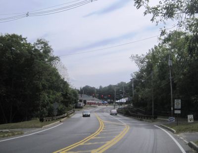
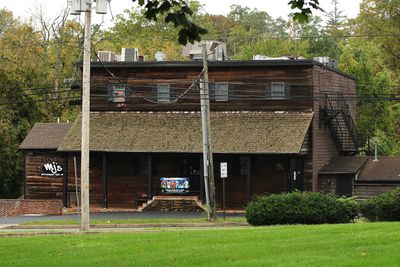
Tinton Falls is a borough in Monmouth County that spans several square miles with both residential neighborhoods and business districts throughout. Shopping centers and office buildings sit alongside family homes in different sections of the community.

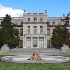
The area saw its first industrial activity in the 1600s when iron operations began, and the land later became an estate under different ownership. These early industries helped shape what the region eventually became.

The Tinton Falls School District maintains three educational facilities for kindergarten through eighth grade students, preparing them for Monmouth Regional High School.

The place is easy to navigate with shopping and services spread across different areas that are fairly close to each other. Getting around by car or on foot is straightforward in most sections.

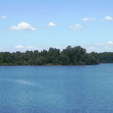
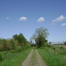
The area is home to New Jersey's tallest waterfall on the coastal plain, which once powered early mills and factories. This waterfall was central to the region's industrial development.

The community of curious travelers

AroundUs brings together thousands of curated places, local tips, and hidden gems, enriched daily by 60,000 contributors worldwide.

Start exploring
Location
Shares border with
Red Bank, Shrewsbury, Shrewsbury Township, Eatontown, Ocean Township, Neptune Township, Wall Township, Colts Neck Township, Middletown Township
GPS coordinates
40.26670,-74.09870
Latest update
December 20, 2025 11:29
Around this place
Shadow Lawn
United States of America

Shadow Lawn

8.1 km
Synagogue of Deal
United States of America

Synagogue of Deal

8.4 km
Swimming River Reservoir
United States of America

Swimming River Reservoir

5.3 km
Murry Guggenheim House
United States of America

Murry Guggenheim House

8.3 km
Shark River Park
United States of America

Shark River Park

7.2 km
T. Thomas Fortune House
United States of America

T. Thomas Fortune House

8.6 km
Allen House
United States of America

Allen House

7.1 km
Old Mill at Tinton Falls
United States of America

Old Mill at Tinton Falls

4.2 km
United States of America

Oceanport Draw

8.5 km
Christ Church , Shrewsbury
United States of America

Christ Church , Shrewsbury

7.1 km
Holmdel Arboretum
United States of America

Holmdel Arboretum

8 km
Lauren K. Woods Theatre
United States of America

Lauren K. Woods Theatre

8.4 km
United States of America

House at 364 Cedar Avenue

8.4 km
Wardell House
United States of America

Wardell House

6.9 km
St. James Memorial Church of Eatontown
United States of America

St. James Memorial Church of Eatontown

5.6 km
Tinton Falls
United States of America

Tinton Falls

4.2 km
United States of America

Shrewsbury Historic District

6.9 km
Brookdale Farm Historic District
United States of America

Brookdale Farm Historic District

8.2 km
United States of America

Tinton Falls Historic District

4.3 km
United States of America

Suneagles Golf Club

4.2 km
United States of America

Pebble Creek Golf Club

6 km
United States of America

Deal Golf and Country Club

7.7 km
United States of America

Trump National Golf Club, Colts Neck

7 km
United States of America

Hollywood Golf Club

6.6 km
United States of America

Colts Neck Golf Club

8.1 km
United States of America

Go Hawks

8.1 km
United States of America

The Involved Student

8 km
United States of America

The Hawk

7.9 km
Show the full map
Reviews
Share your experience

No review yet

Discussions
Start a discussion...

No discussion yet

« Tinton Falls - Administrative division in Monmouth County, New Jersey, United States » is provided by Around Us (aroundus.com). Images and texts are derived from Wikimedia project under a Creative Commons license. You are allowed to copy, distribute, and modify copies of this page, under the conditions set by the license, as long as this note is clearly visible.

Discover hidden gems everywhere you go!

From secret cafés to breathtaking viewpoints, skip the crowded tourist spots and find places that match your style. Our app makes it easy with voice search, smart filtering, route optimization, and insider tips from travelers worldwide. Download now for the complete mobile experience.

Around Us App Screenshot

A unique approach to discovering new places

Le Figaro

All the places worth exploring

France Info

A tailor-made excursion in just a few clicks

20 Minutes

Around Us
Travel Guide & Maps
Download

Send to your phone

QR Code
1

Open the camera app on your mobile.

2

Point at the QR code with your camera. A notification will appear.

3

Tap the notification to open the link.