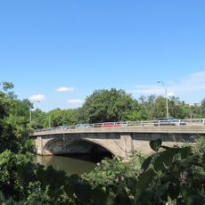
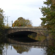
Charles River Reservation Parkways, Historic parkway network along Charles River in Boston, United States.
The Charles River Reservation Parkways form a connected system of roads and paths stretching from downtown Boston through several neighborhoods to outlying areas. The network includes flat terrain along the river, nearby green spaces, and designated areas for walking, cycling, and water activities.
The parkways were designed and built in the 1890s by landscape architect Charles Eliot and the Olmsted Brothers firm. The project transformed swampy riverbanks into public recreational spaces and became a model for protecting natural areas within cities.
The parkways were created to give city residents access to nature as Boston expanded rapidly in the late 1800s. Today, people of all ages use the paths for walking, cycling, and spending time outdoors by the water.
The paths are easily accessible on foot and by bike, with multiple entry points scattered across different neighborhoods. Visitors should know that some areas have seasonal variations in conditions, and parking can be limited at popular spots.
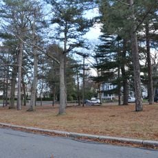
The lower sections near downtown feature formal, structured designs with fountains and monuments, while upper sections transition into natural woodland paths with fewer visitors. These contrasts were intentional in the original design, which planned different functions for different urban areas.
The community of curious travelers
AroundUs brings together thousands of curated places, local tips, and hidden gems, enriched daily by 60,000 contributors worldwide.