Chambersburg

Log in to your account

AroundUs is a community-driven map of interesting places, built by curious explorers like you. It grows with every review, story, and photo you share.
Connect to save your favorite spots, contribute locations, and create personalized routes.
Continue with Google
Continue with Apple
Continue with X
Continue with Facebook
Continue with email
By continuing, you accept our Terms and Conditions and our Privacy Policy
Create an account
Add to collection
Map
Suggest a change
Share

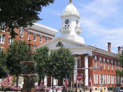
Chambersburg, County seat borough in Franklin County, Pennsylvania, United States

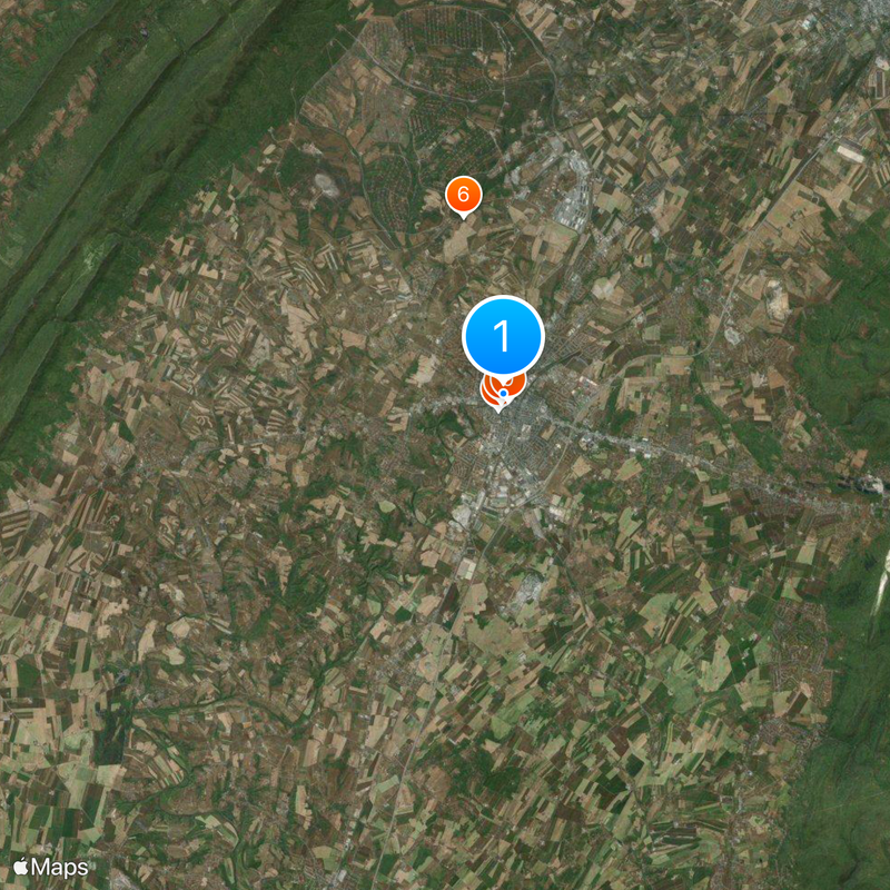
Chambersburg is a county seat borough where Conococheague Creek meets Falling Spring Creek, surrounded by farmland and rolling hills in the Cumberland Valley of South Central Pennsylvania. The town manages its own electric grid, gas lines, water supply, and sewer system independently, which allows direct oversight of these public utilities.

Benjamin Chambers built water mills in 1730 and established a settlement that became official with a land grant of about 162 hectares in 1734. Confederate troops set fire to the northern part of town on July 30, 1864, after residents refused to pay a ransom during the Civil War.

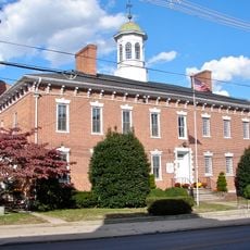
The Franklin County Heritage Center, housed in a 1915 marble bank building, presents exhibits about frontier life, architecture, and transportation through five thematic sections.

The Franklin County Heritage Center occupies a former marble bank building from 1915 and displays exhibits on frontier life, architecture, and transport across five themed sections. The town lies in the southern Cumberland Valley surrounded by farmland and gentle hills, making orientation and access straightforward.

The town has supplied its own electricity and gas for decades, which results in consistently lower rates than private providers in the region. Some streets in the old center still follow lot lines that were surveyed after the 1864 fire.

Location: Franklin County

Inception: 1734

Elevation above the sea: 192 m

Website: http://borough.chambersburg.pa.us

GPS coordinates: 39.93751,-77.66126

Latest update: December 13, 2025 17:02

Photos
Around this place
Wilson College
United States of America

Wilson College

1.4 km
Franklin County Courthouse
United States of America

Franklin County Courthouse

13 m
Franklin County Jail
United States of America

Franklin County Jail

204 m
John Brown House
United States of America

John Brown House

222 m
Rocky Spring Presbyterian Church
United States of America

Rocky Spring Presbyterian Church

5.8 km
Zion Reformed Church
United States of America

Zion Reformed Church

556 m
Capitol Theatre
United States of America

Capitol Theatre

307 m
Masonic Temple
United States of America

Masonic Temple

254 m
Chambersburg Historic District
United States of America

Chambersburg Historic District

959 m
Brotherton Farm
United States of America

Brotherton Farm

4.8 km
United States of America

Memorial Fountain and Statue

4 m
Gass House
United States of America

Gass House

2.9 km
Coldbrook Farm
United States of America

Coldbrook Farm

1.6 km
James Finley House
United States of America

James Finley House

7.1 km
Townhouse Row
United States of America

Townhouse Row

136 m
Chambersburg and Bedford Turnpike Road Company Toll House
United States of America

Chambersburg and Bedford Turnpike Road Company Toll House

13.3 km
Bridge between Guilford and Hamilton Townships
United States of America

Bridge between Guilford and Hamilton Townships

7.3 km
Franklin Furnace Historic District
United States of America

Franklin Furnace Historic District

14 km
Corker Hill
United States of America

Corker Hill

8 km
Culbertson-Harbison Farm
United States of America

Culbertson-Harbison Farm

9.3 km
Old Brown's Mill School
United States of America

Old Brown's Mill School

12.4 km
United States of America

Penn National Golf Course

12.8 km
United States of America

Penn National

13.7 km
United States of America

Penn National Golf Course

12.3 km
United States of America

Conocodell Golf Course

10.3 km
United States of America

Chambersburg Country Club

6.6 km
United States of America

Work of art, statue

1.2 km
United States of America

9/11 Memorial

6.5 km
Show the full map
Reviews

Visited this place? Tap the stars to rate it and share your experience / photos with the community! Try now! You can cancel it anytime.

« Chambersburg - County seat borough in Franklin County, Pennsylvania, United States » is provided by Around Us (aroundus.com). Images and texts are derived from Wikimedia project under a Creative Commons license. You are allowed to copy, distribute, and modify copies of this page, under the conditions set by the license, as long as this note is clearly visible.

Discover hidden gems everywhere you go!

From secret cafés to breathtaking viewpoints, skip the crowded tourist spots and find places that match your style. Our app makes it easy with voice search, smart filtering, route optimization, and insider tips from travelers worldwide. Download now for the complete mobile experience.

Around Us App Screenshot

A unique approach to discovering new places

Le Figaro

All the places worth exploring

France Info

A tailor-made excursion in just a few clicks

20 Minutes