Enable Location

We need your location to show you interesting places around you

Discover nearby places

Find interesting locations and hidden gems around you

Precise directions

Get accurate directions and distances to places

Your location is never shared with other users. It's only used when you tap the location button.

Montgomery Worsted Mills

Log in to your account

Start exploring — it's free

Trusted by 62,284 travelers worldwide

Continue with Google
Continue with Apple
or

We will send you a code to connect

By continuing, you accept our Terms and Conditions and our Privacy Policy

Check your inbox

We've sent a pincode in your inbox. Please enter the code below.

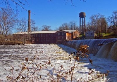
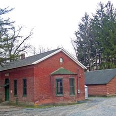
Montgomery Worsted Mills, Historic watermill in Montgomery, United States.

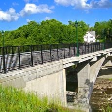
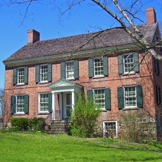
Montgomery Worsted Mills is a textile mill along the Wallkill River with a main brick building and two side structures for hydroelectric systems and offices. The facility uses the river water to generate electricity and operates a retail shop selling yarn products.

The mill was founded in 1813 and rebuilt in 1892 after a fire damaged the original structure, establishing itself as a major textile producer. During the Great Depression, textile production ceased but the facility shifted to hydroelectric generation instead.

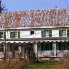
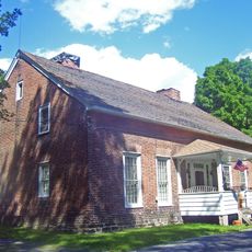
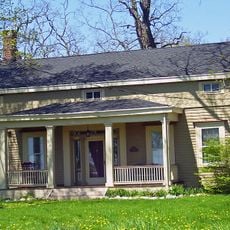
The mill complex shapes the local landscape with its brick buildings and worker housing lining Factory Street, making the industrial past visible in the community. These structures tell the story of how the area grew around the factory operations.

The site is accessible to visitors during business hours, with a retail shop where you can purchase yarn products. The location sits directly along the river, offering good views of the hydroelectric equipment and historic buildings.

Remarkably, the mill continues to sell yarn products through its shop even though production shifted away from textiles to electricity generation. This unusual blend of modern power operations with sales of traditional yarn products sets it apart from typical industrial sites.

The community of curious travelers

AroundUs brings together thousands of curated places, local tips, and hidden gems, enriched daily by 60,000 contributors worldwide.

Start exploring
Location
GPS coordinates
41.53056,-74.22667
Latest update
December 13, 2025 11:47
Around this place
Peale's Barber Farm Mastodon Exhumation Site
United States of America

Peale's Barber Farm Mastodon Exhumation Site

874 m
Winding Hills Park
United States of America

Winding Hills Park

4.1 km
African-American Cemetery
United States of America

African-American Cemetery

3.7 km
Walden United Methodist Church
United States of America

Walden United Methodist Church

4.4 km
Jacob T. Walden Stone House
United States of America

Jacob T. Walden Stone House

4.7 km
Ward's Bridge
United States of America

Ward's Bridge

987 m
Bridge Street Historic District
United States of America

Bridge Street Historic District

1.2 km
Benjamin Haines House
United States of America

Benjamin Haines House

3.5 km
John Blake House
United States of America

John Blake House

4.4 km
Walden Veterans' Memorial Bridge
United States of America

Walden Veterans' Memorial Bridge

4.3 km
The Smith House
United States of America

The Smith House

2.6 km
Daniel Waring House
United States of America

Daniel Waring House

825 m
Bodine's Bridge
United States of America

Bodine's Bridge

4.4 km
Patchett House
United States of America

Patchett House

534 m
Walden Low Bridge
United States of America

Walden Low Bridge

4.6 km
Gilbert Millspaugh House
United States of America

Gilbert Millspaugh House

4.5 km
Jacob Bookstaver House
United States of America

Jacob Bookstaver House

4.7 km
Johannes Miller House
United States of America

Johannes Miller House

3 km
John A. Crabtree House
United States of America

John A. Crabtree House

217 m
John R. Hays House
United States of America

John R. Hays House

4.5 km
Peachcroft
United States of America

Peachcroft

2 km
Tweddle Farmstead
United States of America

Tweddle Farmstead

2.8 km
Gideon Pelton Farm
United States of America

Gideon Pelton Farm

3.2 km
Jacob Shafer House
United States of America

Jacob Shafer House

3.8 km
Union Street–Academy Hill Historic District
United States of America

Union Street–Academy Hill Historic District

1.1 km
Milliken-Smith Farm
United States of America

Milliken-Smith Farm

1.5 km
Montgomery Water Works
United States of America

Montgomery Water Works

588 m
Nathaniel Hill Brick House
United States of America

Nathaniel Hill Brick House

4.3 km
Show the full map
« Montgomery Worsted Mills - Historic watermill in Montgomery, United States » is provided by Around Us (aroundus.com). Images and texts are derived from Wikimedia project under a Creative Commons license. You are allowed to copy, distribute, and modify copies of this page, under the conditions set by the license, as long as this note is clearly visible.

Discover hidden gems everywhere you go!

From secret cafés to breathtaking viewpoints, skip the crowded tourist spots and find places that match your style. Our app makes it easy with voice search, smart filtering, route optimization, and insider tips from travelers worldwide. Download now for the complete mobile experience.

Around Us App Screenshot

A unique approach to discovering new places

Le Figaro

All the places worth exploring

France Info

A tailor-made excursion in just a few clicks

20 Minutes

Around Us
Travel Guide & Maps
Download

Send to your phone

QR Code
1

Open the camera app on your mobile.

2

Point at the QR code with your camera. A notification will appear.

3

Tap the notification to open the link.