Enable Location

We need your location to show you interesting places around you

Discover nearby places

Find interesting locations and hidden gems around you

Precise directions

Get accurate directions and distances to places

Your location is never shared with other users. It's only used when you tap the location button.

Bridge Street Historic District

Log in to your account

Start exploring — it's free

Trusted by 63,013 travelers worldwide

Continue with Google
Continue with Apple
or

We will send you a code to connect

By continuing, you accept our Terms and Conditions and our Privacy Policy

Check your inbox

We've sent a pincode in your inbox. Please enter the code below.

Discussion Reviews 1 Photos
1.1k Popularity

Bridge Street Historic District, listed on the NRHP in New York

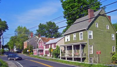
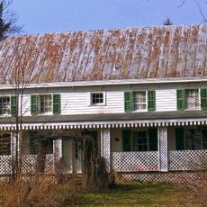
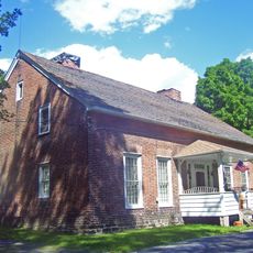
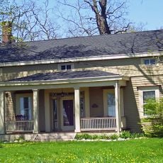
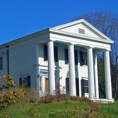
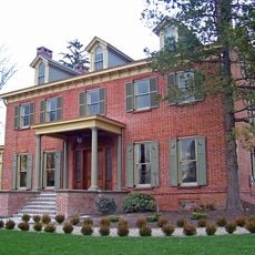
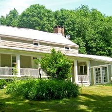
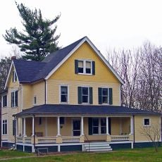
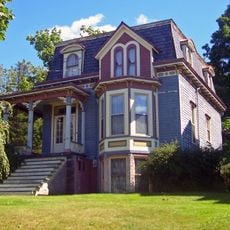
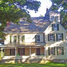
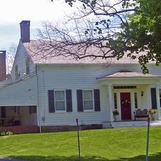
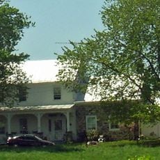
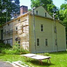
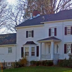
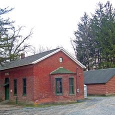
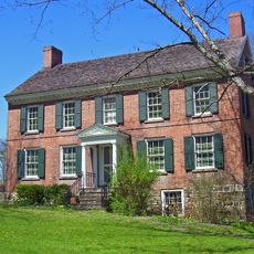
The Bridge Street Historic District is a neighborhood of roughly 28 buildings dating from the late 1700s and early 1800s in Montgomery, New York. The structures display Federal and Greek Revival styles with brick or wood exteriors, pitched roofs, tall windows, and ornamental details around doorways and windows.

The oldest building in the district dates to 1792, marking the start of permanent settlement in this area during Montgomery's early growth period. Most homes were built during the late 1700s and early 1800s when the village was developing as a trading and community center.

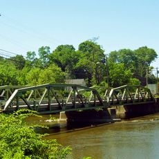
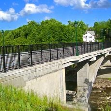
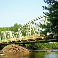
The street takes its name from Ward's Bridge, which crosses the Wallkill River and serves as the gateway to the village. Residents maintain pride in their surroundings and keep local traditions alive through daily life in these century-old homes.

The district is located along Bridge Street near Ward's Bridge where Route 17K enters Montgomery. The area is accessible for walking, allowing visitors to explore and view the historic buildings and their architectural features from the street at their own pace.

Ward's Bridge, from which the street takes its name, historically marked the boundary between the village and surrounding territories. This modest crossing of the Wallkill River was long a key point for trade and travel in the region.

The community of curious travelers

AroundUs brings together thousands of curated places, local tips, and hidden gems, enriched daily by 60,000 contributors worldwide.

Start exploring
Location
GPS coordinates
41.52722,-74.24028
Latest update
February 9, 2026 11:06
Around this place
Montgomery Worsted Mills
United States of America

Montgomery Worsted Mills

1.2 km
Peale's Barber Farm Mastodon Exhumation Site
United States of America

Peale's Barber Farm Mastodon Exhumation Site

1.9 km
Winding Hills Park
United States of America

Winding Hills Park

3.1 km
African-American Cemetery
United States of America

African-American Cemetery

2.8 km
Walden United Methodist Church
United States of America

Walden United Methodist Church

5.5 km
Ward's Bridge
United States of America

Ward's Bridge

249 m
Benjamin Haines House
United States of America

Benjamin Haines House

4.7 km
John Blake House
United States of America

John Blake House

4.5 km
Walden Veterans' Memorial Bridge
United States of America

Walden Veterans' Memorial Bridge

5.4 km
The Smith House
United States of America

The Smith House

2.8 km
Daniel Waring House
United States of America

Daniel Waring House

390 m
Bodine's Bridge
United States of America

Bodine's Bridge

3.4 km
Patchett House
United States of America

Patchett House

1.1 km
Walden Low Bridge
United States of America

Walden Low Bridge

5.6 km
Gilbert Millspaugh House
United States of America

Gilbert Millspaugh House

5.6 km
Johannes Miller House
United States of America

Johannes Miller House

2 km
Jacob Bookstaver House
United States of America

Jacob Bookstaver House

5.3 km
John A. Crabtree House
United States of America

John A. Crabtree House

1.1 km
John R. Hays House
United States of America

John R. Hays House

5.6 km
Peachcroft
United States of America

Peachcroft

3 km
Tweddle Farmstead
United States of America

Tweddle Farmstead

2.4 km
Gideon Pelton Farm
United States of America

Gideon Pelton Farm

2.5 km
Abraham Dickerson Farmhouse
United States of America

Abraham Dickerson Farmhouse

5.1 km
Jacob Shafer House
United States of America

Jacob Shafer House

2.6 km
Union Street–Academy Hill Historic District
United States of America

Union Street–Academy Hill Historic District

270 m
Milliken-Smith Farm
United States of America

Milliken-Smith Farm

2.6 km
Montgomery Water Works
United States of America

Montgomery Water Works

1.2 km
Nathaniel Hill Brick House
United States of America

Nathaniel Hill Brick House

5.4 km
Show the full map
Reviews
Share your experience

No review yet

Discussions
Start a discussion...

No discussion yet

« Bridge Street Historic District - listed on the NRHP in New York » is provided by Around Us (aroundus.com). Images and texts are derived from Wikimedia project under a Creative Commons license. You are allowed to copy, distribute, and modify copies of this page, under the conditions set by the license, as long as this note is clearly visible.

Discover hidden gems everywhere you go!

From secret cafés to breathtaking viewpoints, skip the crowded tourist spots and find places that match your style. Our app makes it easy with voice search, smart filtering, route optimization, and insider tips from travelers worldwide. Download now for the complete mobile experience.

Around Us App Screenshot

A unique approach to discovering new places

Le Figaro

All the places worth exploring

France Info

A tailor-made excursion in just a few clicks

20 Minutes

Around Us
Travel Guide & Maps
Download

Send to your phone

QR Code
1

Open the camera app on your mobile.

2

Point at the QR code with your camera. A notification will appear.

3

Tap the notification to open the link.