Chest opened
+${chestReward.xp} XP
Explorer
NOUVEAU ×${chestReward.collectible.quantity}
tapez pour fermer
Chest locked

Open chests in the app

Around Us is built for your phone — chests unlock when you walk, explore and capture nearby places.

Enable Location

We need your location to show you interesting places around you

Discover nearby places

Find interesting locations and hidden gems around you

Precise directions

Get accurate directions and distances to places

Your location is never shared with other users. It's only used when you tap the location button.

Log in to your account

Start exploring — it's free

Trusted by 72,891 travelers worldwide

Continue with Google
Continue with Apple
or

We will send you a code to connect

By continuing, you accept our Terms and Conditions and our Privacy Policy

Check your inbox

We've sent a pincode in your inbox. Please enter the code below.

Olmsted Park
Discussion Reviews Photo
5k Popularity

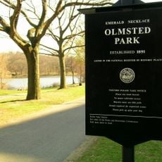
Olmsted Park, Urban park system in Boston, United States.

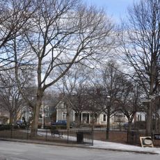
Olmsted Park is a park system in Boston featuring walking trails, open meadows, and water features. It connects Jamaica Pond and Leverett Pond as part of a larger network of green spaces.

Frederick Law Olmsted designed this park in the late 19th century as part of his vision for urban green spaces. His work established a new approach to bringing nature into cities.

The park functions as a place where visitors can observe and connect with local nature in the city. Birdwatchers and nature lovers regularly come here to discover native species in their natural surroundings.

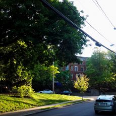
The park has multiple entry points around its perimeter that are easy for visitors to reach. Parking areas and public transit connections make getting there straightforward.

The park connects multiple ponds and water features through restored pathways and wooden bridges. These connections create a unified space where water and walking routes flow seamlessly together.

The community of curious travelers

AroundUs brings together thousands of curated places, local tips, and hidden gems, enriched daily by 60,000 contributors worldwide.

Start exploring
Part of
Emerald Necklace
GPS coordinates
42.32590,-71.11490
Latest update
December 10, 2025 20:00
Around this place
Brookline
United States of America

Brookline

850 m
Emerald Necklace
United States of America

Emerald Necklace

47 m
Lucy Parsons Center
United States of America

Lucy Parsons Center

719 m
Pinebank Mansion
United States of America

Pinebank Mansion

797 m
Timothy Hoxie House
United States of America

Timothy Hoxie House

982 m
William Ingersoll Bowditch House
United States of America

William Ingersoll Bowditch House

1.1 km
Pill Hill Historic District
United States of America

Pill Hill Historic District

524 m
House at 9 Linden Street
United States of America

House at 9 Linden Street

1 km
Old Burying Ground
United States of America

Old Burying Ground

1.1 km
Eliphalet Spurr House
United States of America

Eliphalet Spurr House

678 m
House at 4 Perry Street
United States of America

House at 4 Perry Street

1.1 km
Thomas Aspinwall Davis House
United States of America

Thomas Aspinwall Davis House

1 km
Ginery Twitchell House
United States of America

Ginery Twitchell House

848 m
Edward H. Haskell Home for Nurses
United States of America

Edward H. Haskell Home for Nurses

633 m
Dr. Tappan Eustis Francis House
United States of America

Dr. Tappan Eustis Francis House

870 m
House at 105 Marion Street
United States of America

House at 105 Marion Street

977 m
White Place Historic District
United States of America

White Place Historic District

511 m
House at 19 Linden Street
United States of America

House at 19 Linden Street

1 km
House at 53 Linden Street
United States of America

House at 53 Linden Street

964 m
House at 44 Linden Street
United States of America

House at 44 Linden Street

976 m
Cypress-Emerson Historic District
United States of America

Cypress-Emerson Historic District

998 m
House at 38–40 Webster Place
United States of America

House at 38–40 Webster Place

896 m
Saint Mary of the Assumption Church, Rectory, School and Convent
United States of America

Saint Mary of the Assumption Church, Rectory, School and Convent

1.1 km
Linden Park
United States of America

Linden Park

1 km
Blessed Sacrament Church
United States of America

Blessed Sacrament Church

691 m
House at 17 Cranston Street
United States of America

House at 17 Cranston Street

708 m
Linden Square
United States of America

Linden Square

1 km
House at 12 Linden Street
United States of America

House at 12 Linden Street

1 km
Show the full map
Reviews
Share your experience

No review yet

Discussions
Start a discussion...

No discussion yet

« Olmsted Park - Urban park system in Boston, United States » is provided by Around Us (aroundus.com). Images and texts are derived from Wikimedia project under a Creative Commons license. You are allowed to copy, distribute, and modify copies of this page, under the conditions set by the license, as long as this note is clearly visible.

Discover hidden gems everywhere you go!

From secret cafés to breathtaking viewpoints, skip the crowded tourist spots and find places that match your style. Our app makes it easy with voice search, smart filtering, route optimization, and insider tips from travelers worldwide. Download now for the complete mobile experience.

Around Us App Screenshot

A unique approach to discovering new places

Le Figaro

All the places worth exploring

France Info

A tailor-made excursion in just a few clicks

20 Minutes

Around Us
Travel Guide & Maps
Download

Send to your phone

QR Code
1

Open the camera app on your mobile.

2

Point at the QR code with your camera. A notification will appear.

3

Tap the notification to open the link.