Chest opened
+${chestReward.xp} XP
Explorer
NOUVEAU ×${chestReward.collectible.quantity}
tapez pour fermer
Chest locked

Open chests in the app

Around Us is built for your phone — chests unlock when you walk, explore and capture nearby places.

Enable Location

We need your location to show you interesting places around you

Discover nearby places

Find interesting locations and hidden gems around you

Precise directions

Get accurate directions and distances to places

Your location is never shared with other users. It's only used when you tap the location button.

Winneconne

Log in to your account

Start exploring — it's free

Trusted by 72,889 travelers worldwide

Continue with Google
Continue with Apple
or

We will send you a code to connect

By continuing, you accept our Terms and Conditions and our Privacy Policy

Check your inbox

We've sent a pincode in your inbox. Please enter the code below.

Discussion Reviews 1 Photos
11.3k Popularity

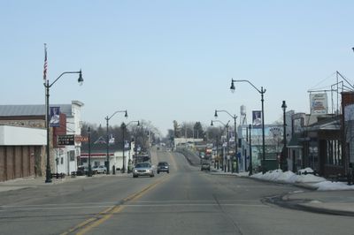
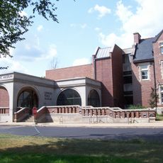
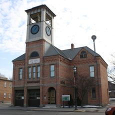
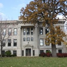
Winneconne, River village in Winnebago County, Wisconsin, United States

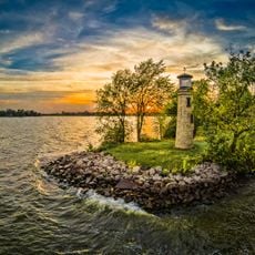
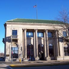
Winneconne is a river village in Winnebago County, Wisconsin, situated where the Wolf River connects three major lakes. The waterway flows through Poygan, Winneconne, and Butte des Morts, forming a natural network that defines the local landscape.

The Menominee people lived in this region until the Treaty of Poygan in 1852, when they ceded additional lands to the United States government. This agreement changed the course of settlement and development in the area.

Water activities shape daily life here, with fishing and boating woven into how residents spend their free time year-round. This connection to the river and lakes runs through the community's identity and traditions.

The village is accessible by road and offers easy access to outdoor and water activities in the surrounding area. Plan visits around seasonal conditions, as river and lake activities depend heavily on weather and time of year.

In 1967, the village declared itself a sovereign state after being left off Wisconsin road maps, sparking a tongue-in-cheek protest that became tradition. This annual celebration called Sovereign State Days remains a source of local pride and humor.

The community of curious travelers

AroundUs brings together thousands of curated places, local tips, and hidden gems, enriched daily by 60,000 contributors worldwide.

Start exploring
GPS coordinates
44.11082,-88.71261
Latest update
December 8, 2025 13:41
Around this place
EAA Aviation Museum
United States of America

EAA Aviation Museum

17.8 km
Paine Art Center and Gardens
United States of America

Paine Art Center and Gardens

14.9 km
Titan Stadium
United States of America

Titan Stadium

15.4 km
Oshkosh Grand Opera House
United States of America

Oshkosh Grand Opera House

17.4 km
Oshkosh Public Museum
United States of America

Oshkosh Public Museum

15 km
Menominee Park Zoo
United States of America

Menominee Park Zoo

18.5 km
Asylum Light
United States of America

Asylum Light

16.7 km
Robert Lutz House
United States of America

Robert Lutz House

16.8 km
Rockwell Light
United States of America

Rockwell Light

19.3 km
Paine Art Center and Gardens
United States of America

Paine Art Center and Gardens

15 km
First Presbyterian Church
United States of America

First Presbyterian Church

17.2 km
Richard Guenther House
United States of America

Richard Guenther House

18.4 km
Trinity Episcopal Church
United States of America

Trinity Episcopal Church

17.2 km
Franklyn C. Shattuck House
United States of America

Franklyn C. Shattuck House

22.3 km
Oviatt House
United States of America

Oviatt House

15.9 km
Henry Sherry House
United States of America

Henry Sherry House

22.4 km
Neenah United States Post Office
United States of America

Neenah United States Post Office

21.5 km
Jessie Jack Hooper House
United States of America

Jessie Jack Hooper House

15.4 km
Algoma Boulevard Historic District
United States of America

Algoma Boulevard Historic District

15.2 km
Omro Village Hall and Engine House
United States of America

Omro Village Hall and Engine House

8.3 km
First Methodist Church
United States of America

First Methodist Church

17.3 km
Hiram Smith House
United States of America

Hiram Smith House

21.2 km
Algoma Boulevard United Methodist Church
United States of America

Algoma Boulevard United Methodist Church

15.3 km
Orville Beach Memorial Manual Training School
United States of America

Orville Beach Memorial Manual Training School

17.1 km
Washington Park SplashPad
United States of America

Washington Park SplashPad

20.6 km
Classic Lanes Fox Valley
United States of America

Classic Lanes Fox Valley

18.8 km
T&O Lanes
United States of America

T&O Lanes

17.7 km
Daily Northwestern Building
United States of America

Daily Northwestern Building

17.6 km
Show the full map
Reviews
Share your experience

No review yet

Discussions
Start a discussion...

No discussion yet

« Winneconne - River village in Winnebago County, Wisconsin, United States » is provided by Around Us (aroundus.com). Images and texts are derived from Wikimedia project under a Creative Commons license. You are allowed to copy, distribute, and modify copies of this page, under the conditions set by the license, as long as this note is clearly visible.

Discover hidden gems everywhere you go!

From secret cafés to breathtaking viewpoints, skip the crowded tourist spots and find places that match your style. Our app makes it easy with voice search, smart filtering, route optimization, and insider tips from travelers worldwide. Download now for the complete mobile experience.

Around Us App Screenshot

A unique approach to discovering new places

Le Figaro

All the places worth exploring

France Info

A tailor-made excursion in just a few clicks

20 Minutes

Around Us
Travel Guide & Maps
Download

Send to your phone

QR Code
1

Open the camera app on your mobile.

2

Point at the QR code with your camera. A notification will appear.

3

Tap the notification to open the link.