Enable Location

We need your location to show you interesting places around you

Discover nearby places

Find interesting locations and hidden gems around you

Precise directions

Get accurate directions and distances to places

Your location is never shared with other users. It's only used when you tap the location button.

Windsor

Log in to your account

Start exploring — it's free

Trusted by 62,043 travelers worldwide

Continue with Google
Continue with Apple
or

We will send you a code to connect

By continuing, you accept our Terms and Conditions and our Privacy Policy

Check your inbox

We've sent a pincode in your inbox. Please enter the code below.

Windsor, Administrative division in North Carolina, United States.

Windsor is a municipality in North Carolina that serves as a local administrative hub for the surrounding region. The town manages essential services including street maintenance, permits, and municipal affairs for its residents.

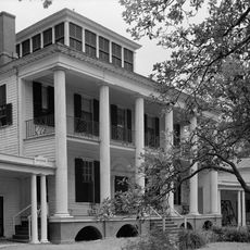
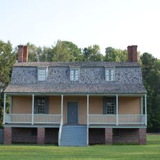
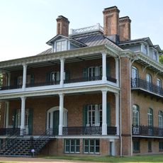
Windsor was established as a settlement during the early phase of European colonization in the Southeast and developed into an organized municipality. The town continues to shape local history and governance in the region today.

Windsor's administrative offices coordinate various community programs through their Information Services department, connecting residents with essential municipal resources.

Most administrative tasks can be handled during regular business hours on weekdays when offices are open. It helps to clarify ahead of time what documents or information you need to bring.

Located at precise coordinates of 35.9984925 latitude and -76.9460641 longitude, Windsor maintains specific geographic boundaries for administrative purposes.

The community of curious travelers

AroundUs brings together thousands of curated places, local tips, and hidden gems, enriched daily by 60,000 contributors worldwide.

Start exploring
GPS coordinates
35.99849,-76.94606
Latest update
December 7, 2025 20:26
Around this place
Hayes Plantation
United States of America

Hayes Plantation

31.5 km
Historic Hope (North Carolina)
United States of America

Historic Hope (North Carolina)

21 km
Roanoke River Light
United States of America

Roanoke River Light

30.9 km
Cupola House
United States of America

Cupola House

30.9 km
Edenton Historic District
United States of America

Edenton Historic District

31 km
St. Paul's Church, Edenton
United States of America

St. Paul's Church, Edenton

31.1 km
Barker House
United States of America

Barker House

31 km
Chowan County Courthouse
United States of America

Chowan County Courthouse

31.1 km
James Iredell House
United States of America

James Iredell House

31.3 km
Latham House
United States of America

Latham House

23.2 km
King House
United States of America

King House

7.5 km
Williamston Colored School
United States of America

Williamston Colored School

19.9 km
Rosefield
United States of America

Rosefield

402 m
Pembroke Hall
United States of America

Pembroke Hall

30.9 km
Skewarkey Primitive Baptist Church
United States of America

Skewarkey Primitive Baptist Church

20.6 km
Wessington House
United States of America

Wessington House

30.9 km
Martin County Courthouse
United States of America

Martin County Courthouse

17.7 km
Asa Biggs House and Site
United States of America

Asa Biggs House and Site

18.7 km
Perry-Spruill House
United States of America

Perry-Spruill House

23.2 km
William H. Lee House
United States of America

William H. Lee House

23.8 km
Roberts H. Jernigan House
United States of America

Roberts H. Jernigan House

31.5 km
Edenton Cotton Mill Historic District
United States of America

Edenton Cotton Mill Historic District

31.7 km
Cullen and Elizabeth Jones House
United States of America

Cullen and Elizabeth Jones House

30.8 km
Williamston Commercial Historic District
United States of America

Williamston Commercial Historic District

18.8 km
Williamston Historic District
United States of America

Williamston Historic District

18.9 km
Roanoke River Light
United States of America

Roanoke River Light

30.8 km
Taylor Twin Cinema
United States of America

Taylor Twin Cinema

31 km
Lane House
United States of America

Lane House

31.5 km
Show the full map
« Windsor - Administrative division in North Carolina, United States » is provided by Around Us (aroundus.com). Images and texts are derived from Wikimedia project under a Creative Commons license. You are allowed to copy, distribute, and modify copies of this page, under the conditions set by the license, as long as this note is clearly visible.

Discover hidden gems everywhere you go!

From secret cafés to breathtaking viewpoints, skip the crowded tourist spots and find places that match your style. Our app makes it easy with voice search, smart filtering, route optimization, and insider tips from travelers worldwide. Download now for the complete mobile experience.

Around Us App Screenshot

A unique approach to discovering new places

Le Figaro

All the places worth exploring

France Info

A tailor-made excursion in just a few clicks

20 Minutes

Around Us
Travel Guide & Maps
Download

Send to your phone

QR Code
1

Open the camera app on your mobile.

2

Point at the QR code with your camera. A notification will appear.

3

Tap the notification to open the link.