De Smet

Log in to your account

AroundUs is a community-driven map of interesting places, built by curious explorers like you. It grows with every review, story, and photo you share.
Connect to save your favorite spots, contribute locations, and create personalized routes.
By continuing, you accept our Terms and Conditions and our Privacy Policy
Add to collection
Map
Suggest a change
Share

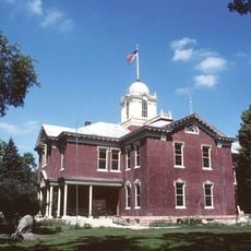
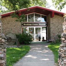
De Smet, County seat in Kingsbury County, South Dakota, United States

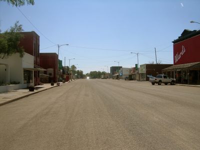
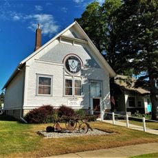
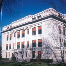
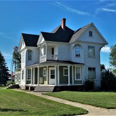
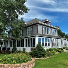
De Smet is the county seat in Kingsbury County, South Dakota, serving as a small administrative and commercial center for the surrounding region. The town displays a mix of buildings spanning from its early years through the 1900s, creating a landscape that reflects rural settlement patterns from that era.

The town was founded in 1880 and named after Belgian Jesuit missionary Father Pierre De Smet, whose work influenced settlements across the western frontier. By the early 1900s, the location grew from scattered farms into an important commercial and trading center for the region.

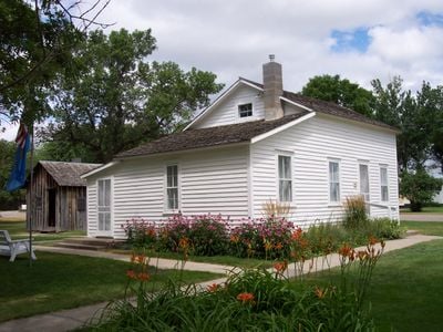
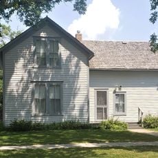
The town maintains a strong connection to Laura Ingalls Wilder's literary legacy through preserved buildings featured in her famous novels. Visitors can walk through locations mentioned in her stories and see where significant moments from her books took place.

The town is easily accessible via U.S. Route 14 and South Dakota Highway 25, which connect it well to surrounding areas and larger towns. A small airport serves the area from the north, providing a local option for air travel if needed.

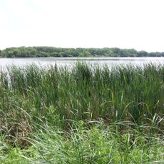
The area experiences extreme swings between hot summers and brutally cold winters, with temperature records spanning from well over 100 degrees Fahrenheit (38°C) to far below zero. These harsh conditions shaped both the landscape and the character of people who settled this region.

Location: Kingsbury County

Inception: 1880

Elevation above the sea: 526 m

Website: http://desmetsd.com

GPS coordinates: 44.38583,-97.55167

Latest update: December 6, 2025 21:26

Photos
Around this place
Show the full map
Ingalls House
United States of America

Ingalls House

251 m
Oakwood Lakes State Park
United States of America

Oakwood Lakes State Park

45.9 km
Lake Herman State Park
United States of America

Lake Herman State Park

53.7 km
Chapel Emmanuel Railroad Car
United States of America

Chapel Emmanuel Railroad Car

52.2 km
Brookings County Courthouse
United States of America

Brookings County Courthouse

60.8 km
Wenona Hall and Wecota Hall
United States of America

Wenona Hall and Wecota Hall

61.2 km
Pyle House
United States of America

Pyle House

52.4 km
Children's Museum of South Dakota
United States of America

Children's Museum of South Dakota

60.7 km
J. Whitney Goff Round Barn
United States of America

J. Whitney Goff Round Barn

50.9 km
Laura Ingalls Wilder Homestead
United States of America

Laura Ingalls Wilder Homestead

2.1 km
Bethel Church
United States of America

Bethel Church

45.1 km
Chicago and North Western Roundhouse
United States of America

Chicago and North Western Roundhouse

52.1 km
Nick's Hamburger Shop
United States of America

Nick's Hamburger Shop

60.5 km
Grace Episcopal Church
United States of America

Grace Episcopal Church

52.7 km
Hattie O. and Henry Drake Octagon House
United States of America

Hattie O. and Henry Drake Octagon House

53.5 km
Arlington Masonic Temple
United States of America

Arlington Masonic Temple

33.3 km
Hamlin County Courthouse
United States of America

Hamlin County Courthouse

40.9 km
Adam and Minnie Royhl House
United States of America

Adam and Minnie Royhl House

33.1 km
Clark County Courthouse
United States of America

Clark County Courthouse

56.8 km
Thomas H. Ruth House
United States of America

Thomas H. Ruth House

187 m
Brookings Commercial Historic District
United States of America

Brookings Commercial Historic District

60.6 km
Kingsbury County Courthouse
United States of America

Kingsbury County Courthouse

553 m
South Dakota Department of Transportation Bridge No. 03-327-230
United States of America

South Dakota Department of Transportation Bridge No. 03-327-230

40.1 km
McMonies Barn
United States of America

McMonies Barn

52.3 km
South Dakota Art Museum
United States of America

South Dakota Art Museum

61.3 km
Cherry Lanes
United States of America

Cherry Lanes

53.8 km
Kingsbury County Country Club
United States of America

Kingsbury County Country Club

664 m
Brookings County Museum
United States of America

Brookings County Museum

50.1 km
Show the full map
Reviews

Visited this place? Tap the stars to rate it and share your experience / photos with the community! Try now! You can cancel it anytime.

« De Smet - County seat in Kingsbury County, South Dakota, United States » is provided by Around Us (aroundus.com). Images and texts are derived from Wikimedia project under a Creative Commons license. You are allowed to copy, distribute, and modify copies of this page, under the conditions set by the license, as long as this note is clearly visible.

Discover hidden gems everywhere you go!

From secret cafés to breathtaking viewpoints, skip the crowded tourist spots and find places that match your style. Our app makes it easy with voice search, smart filtering, route optimization, and insider tips from travelers worldwide. Download now for the complete mobile experience.

Around Us App Screenshot

A unique approach to discovering new places

Le Figaro

All the places worth exploring

France Info

A tailor-made excursion in just a few clicks

20 Minutes