
Hiram, human settlement in Oxford County, Maine, United States of America
Location: Oxford County
Elevation above the sea: 251 m
GPS coordinates: 43.87861,-70.80333
Latest update: March 4, 2025 11:11

Sebago Lake
19.3 km
Sebago Lake State Park
18.8 kmPleasant Mountain
16.6 km
Songo Lock
18.9 km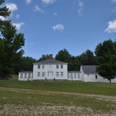
John Watson House
2.3 km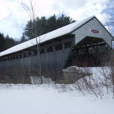
Porter-Parsonfield Bridge
14.5 km
Odd Fellows-Rebekah Hall
8.3 km
Stone House
16.9 km
Union Church
18.7 km
Blazo-Leavitt House
17 km
Valley Lodge
9 km
Caleb R. Ayer House
8.3 km
Benjamin Cleaves House
19.4 km
Sam Perley Farm
16.4 km
LeRoy F. Pike Memorial Building
8.1 km
Old Town House
19.6 km
Steep Falls Library
15.6 km
Porter Old Meetinghouse
13.4 km
Dyke Mountain Annex
7.5 km
George F. Clifford House
10.4 km
Manor House
18.1 km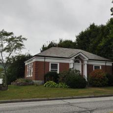
Limington Historic District
17.9 km
Benjamin and Abigail Dalton House
19.6 km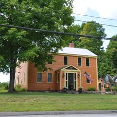
Burnell Tavern
5.4 km
Soldiers Memorial Library
562 m
Libby-MacArthur House
18 km
Limington Academy
18.2 km
Lt. Robert Andrews House
15.1 kmVisited this place? Tap the stars to rate it and share your experience / photos with the community! Try now! You can cancel it anytime.
Discover hidden gems everywhere you go!
From secret cafés to breathtaking viewpoints, skip the crowded tourist spots and find places that match your style. Our app makes it easy with voice search, smart filtering, route optimization, and insider tips from travelers worldwide. Download now for the complete mobile experience.

A unique approach to discovering new places❞
— Le Figaro
All the places worth exploring❞
— France Info
A tailor-made excursion in just a few clicks❞
— 20 Minutes