Enable Location

We need your location to show you interesting places around you

Discover nearby places

Find interesting locations and hidden gems around you

Precise directions

Get accurate directions and distances to places

Your location is never shared with other users. It's only used when you tap the location button.

Acushnet Heights Historic District

Log in to your account

Start exploring — it's free

Trusted by 61,833 travelers worldwide

Continue with Google
Continue with Apple
or

We will send you a code to connect

By continuing, you accept our Terms and Conditions and our Privacy Policy

Check your inbox

We've sent a pincode in your inbox. Please enter the code below.

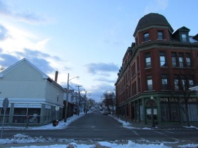
Acushnet Heights Historic District, Residential historic district in New Bedford, United States.

Description

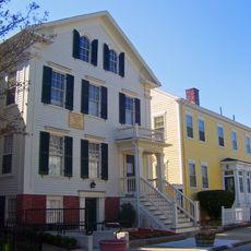
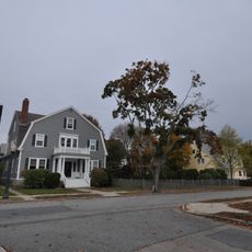
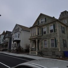
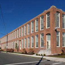
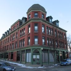
Acushnet Heights Historic District is a densely built neighborhood in New Bedford with wooden houses and brick buildings dating mostly to the middle 1800s. The streets follow a tight grid pattern that reflects how the area was planned as a working-class settlement.

History

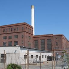
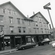
The neighborhood took shape in the 1860s as New Bedford became a busy port and needed housing for thousands of workers. Most buildings were constructed quickly to shelter workers employed in nearby mills and shipping operations.

Culture

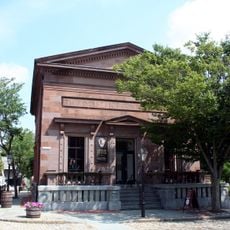
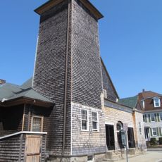
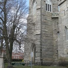
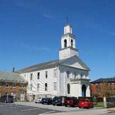
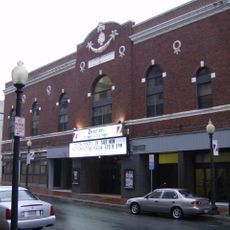
Four churches built in the 1800s sit among the homes and show how much religion mattered to the working families who lived here. These buildings remain gathering places for the neighborhood today.

Practical

You can walk through the district to see the buildings and streets at your own pace, especially along the main roads between Purchase Street and County Street. Visiting during the day helps you notice the building details and get a sense of how the neighborhood is laid out.

Did you know?

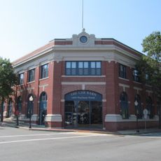
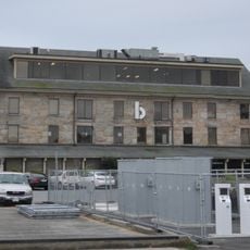
The neighborhood contains an old streetcar barn, a surviving piece of transportation infrastructure from the early 1900s that connected workers to their jobs. This building is a reminder of how important public transportation was to daily life in a working-class district.

Location
GPS coordinates
41.64778,-70.93139
Latest update
December 14, 2025 18:02

AroundUs brings together thousands of curated places, local tips, and hidden gems, enriched daily by 60,000 contributors worldwide. Discover all places nearby (New Bedford).

Around this place
New Bedford Whaling Museum
United States of America

New Bedford Whaling Museum

1.5 km
Effie M. Morrissey
United States of America

Effie M. Morrissey

1.8 km
New Bedford Whaling National Historical Park
United States of America

New Bedford Whaling National Historical Park

1.5 km
Seamen's Bethel
United States of America

Seamen's Bethel

1.5 km
Nathan and Mary Johnson properties
United States of America

Nathan and Mary Johnson properties

1.6 km
New Bedford Historic District
United States of America

New Bedford Historic District

1.5 km
New Bedford – Fairhaven Bridge
United States of America

New Bedford – Fairhaven Bridge

1.5 km
Rotch-Jones-Duff House and Garden Museum
United States of America

Rotch-Jones-Duff House and Garden Museum

2 km
Sgt. William H. Carney House
United States of America

Sgt. William H. Carney House

1.2 km
William J. Rotch Gothic Cottage
United States of America

William J. Rotch Gothic Cottage

1.9 km
Moreland Terrace Historic District
United States of America

Moreland Terrace Historic District

2.3 km
Fairhaven Bridge Light
United States of America

Fairhaven Bridge Light

1.5 km
Central New Bedford Historic District
United States of America

Central New Bedford Historic District

1.5 km
United States Customhouse
United States of America

United States Customhouse

1.5 km
Union Street Railway Carbarn, Repair Shop
United States of America

Union Street Railway Carbarn, Repair Shop

464 m
Riverside Cemetery
United States of America

Riverside Cemetery

1.6 km
Union Baptist Church
United States of America

Union Baptist Church

1.5 km
County Street Historic District
United States of America

County Street Historic District

1.8 km
New Bedford Gas and Edison Light Complex
United States of America

New Bedford Gas and Edison Light Complex

2.1 km
First Baptist Church
United States of America

First Baptist Church

1.4 km
Merrill's Wharf Historic District
United States of America

Merrill's Wharf Historic District

1.9 km
North Bedford Historic District
United States of America

North Bedford Historic District

840 m
Old Third District Courthouse
United States of America

Old Third District Courthouse

1.5 km
Times and Olympia Buildings
United States of America

Times and Olympia Buildings

1.3 km
Whitman Mills
United States of America

Whitman Mills

1.9 km
Dawson Building
United States of America

Dawson Building

273 m
Bradford Smith Building
United States of America

Bradford Smith Building

382 m
Zeiterion Theatre
United States of America

Zeiterion Theatre

1.7 km
Show the full map
« Acushnet Heights Historic District - Residential historic district in New Bedford, United States » is provided by Around Us (aroundus.com). Images and texts are derived from Wikimedia project under a Creative Commons license. You are allowed to copy, distribute, and modify copies of this page, under the conditions set by the license, as long as this note is clearly visible.

Discover hidden gems everywhere you go!

From secret cafés to breathtaking viewpoints, skip the crowded tourist spots and find places that match your style. Our app makes it easy with voice search, smart filtering, route optimization, and insider tips from travelers worldwide. Download now for the complete mobile experience.

Around Us App Screenshot

A unique approach to discovering new places

Le Figaro

All the places worth exploring

France Info

A tailor-made excursion in just a few clicks

20 Minutes

Around Us
Travel Guide & Maps
Download

Send to your phone

QR Code
1

Open the camera app on your mobile.

2

Point at the QR code with your camera. A notification will appear.

3

Tap the notification to open the link.