Enable Location

We need your location to show you interesting places around you

Discover nearby places

Find interesting locations and hidden gems around you

Precise directions

Get accurate directions and distances to places

Your location is never shared with other users. It's only used when you tap the location button.

Arrow Rock Historic District

Log in to your account

Start exploring — it's free

Trusted by 61,906 travelers worldwide

Continue with Google
Continue with Apple
or

We will send you a code to connect

By continuing, you accept our Terms and Conditions and our Privacy Policy

Check your inbox

We've sent a pincode in your inbox. Please enter the code below.

Arrow Rock Historic District, Historic district in Arrow Rock, Missouri, United States

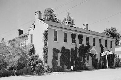
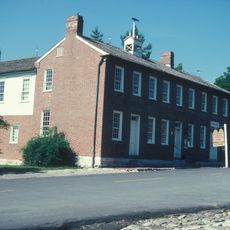
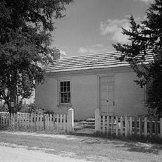
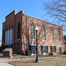
Arrow Rock Historic District is a 260-acre settlement area with preserved buildings, streets, and structures from the early 1800s that reflect frontier life. The layout and construction show how people organized towns and lived during westward expansion.

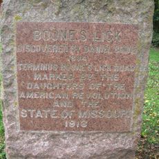
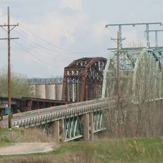
The settlement began as a key stopping point along the Santa Fe Trail where travelers crossed the Missouri River. This location made it a center for trade and movement during the settlement of the West.

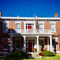
The tavern building from the 1800s shows how travelers and settlers gathered to eat and socialize during their journeys. Its rooms with simple furnishings still convey a sense of daily frontier life as it was experienced.

Wear good walking shoes since many buildings are spread across unpaved streets and uneven ground throughout the area. Plan to move slowly and spend time at each location rather than rushing.

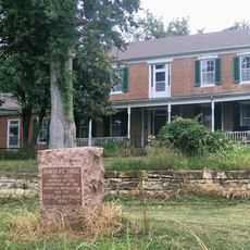
Archaeological research since 1996 has uncovered important evidence about the lives of Black residents in the district during the 1800s. This research reveals a history that was long overlooked and adds depth to understanding the settlement.

The community of curious travelers

AroundUs brings together thousands of curated places, local tips, and hidden gems, enriched daily by 60,000 contributors worldwide.

Start exploring
Location
GPS coordinates
39.06667,-92.94472
Latest update
December 13, 2025 17:02
Around this place
Boone's Lick State Historic Site
United States of America

Boone's Lick State Historic Site

5.9 km
Arrow Rock State Historic Site
United States of America

Arrow Rock State Historic Site

10.9 km
J. Huston Tavern
United States of America

J. Huston Tavern

96 m
George Caleb Bingham House
United States of America

George Caleb Bingham House

486 m
Glasgow Railroad Bridge
United States of America

Glasgow Railroad Bridge

19.2 km
Greenwood
United States of America

Greenwood

16.7 km
Thomas Nelson House
United States of America

Thomas Nelson House

20.9 km
Glasgow Bridge, Missouri
United States of America

Glasgow Bridge, Missouri

19.2 km
Cedar Grove
United States of America

Cedar Grove

14.1 km
Glasgow Presbyterian Church
United States of America

Glasgow Presbyterian Church

19.8 km
Campbell Chapel African Methodist Episcopal Church
United States of America

Campbell Chapel African Methodist Episcopal Church

19.9 km
William B. Sappington House
United States of America

William B. Sappington House

4.6 km
Lyric Theater
United States of America

Lyric Theater

20.3 km
St. Matthew's Chapel A.M.E. Church
United States of America

St. Matthew's Chapel A.M.E. Church

20.4 km
Glasgow Public Library
United States of America

Glasgow Public Library

19.8 km
Blackwater Residential Historic District
United States of America

Blackwater Residential Historic District

10.4 km
Roeschel-Toennes-Oswald Property
United States of America

Roeschel-Toennes-Oswald Property

19.4 km
Harris-Chilton-Ruble House
United States of America

Harris-Chilton-Ruble House

18.4 km
Edwin and Nora Payne Bedford House
United States of America

Edwin and Nora Payne Bedford House

15.4 km
Historic District D
United States of America

Historic District D

20.1 km
Albert Gallatin Blakey House
United States of America

Albert Gallatin Blakey House

19.6 km
Meierhoffer Sand Company Office Building
United States of America

Meierhoffer Sand Company Office Building

19.6 km
Andrews-Wing House
United States of America

Andrews-Wing House

20.5 km
William S. and Mary Beckett House
United States of America

William S. and Mary Beckett House

20.4 km
Sumner Public School
United States of America

Sumner Public School

20.4 km
New Franklin Commercial Historic District
United States of America

New Franklin Commercial Historic District

18.8 km
Historic District C
United States of America

Historic District C

19.9 km
Boonslick Bridge
United States of America

Boonslick Bridge

19.6 km
Show the full map
« Arrow Rock Historic District - Historic district in Arrow Rock, Missouri, United States » is provided by Around Us (aroundus.com). Images and texts are derived from Wikimedia project under a Creative Commons license. You are allowed to copy, distribute, and modify copies of this page, under the conditions set by the license, as long as this note is clearly visible.

Discover hidden gems everywhere you go!

From secret cafés to breathtaking viewpoints, skip the crowded tourist spots and find places that match your style. Our app makes it easy with voice search, smart filtering, route optimization, and insider tips from travelers worldwide. Download now for the complete mobile experience.

Around Us App Screenshot

A unique approach to discovering new places

Le Figaro

All the places worth exploring

France Info

A tailor-made excursion in just a few clicks

20 Minutes

Around Us
Travel Guide & Maps
Download

Send to your phone

QR Code
1

Open the camera app on your mobile.

2

Point at the QR code with your camera. A notification will appear.

3

Tap the notification to open the link.