Enable Location

We need your location to show you interesting places around you

Discover nearby places

Find interesting locations and hidden gems around you

Precise directions

Get accurate directions and distances to places

Your location is never shared with other users. It's only used when you tap the location button.

Avery Homestead

Log in to your account

Start exploring — it's free

Trusted by 62,586 travelers worldwide

Continue with Google
Continue with Apple
or

We will send you a code to connect

By continuing, you accept our Terms and Conditions and our Privacy Policy

Check your inbox

We've sent a pincode in your inbox. Please enter the code below.

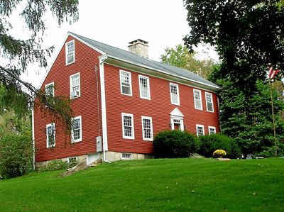
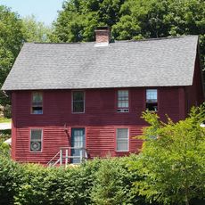
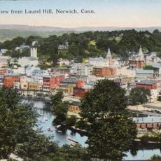
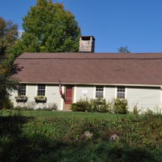
Avery Homestead, Ledyard, Connecticut

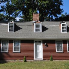
The Avery Homestead is a historic house in Connecticut built around 1696 in Colonial style using wood and stone construction. The two-story structure was expanded over centuries and features crafted details including wide wooden floors and large fireplaces that heated most rooms.

The property began as a single-room structure with a thatched roof and was expanded by 1726 to two rooms and two stories, with later additions in the late 1700s. It was restored in 1956 by Amos Avery to recover its 1700s appearance and listed on the National Register of Historic Places in 1992.

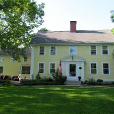
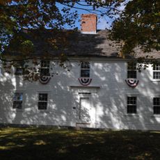
The name Avery comes from the family that has lived on this property for many generations. The house is now sometimes used as a hotel, drawing visitors interested in early American farm life and settlement.

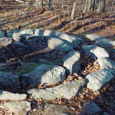
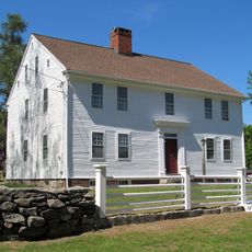
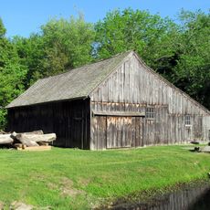
The property sits on a gentle hill next to a historic barn and is surrounded by about 100 acres of protected land in a land trust. Visitors can walk the old paths and explore stone walls to gain a sense of farm life from centuries past.

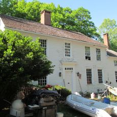
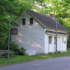
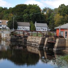
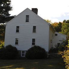
The barn next to the house is an English bank barn style built into a hillside to make it easier to access animals and hay. A nearby pond once served as an ice pond where families would gather ice for food storage before modern refrigeration existed.

The community of curious travelers

AroundUs brings together thousands of curated places, local tips, and hidden gems, enriched daily by 60,000 contributors worldwide.

Start exploring
Location
Inception
1696
GPS coordinates
41.45194,-72.04694
Latest update
February 9, 2026 08:19
Around this place
USS Nautilus
United States of America

USS Nautilus

8 km
Mohegan Sun
United States of America

Mohegan Sun

5.8 km
Submarine Force Library and Museum
United States of America

Submarine Force Library and Museum

7.8 km
Gungywamp
United States of America

Gungywamp

7 km
USS X-1
United States of America

USS X-1

7.9 km
Mashantucket Pequot Museum and Research Center
United States of America

Mashantucket Pequot Museum and Research Center

7.2 km
Fort Shantok
United States of America

Fort Shantok

3.9 km
American Thermos Bottle Company Laurel Hill Plant
United States of America

American Thermos Bottle Company Laurel Hill Plant

7 km
Applewood Farm
United States of America

Applewood Farm

5.3 km
The Earth Tower
United States of America

The Earth Tower

5.9 km
Quaker Hill Historic District
United States of America

Quaker Hill Historic District

7.5 km
Nathan Lester House
United States of America

Nathan Lester House

3.2 km
Gurdon Bill Store
United States of America

Gurdon Bill Store

2.8 km
John Fox Slater House
United States of America

John Fox Slater House

8.3 km
Laurel Hill Historic District
United States of America

Laurel Hill Historic District

7.7 km
Samson Occom Bridge
United States of America

Samson Occom Bridge

4.6 km
Hallville Mill Historic District
United States of America

Hallville Mill Historic District

4.9 km
Capt. Mark Stoddard Farmstead
United States of America

Capt. Mark Stoddard Farmstead

2 km
Perkins-Bill House
United States of America

Perkins-Bill House

6.8 km
Shubel Smith House
United States of America

Shubel Smith House

6 km
Mohegan-Pequot Bridge
United States of America

Mohegan-Pequot Bridge

4.1 km
United States Post Office–Norwich Main
United States of America

United States Post Office–Norwich Main

8.3 km
David Chapman Farmstead
United States of America

David Chapman Farmstead

826 m
Lamb Homestead
United States of America

Lamb Homestead

5.9 km
William Noyes Farmstead
United States of America

William Noyes Farmstead

8.3 km
Norwich State Hospital
United States of America

Norwich State Hospital

4.7 km
Main Sawmill
United States of America

Main Sawmill

5 km
Shetucket River Bridge
United States of America

Shetucket River Bridge

8.3 km
Show the full map
« Avery Homestead - Ledyard, Connecticut » is provided by Around Us (aroundus.com). Images and texts are derived from Wikimedia project under a Creative Commons license. You are allowed to copy, distribute, and modify copies of this page, under the conditions set by the license, as long as this note is clearly visible.

Discover hidden gems everywhere you go!

From secret cafés to breathtaking viewpoints, skip the crowded tourist spots and find places that match your style. Our app makes it easy with voice search, smart filtering, route optimization, and insider tips from travelers worldwide. Download now for the complete mobile experience.

Around Us App Screenshot

A unique approach to discovering new places

Le Figaro

All the places worth exploring

France Info

A tailor-made excursion in just a few clicks

20 Minutes

Around Us
Travel Guide & Maps
Download

Send to your phone

QR Code
1

Open the camera app on your mobile.

2

Point at the QR code with your camera. A notification will appear.

3

Tap the notification to open the link.