Enable Location

We need your location to show you interesting places around you

Discover nearby places

Find interesting locations and hidden gems around you

Precise directions

Get accurate directions and distances to places

Your location is never shared with other users. It's only used when you tap the location button.

Log in to your account

Start exploring — it's free

Trusted by 61,658 travelers worldwide

Continue with Google
Continue with Apple
or

We will send you a code to connect

By continuing, you accept our Terms and Conditions and our Privacy Policy

Check your inbox

We've sent a pincode in your inbox. Please enter the code below.

Balsam Cap

Balsam Cap, Mountain summit in Ulster County, US.

Description

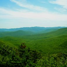
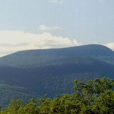
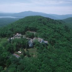
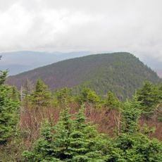
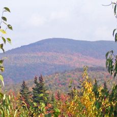
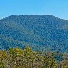
Balsam Cap is a mountain summit in the Southern Catskills of New York reaching 3,623 feet in elevation. Its slopes drain into multiple water systems that shape the surrounding landscape.

History

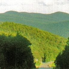
The mountain became part of the Catskill State Park system, securing its role in preserving New York's natural heritage. This protection has ensured the area remains conserved for the future.

Culture

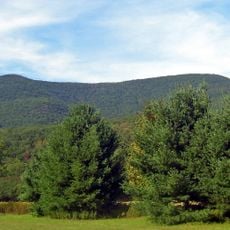
Many hiking groups regularly undertake expeditions to Balsam Cap as part of the Catskill High Peaks challenge, ranking as the 24th highest summit.

Practical

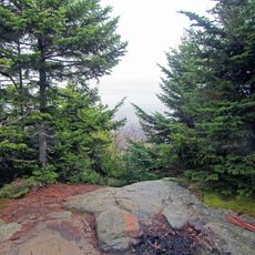
Reaching the summit requires advanced navigation skills since trails are unmarked. GPS devices and topographic maps are essential for safe travel to the peak.

Did you know?

Near the mountain, hikers can discover remains of a World War II aircraft that crashed on neighboring slopes. This historical remnant surprises many visitors exploring the area.

Location
GPS coordinates
41.97709,-74.35742
Latest update
December 14, 2025 18:41

AroundUs brings together thousands of curated places, local tips, and hidden gems, enriched daily by 60,000 contributors worldwide. Discover all places nearby (Ulster County).

Around this place
Ashokan Reservoir
United States of America

Ashokan Reservoir

12 km
Catskill Park
United States of America

Catskill Park

16.7 km
Slide Mountain
United States of America

Slide Mountain

3.4 km
Rondout Reservoir
United States of America

Rondout Reservoir

19.6 km
Panther Mountain
United States of America

Panther Mountain

9.4 km
Zen Mountain Monastery
United States of America

Zen Mountain Monastery

10.6 km
Glen Tonche
United States of America

Glen Tonche

14.3 km
Mount Tremper
United States of America

Mount Tremper

12.7 km
Ashokan Bridge
United States of America

Ashokan Bridge

14.2 km
Peekamoose Mountain
United States of America

Peekamoose Mountain

4.3 km
Wittenberg Mountain
United States of America

Wittenberg Mountain

3.6 km
Graham Mountain
United States of America

Graham Mountain

17.3 km
Red Hill Fire Observation Station
United States of America

Red Hill Fire Observation Station

14.5 km
Cornell Mountain
United States of America

Cornell Mountain

2.7 km
Empire State Railway Museum
United States of America

Empire State Railway Museum

12.2 km
Emile Brunel Studio and Sculpture Garden
United States of America

Emile Brunel Studio and Sculpture Garden

8.1 km
Table Mountain
United States of America

Table Mountain

4.4 km
Mount Tremper Fire Observation Station
United States of America

Mount Tremper Fire Observation Station

12.7 km
Eagle Mountain
United States of America

Eagle Mountain

15.7 km
Olive and Hurley Old School Baptist Church
United States of America

Olive and Hurley Old School Baptist Church

12 km
Tappan Bridge
United States of America

Tappan Bridge

18.8 km
Forge Bridge
United States of America

Forge Bridge

19.8 km
Sebastian Baker Stone House
United States of America

Sebastian Baker Stone House

18.7 km
Vosburg Turning Mill Complex
United States of America

Vosburg Turning Mill Complex

14.7 km
Zachariah Barley Stone House
United States of America

Zachariah Barley Stone House

19.5 km
Krom Stone House at 45 Upper Whitfield Road
United States of America

Krom Stone House at 45 Upper Whitfield Road

19.6 km
Krom Stone House at 31 Upper Whitfield Road
United States of America

Krom Stone House at 31 Upper Whitfield Road

19.7 km
Jacob F. Markle Stone House
United States of America

Jacob F. Markle Stone House

19.8 km
Show the full map
« Balsam Cap - Mountain summit in Ulster County, US » is provided by Around Us (aroundus.com). Images and texts are derived from Wikimedia project under a Creative Commons license. You are allowed to copy, distribute, and modify copies of this page, under the conditions set by the license, as long as this note is clearly visible.

Discover hidden gems everywhere you go!

From secret cafés to breathtaking viewpoints, skip the crowded tourist spots and find places that match your style. Our app makes it easy with voice search, smart filtering, route optimization, and insider tips from travelers worldwide. Download now for the complete mobile experience.

Around Us App Screenshot

A unique approach to discovering new places

Le Figaro

All the places worth exploring

France Info

A tailor-made excursion in just a few clicks

20 Minutes

Around Us
Travel Guide & Maps
Download

Send to your phone

QR Code
1

Open the camera app on your mobile.

2

Point at the QR code with your camera. A notification will appear.

3

Tap the notification to open the link.