Enable Location

We need your location to show you interesting places around you

Discover nearby places

Find interesting locations and hidden gems around you

Precise directions

Get accurate directions and distances to places

Your location is never shared with other users. It's only used when you tap the location button.

Beaver Creek Plantation

Log in to your account

Start exploring — it's free

Trusted by 62,509 travelers worldwide

Continue with Google
Continue with Apple
or

We will send you a code to connect

By continuing, you accept our Terms and Conditions and our Privacy Policy

Check your inbox

We've sent a pincode in your inbox. Please enter the code below.

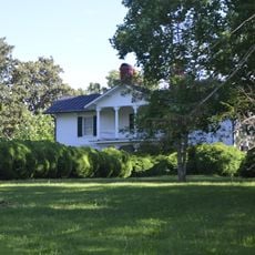
Beaver Creek Plantation, human settlement in Virginia, United States of America

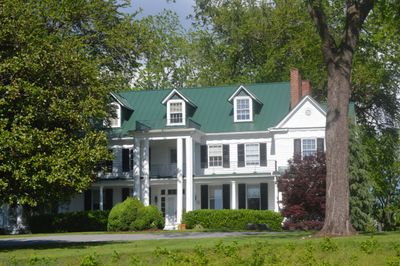
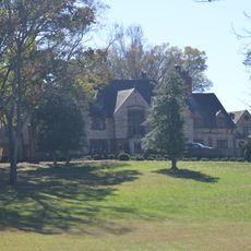
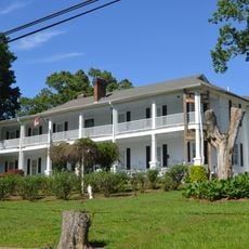
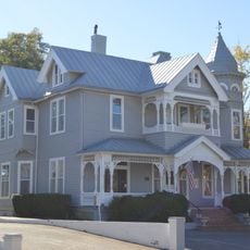
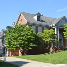
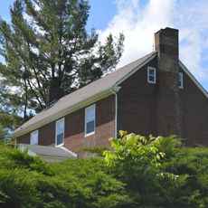
Beaver Creek Plantation is a farm with a two-story wooden main house from the early 1800s featuring a wide porch and distinctive front windows. The grounds include barns, outbuildings, old trees for shade, and open fields spread across the quiet rural property.

The plantation was founded in 1776 by George Hairston, whose original brick house burned in 1839. His son Marshall then built a wooden replacement that was later expanded with wings and porches, forming the structure visible today.

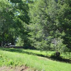
The name comes from the nearby creek and the agricultural heritage of the Hairston family who shaped the area. Tobacco farming defined the economy and social life here for generations, and this agricultural past remains central to how the community understands its identity today.

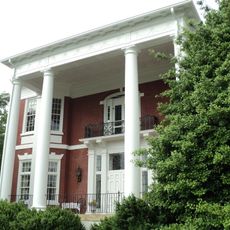
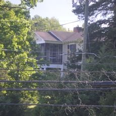
The property is privately owned and best viewed from the road, though visitors should not enter without permission. Those interested in history and rural architecture can observe the buildings and grounds from a distance while enjoying the quiet countryside setting.

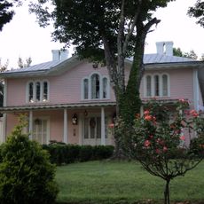
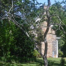
Local legend claims that Marshall Hairston's profile was etched on a rear third-floor window after he was struck by lightning there. This is one of several family stories that visitors notice when looking closely at the old windows and details of the house.

The community of curious travelers

AroundUs brings together thousands of curated places, local tips, and hidden gems, enriched daily by 60,000 contributors worldwide.

Start exploring
Location
GPS coordinates
36.71940,-79.88110
Latest update
February 7, 2026 11:00
Around this place
Martinsville Speedway
United States of America

Martinsville Speedway

9.9 km
Fairy Stone State Park
United States of America

Fairy Stone State Park

19.6 km
Philpott Dam
United States of America

Philpott Dam

14.8 km
Virginia Museum of Natural History
United States of America

Virginia Museum of Natural History

4 km
Stoneleigh
United States of America

Stoneleigh

6 km
Martinsville Fish Dam
United States of America

Martinsville Fish Dam

7.5 km
John D. Bassett High School
United States of America

John D. Bassett High School

16.5 km
Edgewood
United States of America

Edgewood

6.7 km
Martinsville Historic District
United States of America

Martinsville Historic District

3.2 km
Eltham Manor
United States of America

Eltham Manor

7.9 km
Grassdale Farm
United States of America

Grassdale Farm

16.3 km
Spring Valley Rural Historic District
United States of America

Spring Valley Rural Historic District

16.6 km
Virginia Home
United States of America

Virginia Home

5.5 km
Piedmont Arts Association
United States of America

Piedmont Arts Association

4.1 km
Scuffle Hill
United States of America

Scuffle Hill

3.6 km
Aurora
United States of America

Aurora

20.2 km
Marshall Field and Company Clubhouse
United States of America

Marshall Field and Company Clubhouse

5.6 km
Dry Bridge School
United States of America

Dry Bridge School

4.2 km
R.L. Stone House
United States of America

R.L. Stone House

10.2 km
Fayette Street Historic District
United States of America

Fayette Street Historic District

3 km
Little Post Office
United States of America

Little Post Office

4.1 km
John Waddey Carter House
United States of America

John Waddey Carter House

3.7 km
Fieldale Historic District
United States of America

Fieldale Historic District

5.6 km
Old Turner Place
United States of America

Old Turner Place

16.1 km
East Church Street-Starling Avenue Historic District
United States of America

East Church Street-Starling Avenue Historic District

3.9 km
Spencer-Penn School
United States of America

Spencer-Penn School

16.5 km
Ingleside
United States of America

Ingleside

13.9 km
Finney-Lee House
United States of America

Finney-Lee House

14.8 km
Show the full map
« Beaver Creek Plantation - human settlement in Virginia, United States of America » is provided by Around Us (aroundus.com). Images and texts are derived from Wikimedia project under a Creative Commons license. You are allowed to copy, distribute, and modify copies of this page, under the conditions set by the license, as long as this note is clearly visible.

Discover hidden gems everywhere you go!

From secret cafés to breathtaking viewpoints, skip the crowded tourist spots and find places that match your style. Our app makes it easy with voice search, smart filtering, route optimization, and insider tips from travelers worldwide. Download now for the complete mobile experience.

Around Us App Screenshot

A unique approach to discovering new places

Le Figaro

All the places worth exploring

France Info

A tailor-made excursion in just a few clicks

20 Minutes

Around Us
Travel Guide & Maps
Download

Send to your phone

QR Code
1

Open the camera app on your mobile.

2

Point at the QR code with your camera. A notification will appear.

3

Tap the notification to open the link.