Chest opened
+${chestReward.xp} XP
Explorer
NOUVEAU ×${chestReward.collectible.quantity}
tapez pour fermer
Chest locked

Open chests in the app

Around Us is built for your phone — chests unlock when you walk, explore and capture nearby places.

Enable Location

We need your location to show you interesting places around you

Discover nearby places

Find interesting locations and hidden gems around you

Precise directions

Get accurate directions and distances to places

Your location is never shared with other users. It's only used when you tap the location button.

Log in to your account

Start exploring — it's free

Trusted by 72,924 travelers worldwide

Continue with Google
Continue with Apple
or

We will send you a code to connect

By continuing, you accept our Terms and Conditions and our Privacy Policy

Check your inbox

We've sent a pincode in your inbox. Please enter the code below.

Beeren Island
Discussion Reviews Photo
1.8k Popularity

Beeren Island, River island in Hudson River, New York, US

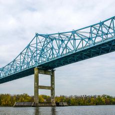
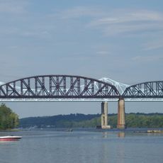
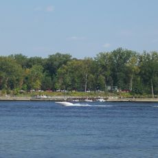
Beeren Island is a river island in the Hudson River, positioned roughly 11 miles south of Albany where four county boundaries converge. Water surrounds the land on all sides, creating an isolated landmass in the middle of the river.

Dutch colonists built a fort on the island in 1643 and positioned cannons to control passing ships. The fortress was part of a larger system designed to enforce commerce and power in the region.

The place carries a name rooted in indigenous language: Native Americans called it Mach-a-wa-meck, combining words for bear and abundance to reflect the animals that thrived here. This naming reveals how closely the landscape was tied to the creatures living on it.

The island sits at a prominent point where multiple county lines meet, making it easy to locate on maps. Visitors should be aware that the terrain is surrounded by water and remains accessible only by boat or through specialized arrangements.

The island is best remembered for a notorious incident when a watchmaster fired a cannonball through a ship's sail after its captain refused to lower his flag. This dramatic event reveals how seriously the Dutch took their authority on the river.

The community of curious travelers

AroundUs brings together thousands of curated places, local tips, and hidden gems, enriched daily by 60,000 contributors worldwide.

Start exploring
GPS coordinates
42.46670,-73.78620
Latest update
December 21, 2025 16:05
Around this place
Castleton Bridge
United States of America

Castleton Bridge

4.9 km
Alcove Reservoir
United States of America

Alcove Reservoir

11.9 km
Alfred H. Smith Memorial Bridge
United States of America

Alfred H. Smith Memorial Bridge

4.8 km
Schodack Island State Park
United States of America

Schodack Island State Park

2.6 km
Van Alen House
United States of America

Van Alen House

12.3 km
Coxsackie Light
United States of America

Coxsackie Light

9.7 km
Bethlehem House
United States of America

Bethlehem House

8.7 km
Ariaanje Coeymans House
United States of America

Ariaanje Coeymans House

1.2 km
Muitzes Kill Historic District
United States of America

Muitzes Kill Historic District

5.3 km
Stuyvesant Light
United States of America

Stuyvesant Light

6.2 km
Bronck Farm 13-Sided Barn
United States of America

Bronck Farm 13-Sided Barn

14.3 km
Van Bergen House
United States of America

Van Bergen House

10 km
Kinderhook Village District
United States of America

Kinderhook Village District

10.8 km
Schodack Landing Historic District
United States of America

Schodack Landing Historic District

2.3 km
Blink Bonnie
United States of America

Blink Bonnie

13.2 km
Israel Shear House
United States of America

Israel Shear House

9.3 km
District School No. 3
United States of America

District School No. 3

7.6 km
Dr. Wesley Blaisdell House
United States of America

Dr. Wesley Blaisdell House

834 m
Peck House
United States of America

Peck House

12.6 km
Mull House and Cemetery
United States of America

Mull House and Cemetery

4.2 km
Valley Paper Mill Chimney and Site
United States of America

Valley Paper Mill Chimney and Site

11.3 km
Coeymans School
United States of America

Coeymans School

1.2 km
Elmbrook Farm
United States of America

Elmbrook Farm

13.3 km
Abraham Houghtaling House
United States of America

Abraham Houghtaling House

1.4 km
District School No. 7
United States of America

District School No. 7

9.4 km
Alcove Historic District
United States of America

Alcove Historic District

11.5 km
Bronk-Silvester House
United States of America

Bronk-Silvester House

12.2 km
New Baltimore Hamlet Historic District
United States of America

New Baltimore Hamlet Historic District

2.3 km
Show the full map
Reviews
Share your experience

No review yet

Discussions
Start a discussion...

No discussion yet

« Beeren Island - River island in Hudson River, New York, US » is provided by Around Us (aroundus.com). Images and texts are derived from Wikimedia project under a Creative Commons license. You are allowed to copy, distribute, and modify copies of this page, under the conditions set by the license, as long as this note is clearly visible.

Discover hidden gems everywhere you go!

From secret cafés to breathtaking viewpoints, skip the crowded tourist spots and find places that match your style. Our app makes it easy with voice search, smart filtering, route optimization, and insider tips from travelers worldwide. Download now for the complete mobile experience.

Around Us App Screenshot

A unique approach to discovering new places

Le Figaro

All the places worth exploring

France Info

A tailor-made excursion in just a few clicks

20 Minutes

Around Us
Travel Guide & Maps
Download

Send to your phone

QR Code
1

Open the camera app on your mobile.

2

Point at the QR code with your camera. A notification will appear.

3

Tap the notification to open the link.