Enable Location

We need your location to show you interesting places around you

Discover nearby places

Find interesting locations and hidden gems around you

Precise directions

Get accurate directions and distances to places

Your location is never shared with other users. It's only used when you tap the location button.

Briar Patch Road Historic District

Log in to your account

Start exploring — it's free

Trusted by 63,004 travelers worldwide

Continue with Google
Continue with Apple
or

We will send you a code to connect

By continuing, you accept our Terms and Conditions and our Privacy Policy

Check your inbox

We've sent a pincode in your inbox. Please enter the code below.

Discussion Reviews 1 Photos
1.5k Popularity

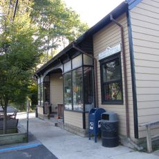
Briar Patch Road Historic District, Historical residential area in East Hampton, United States.

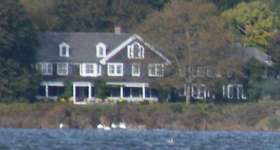
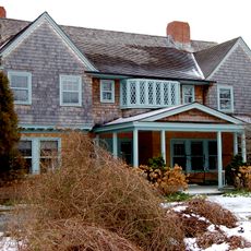
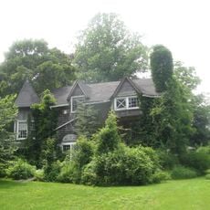
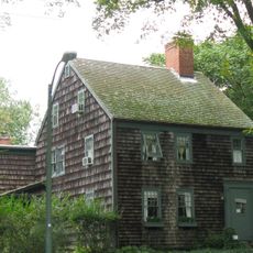
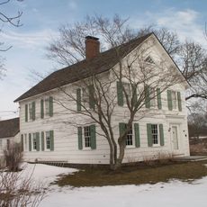
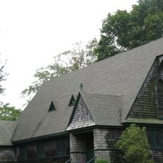
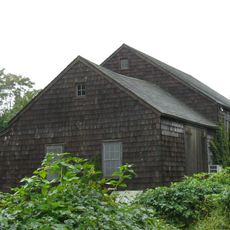
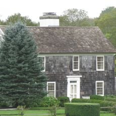
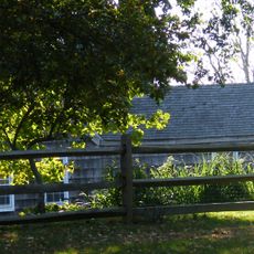
Briar Patch Road Historic District is a residential area along Georgica Pond with seven buildings constructed between 1897 and 1932. The houses display Colonial Revival and Shingle Style features and span about 30 acres along a narrow unpaved lane.

The district was added to the National Register of Historic Places in 1988 after homes were constructed over several decades. This recognition honored the importance of these residences to local architectural history.

The houses reflect the tastes of artists who settled in East Hampton during the late 19th century. Visitors can still see today the architectural styles that this creative community preferred.

Access is via Georgica Road to a narrow unpaved lane that is best explored on foot. Visitors should wear comfortable shoes and be aware that the way is surrounded by dense pine and oak forest.

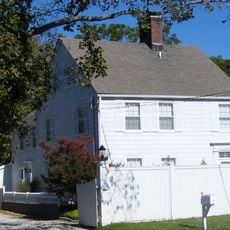
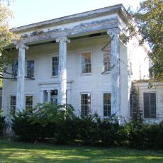
The Augustus Thomas House stands out from the other homes by having wooden clapboard siding instead of shingles. This detail makes it the only residence in the area with this exterior treatment.

The community of curious travelers

AroundUs brings together thousands of curated places, local tips, and hidden gems, enriched daily by 60,000 contributors worldwide.

Start exploring
Location
GPS coordinates
40.94250,-72.22806
Latest update
December 14, 2025 14:41
Around this place
Grey Gardens
United States of America

Grey Gardens

1.1 km
United States of America

Sag Harbor Hills, Azurest, and Ninevah Beach Subdivisions Historic District

7.3 km
Hook Windmill
United States of America

Hook Windmill

4.5 km
Hampton Classic Horse Show
United States of America

Hampton Classic Horse Show

7.5 km
Bunshaft Residence
United States of America

Bunshaft Residence

501 m
Thomas Moran House
United States of America

Thomas Moran House

3.1 km
Beebe Windmill
United States of America

Beebe Windmill

6.2 km
Mulford Farmhouse
United States of America

Mulford Farmhouse

3.5 km
United States of America

Dia Bridgehampton

6.5 km
Hayground Windmill
United States of America

Hayground Windmill

5.4 km
John Lyon Gardiner Mill Cottage
United States of America

John Lyon Gardiner Mill Cottage

3.4 km
East Hampton Village District
United States of America

East Hampton Village District

3.4 km
Wainscott Windmill
United States of America

Wainscott Windmill

1.2 km
Jericho Historic District
United States of America

Jericho Historic District

1.4 km
Pantigo Windmill
United States of America

Pantigo Windmill

3.5 km
Pantigo Road Historic District
United States of America

Pantigo Road Historic District

5 km
Stephen Sherrill House
United States of America

Stephen Sherrill House

5.2 km
Sagaponack Historic District
United States of America

Sagaponack Historic District

4.6 km
Saint Thomas' Chapel
United States of America

Saint Thomas' Chapel

7.8 km
East Hampton Beach
United States of America

East Hampton Beach

2.9 km
Nathaniel Rogers House
United States of America

Nathaniel Rogers House

6.1 km
North Main Street Historic District
United States of America

North Main Street Historic District

4.5 km
Jones Road Historic District
United States of America

Jones Road Historic District

1.4 km
Egypt Lane Historic District
United States of America

Egypt Lane Historic District

4.6 km
Buell's Lane Historic District
United States of America

Buell's Lane Historic District

3.1 km
Thomas Strong House
United States of America

Thomas Strong House

2.1 km
Townline BBQ
United States of America

Townline BBQ

2.9 km
Main Beach
United States of America

Main Beach

2.9 km
Show the full map
Reviews
Share your experience

No review yet

Discussions
Start a discussion...

No discussion yet

« Briar Patch Road Historic District - Historical residential area in East Hampton, United States » is provided by Around Us (aroundus.com). Images and texts are derived from Wikimedia project under a Creative Commons license. You are allowed to copy, distribute, and modify copies of this page, under the conditions set by the license, as long as this note is clearly visible.

Discover hidden gems everywhere you go!

From secret cafés to breathtaking viewpoints, skip the crowded tourist spots and find places that match your style. Our app makes it easy with voice search, smart filtering, route optimization, and insider tips from travelers worldwide. Download now for the complete mobile experience.

Around Us App Screenshot

A unique approach to discovering new places

Le Figaro

All the places worth exploring

France Info

A tailor-made excursion in just a few clicks

20 Minutes

Around Us
Travel Guide & Maps
Download

Send to your phone

QR Code
1

Open the camera app on your mobile.

2

Point at the QR code with your camera. A notification will appear.

3

Tap the notification to open the link.