Enable Location

We need your location to show you interesting places around you

Discover nearby places

Find interesting locations and hidden gems around you

Precise directions

Get accurate directions and distances to places

Your location is never shared with other users. It's only used when you tap the location button.

Log in to your account

Start exploring — it's free

Trusted by 61,990 travelers worldwide

Continue with Google
Continue with Apple
or

We will send you a code to connect

By continuing, you accept our Terms and Conditions and our Privacy Policy

Check your inbox

We've sent a pincode in your inbox. Please enter the code below.

Channels State Forest

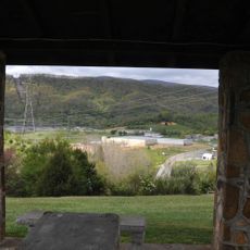
Channels State Forest, Protected forest area in Washington and Russell counties, Virginia.

Channels State Forest is a protected woodland area in Virginia's mountain region that spans thousands of acres with mixed hardwood forests, mountain streams, and varying elevation changes. The landscape includes natural rock formations and large boulder fields that shape its terrain.

The land was privately owned and used for timber production until the early 2000s, when conservation efforts brought it into public ownership for long-term protection. This transition marked a shift toward preserving the area's natural resources and forest ecosystem.

The forest serves as a center for scientific forest management, applied research, wildlife habitat development, and watershed protection in the Virginia mountain region.

The forest is accessible through multiple hiking trails that offer different difficulty levels and distances for various types of visitors. Sturdy footwear and appropriate gear are recommended because of the mountainous terrain and elevation changes.

At the mountain ridge, massive sandstone formations with deep crevices between enormous boulders create striking geological features that date back hundreds of millions of years. These distinctive rock formations make the landscape visually dramatic for those hiking through the forest.

The community of curious travelers

AroundUs brings together thousands of curated places, local tips, and hidden gems, enriched daily by 60,000 contributors worldwide.

Start exploring
Location
GPS coordinates
36.82800,-81.96210
Latest update
December 13, 2025 11:48
Around this place
Barter Theatre
United States of America

Barter Theatre

12.9 km
Preston House
United States of America

Preston House

30.8 km
Moonlite Drive-In
United States of America

Moonlite Drive-In

18.9 km
Heartwood – The Southwest Virginia Artisan Gateway
United States of America

Heartwood – The Southwest Virginia Artisan Gateway

15 km
Blackford Bridge
United States of America

Blackford Bridge

15.8 km
Mont Calm
United States of America

Mont Calm

13.5 km
Carter Hill
United States of America

Carter Hill

24.6 km
Edmondson Hall
United States of America

Edmondson Hall

11.3 km
Abingdon Bank
United States of America

Abingdon Bank

12.8 km
Bush Mill
United States of America

Bush Mill

21 km
Walnut Grove
United States of America

Walnut Grove

25.2 km
Preston House
United States of America

Preston House

18.5 km
White's Mill
United States of America

White's Mill

7.1 km
Saltville Battlefields Historic District
United States of America

Saltville Battlefields Historic District

18.3 km
Brook Hall
United States of America

Brook Hall

16 km
Jessees Mill
United States of America

Jessees Mill

21 km
Old Russell County Courthouse
United States of America

Old Russell County Courthouse

24.6 km
A.C. Beatie House
United States of America

A.C. Beatie House

25 km
Samuel Gilmer House
United States of America

Samuel Gilmer House

11.2 km
H.L. Bonham House
United States of America

H.L. Bonham House

25.3 km
Stephen B. Quillen House
United States of America

Stephen B. Quillen House

13.4 km
Smithfield (Rosedale, Virginia)
United States of America

Smithfield (Rosedale, Virginia)

14.3 km
Dr. William H. Pitts House
United States of America

Dr. William H. Pitts House

12.9 km
Downtown Chilhowie Historic District
United States of America

Downtown Chilhowie Historic District

25.2 km
Saltville Historic District
United States of America

Saltville Historic District

18.3 km
Scott-Walker House
United States of America

Scott-Walker House

22.2 km
Mason-Dorton School
United States of America

Mason-Dorton School

29.1 km
Glade Spring Commercial Historic District
United States of America

Glade Spring Commercial Historic District

17.3 km
Show the full map
« Channels State Forest - Protected forest area in Washington and Russell counties, Virginia » is provided by Around Us (aroundus.com). Images and texts are derived from Wikimedia project under a Creative Commons license. You are allowed to copy, distribute, and modify copies of this page, under the conditions set by the license, as long as this note is clearly visible.

Discover hidden gems everywhere you go!

From secret cafés to breathtaking viewpoints, skip the crowded tourist spots and find places that match your style. Our app makes it easy with voice search, smart filtering, route optimization, and insider tips from travelers worldwide. Download now for the complete mobile experience.

Around Us App Screenshot

A unique approach to discovering new places

Le Figaro

All the places worth exploring

France Info

A tailor-made excursion in just a few clicks

20 Minutes

Around Us
Travel Guide & Maps
Download

Send to your phone

QR Code
1

Open the camera app on your mobile.

2

Point at the QR code with your camera. A notification will appear.

3

Tap the notification to open the link.