Chest opened
+${chestReward.xp} XP
Explorer
NOUVEAU ×${chestReward.collectible.quantity}
tapez pour fermer
Chest locked

Open chests in the app

Around Us is built for your phone — chests unlock when you walk, explore and capture nearby places.

Enable Location

We need your location to show you interesting places around you

Discover nearby places

Find interesting locations and hidden gems around you

Precise directions

Get accurate directions and distances to places

Your location is never shared with other users. It's only used when you tap the location button.

Log in to your account

Start exploring — it's free

Trusted by 73,103 travelers worldwide

Continue with Google
Continue with Apple
or

We will send you a code to connect

By continuing, you accept our Terms and Conditions and our Privacy Policy

Check your inbox

We've sent a pincode in your inbox. Please enter the code below.

Connecticut Audubon Society Coastal Center at Milford Point
Discussion Reviews Photo
1.3k Popularity

Connecticut Audubon Society Coastal Center at Milford Point, Protected nature center at Milford Point, Connecticut

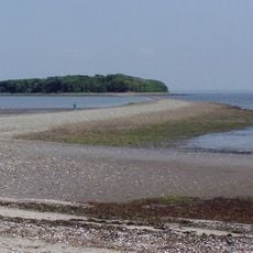
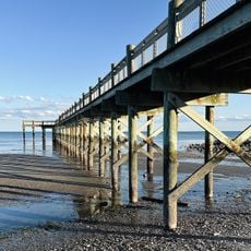
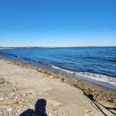
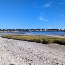
The Connecticut Audubon Society Coastal Center at Milford Point protects a barrier beach area with adjoining salt marsh habitats at the mouth of the Housatonic River. The property encompasses several hundred acres of natural space with varied environments that support coastal bird species and other wildlife.

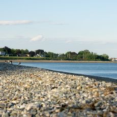
The Smith-Hubbell Wildlife Refuge was established to monitor and protect bird species along Long Island Sound. Over time, the location became a critical observation point for tracking migratory birds during their seasonal movements.

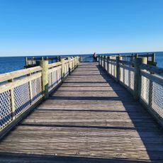
The site functions as a teaching space where school groups explore salt marshes, beaches, and coastal dunes through direct experience. Visitors can observe how this center helps young people connect with their natural surroundings.

The site is best visited during warm months when bird activity and migration patterns are most visible. Good footwear and weather-resistant clothing are needed since paths lead through wet coastal habitats.

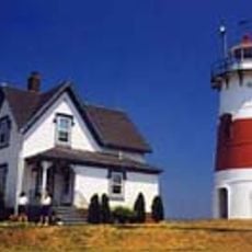
The center operates a live-streaming camera at an osprey nesting site, allowing viewers to watch from their computer how fish hawks raise their young. This remote observation has helped a wide audience understand the daily rhythms of these coastal birds of prey.

The community of curious travelers

AroundUs brings together thousands of curated places, local tips, and hidden gems, enriched daily by 60,000 contributors worldwide.

Start exploring
Location
GPS coordinates
41.17310,-73.11010
Latest update
December 14, 2025 18:15
Around this place
Silver Sands State Park
United States of America

Silver Sands State Park

4.4 km
Silver Sands
United States of America

Silver Sands

4.7 km
Moses Wheeler Bridge
United States of America

Moses Wheeler Bridge

3.5 km
Housatonic River Railroad Bridge
United States of America

Housatonic River Railroad Bridge

3.6 km
Washington Bridge
United States of America

Washington Bridge

3 km
United States of America

Charles E. Wheeler Wildlife Management Area

892 m
Captain David Judson House
United States of America

Captain David Judson House

2.3 km
Walnut Beach
United States of America

Walnut Beach

3.7 km
Stratford Point Light
United States of America

Stratford Point Light

2.4 km
Tongue Point Light
United States of America

Tongue Point Light

5.7 km
Sterling Homestead
United States of America

Sterling Homestead

2.7 km
East Main Street Historic District
United States of America

East Main Street Historic District

6 km
Stratford Center Historic District
United States of America

Stratford Center Historic District

2.2 km
Sterling Homestead
United States of America

Sterling Homestead

2.7 km
Sterling Hill Historic District
United States of America

Sterling Hill Historic District

5.8 km
Eagle's Nest
United States of America

Eagle's Nest

4.2 km
Isaac Lewis House
United States of America

Isaac Lewis House

4.4 km
Milford Point Hotel
United States of America

Milford Point Hotel

748 m
Remington City Historic District
United States of America

Remington City Historic District

5.4 km
Ein Jacob Synagogue
United States of America

Ein Jacob Synagogue

4.6 km
Gateway Village Historic District
United States of America

Gateway Village Historic District

4.2 km
Deacon's Point Historic District
United States of America

Deacon's Point Historic District

5.2 km
Long Beach
United States of America

Long Beach

3.9 km
Walnut Public Beach
United States of America

Walnut Public Beach

3.6 km
Short Beach
United States of America

Short Beach

1.5 km
Lordship Beach
United States of America

Lordship Beach

2.5 km
Nathaniel Curtis House
United States of America

Nathaniel Curtis House

2.8 km
Fort Trumbull Beach
United States of America

Fort Trumbull Beach

5.9 km
Show the full map
Reviews
Share your experience

No review yet

Discussions
Start a discussion...

No discussion yet

« Connecticut Audubon Society Coastal Center at Milford Point - Protected nature center at Milford Point, Connecticut » is provided by Around Us (aroundus.com). Images and texts are derived from Wikimedia project under a Creative Commons license. You are allowed to copy, distribute, and modify copies of this page, under the conditions set by the license, as long as this note is clearly visible.

Discover hidden gems everywhere you go!

From secret cafés to breathtaking viewpoints, skip the crowded tourist spots and find places that match your style. Our app makes it easy with voice search, smart filtering, route optimization, and insider tips from travelers worldwide. Download now for the complete mobile experience.

Around Us App Screenshot

A unique approach to discovering new places

Le Figaro

All the places worth exploring

France Info

A tailor-made excursion in just a few clicks

20 Minutes

Around Us
Travel Guide & Maps
Download

Send to your phone

QR Code
1

Open the camera app on your mobile.

2

Point at the QR code with your camera. A notification will appear.

3

Tap the notification to open the link.