Enable Location

We need your location to show you interesting places around you

Discover nearby places

Find interesting locations and hidden gems around you

Precise directions

Get accurate directions and distances to places

Your location is never shared with other users. It's only used when you tap the location button.

Dennisville Historic District

Log in to your account

Start exploring — it's free

Trusted by 62,292 travelers worldwide

Continue with Google
Continue with Apple
or

We will send you a code to connect

By continuing, you accept our Terms and Conditions and our Privacy Policy

Check your inbox

We've sent a pincode in your inbox. Please enter the code below.

Dennisville Historic District, Historic district in Dennis Township, United States.

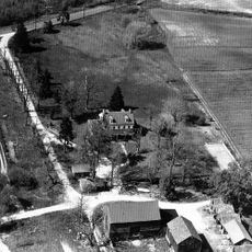
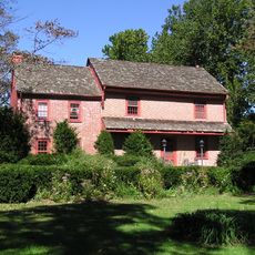
Dennisville Historic District is a neighborhood with buildings from different time periods spread across a large area. The houses sit within a unified zone bordered by local roads and pathways.

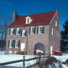
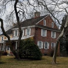
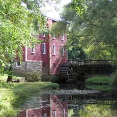
The area was founded in 1726 as Dennis Creek and was originally a trading center along a waterway. Houses were built over many generations, with each era leaving behind its own building style.

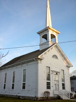
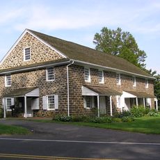
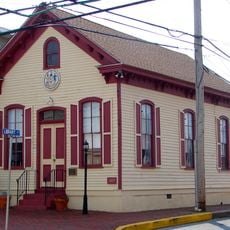
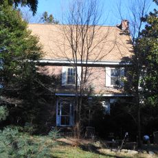
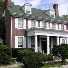
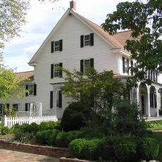
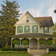
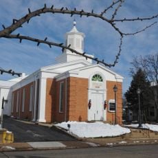
The neighborhood contains houses of different styles, from simple craftsmanship to elaborate decoration, reflecting local building traditions. The structures tell stories of people who lived and worked here, from tradespeople to merchants.

The neighborhood is open to walk through and explore freely without any special equipment or preparation needed. It is best visited during daylight to see the building details and street layouts clearly.

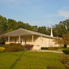
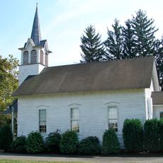
The buildings in the neighborhood come from different decades and show how taste and building techniques changed over time. From simpler early structures to more decorative versions from later periods, you can observe this evolution while walking through.

The community of curious travelers

AroundUs brings together thousands of curated places, local tips, and hidden gems, enriched daily by 60,000 contributors worldwide.

Start exploring
Location
GPS coordinates
39.79220,-74.82330
Latest update
December 14, 2025 18:04
Around this place
Pine Barrens
United States of America

Pine Barrens

7.8 km
Paulsdale
United States of America

Paulsdale

20.5 km
Diggerland USA
United States of America

Diggerland USA

8.8 km
Temple Beth Sholom
United States of America

Temple Beth Sholom

14.5 km
Valenzano Winery
United States of America

Valenzano Winery

7.5 km
Amalthea Cellars
United States of America

Amalthea Cellars

8.1 km
Barclay Farm House
United States of America

Barclay Farm House

19.5 km
Scarborough Bridge
United States of America

Scarborough Bridge

18.8 km
Hell Cat
United States of America

Hell Cat

13.8 km
Jack Rabbit
United States of America

Jack Rabbit

13.8 km
St. Mary of the Lakes Catholic Church
United States of America

St. Mary of the Lakes Catholic Church

8 km
Evesham Friends Meeting House
United States of America

Evesham Friends Meeting House

16.9 km
Springdale Farms
United States of America

Springdale Farms

16.6 km
Solomon Wesley United Methodist Church
United States of America

Solomon Wesley United Methodist Church

19.1 km
Glendale Methodist Episcopal Church
United States of America

Glendale Methodist Episcopal Church

15.3 km
Cropwell Friends Meeting House
United States of America

Cropwell Friends Meeting House

14.3 km
Lewis W. Barton Arboretum
United States of America

Lewis W. Barton Arboretum

12.6 km
Bishop-Irick Farmstead
United States of America

Bishop-Irick Farmstead

17.7 km
Grant A.M.E. Church
United States of America

Grant A.M.E. Church

8 km
Jacobus Evangelical Lutheran Church
United States of America

Jacobus Evangelical Lutheran Church

20.7 km
Free Library and Reading Room-Williamstown Memorial Library
United States of America

Free Library and Reading Room-Williamstown Memorial Library

18.9 km
Samuel Coles House
United States of America

Samuel Coles House

18.9 km
Stokes-Evans House
United States of America

Stokes-Evans House

13.6 km
John Inskeep Homestead
United States of America

John Inskeep Homestead

14.2 km
Jacob Wills House
United States of America

Jacob Wills House

11.7 km
Kirby's Mill
United States of America

Kirby's Mill

13.9 km
Berlin Historic District
United States of America

Berlin Historic District

9 km
Blackwood Historic District
United States of America

Blackwood Historic District

19.7 km
Show the full map
« Dennisville Historic District - Historic district in Dennis Township, United States » is provided by Around Us (aroundus.com). Images and texts are derived from Wikimedia project under a Creative Commons license. You are allowed to copy, distribute, and modify copies of this page, under the conditions set by the license, as long as this note is clearly visible.

Discover hidden gems everywhere you go!

From secret cafés to breathtaking viewpoints, skip the crowded tourist spots and find places that match your style. Our app makes it easy with voice search, smart filtering, route optimization, and insider tips from travelers worldwide. Download now for the complete mobile experience.

Around Us App Screenshot

A unique approach to discovering new places

Le Figaro

All the places worth exploring

France Info

A tailor-made excursion in just a few clicks

20 Minutes

Around Us
Travel Guide & Maps
Download

Send to your phone

QR Code
1

Open the camera app on your mobile.

2

Point at the QR code with your camera. A notification will appear.

3

Tap the notification to open the link.