Enable Location

We need your location to show you interesting places around you

Discover nearby places

Find interesting locations and hidden gems around you

Precise directions

Get accurate directions and distances to places

Your location is never shared with other users. It's only used when you tap the location button.

Dix Hill

Log in to your account

Start exploring — it's free

Trusted by 62,050 travelers worldwide

Continue with Google
Continue with Apple
or

We will send you a code to connect

By continuing, you accept our Terms and Conditions and our Privacy Policy

Check your inbox

We've sent a pincode in your inbox. Please enter the code below.

Dix Hill, Historic district in North Carolina, US.

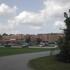
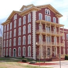
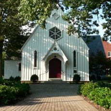
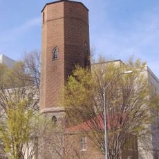
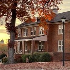
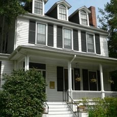
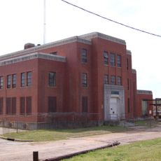
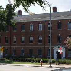
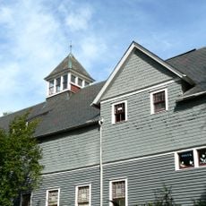
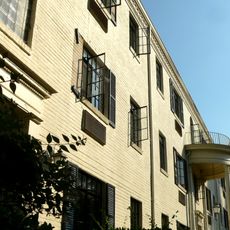
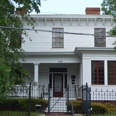
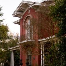
Dix Hill is a historic district containing 18 buildings, one historical site, and three structures within its boundaries. The buildings represent various architectural movements including Colonial Revival, Bungalow, American Craftsman, and Stick Style designs.

The area became part of the North Carolina State Hospital system in 1898 and operated as a healthcare facility through much of the 20th century. The buildings were constructed at different times throughout this period, reflecting changes in medical care approaches.

The grounds showcase architectural styles from different eras, and visitors can observe how the buildings reflect the area's use as a hospital campus. The layering of designs across the site tells a story about care and community in the early 20th century.

The district is accessible from major transportation routes and is bordered by Dorothea Drive and Lake Wheeler Road. Visitors should be aware that the site includes railroad tracks running through it, which defines part of its boundary.

The site is noteworthy for concentrating several architectural styles from a single historical period within one campus setting. This variety offers a rare opportunity to see how different design approaches coexisted during the same era.

The community of curious travelers

AroundUs brings together thousands of curated places, local tips, and hidden gems, enriched daily by 60,000 contributors worldwide.

Start exploring
Location
Inception
1898
GPS coordinates
35.76833,-78.65417
Latest update
December 12, 2025 07:57
Around this place
Central Prison
United States of America

Central Prison

894 m
Red Hat Amphitheater
United States of America

Red Hat Amphitheater

1.2 km
Two Progress Plaza
United States of America

Two Progress Plaza

1.6 km
Joel Lane House
United States of America

Joel Lane House

1.1 km
Pope House Museum
United States of America

Pope House Museum

1.5 km
Pullen Park Carousel
United States of America

Pullen Park Carousel

1.6 km
Contemporary Art Museum of Raleigh
United States of America

Contemporary Art Museum of Raleigh

1.2 km
Two Hannover Square
United States of America

Two Hannover Square

1.5 km
Federal Building
United States of America

Federal Building

1.3 km
Sir Walter Raleigh Hotel
United States of America

Sir Walter Raleigh Hotel

1.1 km
Estey Hall
United States of America

Estey Hall

1.6 km
One Progress Plaza
United States of America

One Progress Plaza

1.6 km
St. Mary's Chapel
United States of America

St. Mary's Chapel

1.5 km
Raleigh Water Tower
United States of America

Raleigh Water Tower

1.5 km
Washington Magnet Elementary School
United States of America

Washington Magnet Elementary School

1 km
One Bank of America Plaza
United States of America

One Bank of America Plaza

1.5 km
333 Fayetteville Street
United States of America

333 Fayetteville Street

1.6 km
Governor Morehead School
United States of America

Governor Morehead School

1.3 km
Capital Club Building
United States of America

Capital Club Building

1.6 km
Professional Building
United States of America

Professional Building

1.6 km
Elmwood
United States of America

Elmwood

1.5 km
Raleigh Water Works and E.B. Bain Water Treatment Plant
United States of America

Raleigh Water Works and E.B. Bain Water Treatment Plant

1.6 km
Boylan Apartments
United States of America

Boylan Apartments

1.6 km
Tucker Carriage House
United States of America

Tucker Carriage House

1.5 km
Grosvenor Gardens Apartments
United States of America

Grosvenor Gardens Apartments

1.5 km
Rogers-Bagley-Daniels-Pegues House
United States of America

Rogers-Bagley-Daniels-Pegues House

1.6 km
Duke Energy Center for the Performing Arts
United States of America

Duke Energy Center for the Performing Arts

1.4 km
Montfort Hall
United States of America

Montfort Hall

933 m
Show the full map
« Dix Hill - Historic district in North Carolina, US » is provided by Around Us (aroundus.com). Images and texts are derived from Wikimedia project under a Creative Commons license. You are allowed to copy, distribute, and modify copies of this page, under the conditions set by the license, as long as this note is clearly visible.

Discover hidden gems everywhere you go!

From secret cafés to breathtaking viewpoints, skip the crowded tourist spots and find places that match your style. Our app makes it easy with voice search, smart filtering, route optimization, and insider tips from travelers worldwide. Download now for the complete mobile experience.

Around Us App Screenshot

A unique approach to discovering new places

Le Figaro

All the places worth exploring

France Info

A tailor-made excursion in just a few clicks

20 Minutes

Around Us
Travel Guide & Maps
Download

Send to your phone

QR Code
1

Open the camera app on your mobile.

2

Point at the QR code with your camera. A notification will appear.

3

Tap the notification to open the link.