East River VFR corridor, Aviation corridor above East River in Manhattan, US.
The East River VFR corridor is an aviation route that runs from Battery Park to LaGuardia Airport, allowing aircraft to navigate through New York City's airspace. The path follows directly above the river and requires pilots to maintain radio contact while adhering to specific altitude restrictions.
The corridor was established with new flight regulations from the Federal Aviation Administration following a 2006 incident. These measures introduced mandatory communication protocols between pilots and air traffic control to ensure safety in this densely-used airspace.
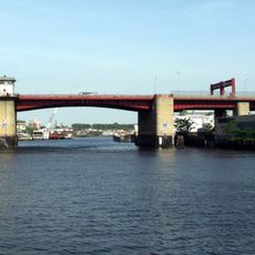
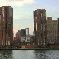
The flight path provides pilots with aerial perspectives of New York's architectural evolution, from century-old bridges to contemporary skyscrapers along the riverbank.
The corridor requires pilots to use frequency 123.075 MHz and follow strict altitude rules throughout the route. Aircraft must stay above the water surface at all times to maintain safety in this restricted airspace over Manhattan.
The corridor divides traffic by direction, with northbound flights operating on the east side of the river and southbound flights on the west side. This separation allows multiple aircraft to safely use the corridor simultaneously without crossing paths.
The community of curious travelers
AroundUs brings together thousands of curated places, local tips, and hidden gems, enriched daily by 60,000 contributors worldwide.