Enable Location

We need your location to show you interesting places around you

Discover nearby places

Find interesting locations and hidden gems around you

Precise directions

Get accurate directions and distances to places

Your location is never shared with other users. It's only used when you tap the location button.

Log in to your account

Start exploring — it's free

Trusted by 62,840 travelers worldwide

Continue with Google
Continue with Apple
or

We will send you a code to connect

By continuing, you accept our Terms and Conditions and our Privacy Policy

Check your inbox

We've sent a pincode in your inbox. Please enter the code below.

East Humboldt Wilderness

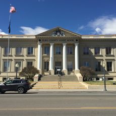
East Humboldt Wilderness, Protected wilderness area in Elko County, Nevada.

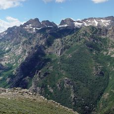
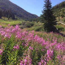
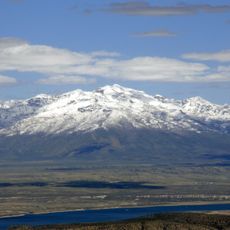
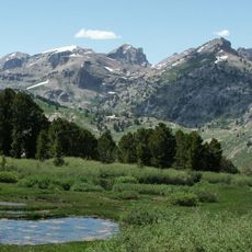
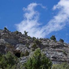
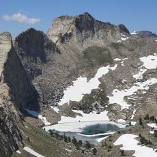
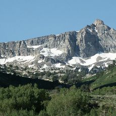
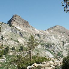
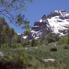
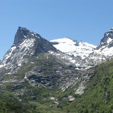
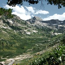
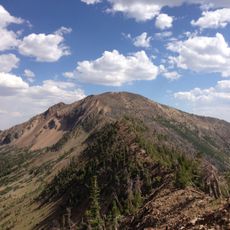
East Humboldt Wilderness is a protected mountain landscape in the East Humboldt Range featuring peaks above 11,000 feet elevation. The terrain contains diverse ecosystems across forested slopes and alpine meadows where mountain goats and other wildlife make their homes.

This landscape received federal protection through the Nevada Wilderness Protection Act of 1989, establishing its current conservation status. The granite formations and canyon shapes developed through tectonic and glacial processes over thousands of years.

The Western Shoshone and Northern Paiute peoples maintained strong connections to this land before European settlers arrived in the region during the 1820s.

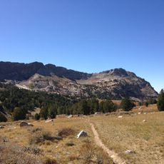
This wilderness contains over 90 miles of hiking trails ranging from easy to challenging routes through lakes and mountain passes. Visitors should prepare for rapid weather changes typical of high elevation areas and follow Forest Service guidelines.

The U-shaped valleys here reveal the work of ancient glaciers that carved the landscape thousands of years ago. These glacial formations remain visible today and show visitors how ice shaped the mountain terrain over geological time.

The community of curious travelers

AroundUs brings together thousands of curated places, local tips, and hidden gems, enriched daily by 60,000 contributors worldwide.

Start exploring
Location
GPS coordinates
40.95000,-115.11700
Latest update
December 14, 2025 12:22
Around this place
Bonneville Speedway
United States of America

Bonneville Speedway

104.9 km
Ruby Mountains
United States of America

Ruby Mountains

47.4 km
Wendover Air Force Base
United States of America

Wendover Air Force Base

95 km
Pilot Peak
United States of America

Pilot Peak

87.7 km
Danger Cave
United States of America

Danger Cave

95.3 km
Jarbidge Wilderness
United States of America

Jarbidge Wilderness

91.9 km
Ruby Dome
United States of America

Ruby Dome

47.4 km
Ruby Lake National Wildlife Refuge
United States of America

Ruby Lake National Wildlife Refuge

89.1 km
Fort Ruby
United States of America

Fort Ruby

104.2 km
Ruby Mountains Wilderness
United States of America

Ruby Mountains Wilderness

47.3 km
Ruby Crest National Recreation Trail
United States of America

Ruby Crest National Recreation Trail

50.9 km
South Fork State Recreation Area
United States of America

South Fork State Recreation Area

62.2 km
Wild Horse State Recreation Area
United States of America

Wild Horse State Recreation Area

98.5 km
Goshute Canyon Wilderness
United States of America

Goshute Canyon Wilderness

105.5 km
Verdi Peaks
United States of America

Verdi Peaks

39.6 km
United States of America

Carlin Canyon

76.6 km
Mount Fitzgerald
United States of America

Mount Fitzgerald

45.7 km
Palisade Canyon
United States of America

Palisade Canyon

109.4 km
Elko County Courthouse
United States of America

Elko County Courthouse

55.8 km
Snow Lake Peak
United States of America

Snow Lake Peak

45 km
Mount Gilbert
United States of America

Mount Gilbert

45.6 km
United States of America

Gold Creek Ranger Station

100.6 km
Seitz Canyon
United States of America

Seitz Canyon

44.8 km
Right Fork Canyon
United States of America

Right Fork Canyon

44.2 km
Maverick Canyon
United States of America

Maverick Canyon

44.9 km
Marys River Peak
United States of America

Marys River Peak

92.4 km
California Trail Interpretive Center, Free Museum
United States of America

California Trail Interpretive Center, Free Museum

71.8 km
UEC Elko Cinema 6
United States of America

UEC Elko Cinema 6

58.4 km
Show the full map
« East Humboldt Wilderness - Protected wilderness area in Elko County, Nevada » is provided by Around Us (aroundus.com). Images and texts are derived from Wikimedia project under a Creative Commons license. You are allowed to copy, distribute, and modify copies of this page, under the conditions set by the license, as long as this note is clearly visible.

Discover hidden gems everywhere you go!

From secret cafés to breathtaking viewpoints, skip the crowded tourist spots and find places that match your style. Our app makes it easy with voice search, smart filtering, route optimization, and insider tips from travelers worldwide. Download now for the complete mobile experience.

Around Us App Screenshot

A unique approach to discovering new places

Le Figaro

All the places worth exploring

France Info

A tailor-made excursion in just a few clicks

20 Minutes

Around Us
Travel Guide & Maps
Download

Send to your phone

QR Code
1

Open the camera app on your mobile.

2

Point at the QR code with your camera. A notification will appear.

3

Tap the notification to open the link.