Chest opened
+${chestReward.xp} XP
Explorer
NOUVEAU ×${chestReward.collectible.quantity}
tapez pour fermer
Chest locked

Open chests in the app

Around Us is built for your phone — chests unlock when you walk, explore and capture nearby places.

Enable Location

We need your location to show you interesting places around you

Discover nearby places

Find interesting locations and hidden gems around you

Precise directions

Get accurate directions and distances to places

Your location is never shared with other users. It's only used when you tap the location button.

Log in to your account

Start exploring — it's free

Trusted by 73,103 travelers worldwide

Continue with Google
Continue with Apple
or

We will send you a code to connect

By continuing, you accept our Terms and Conditions and our Privacy Policy

Check your inbox

We've sent a pincode in your inbox. Please enter the code below.

Eleven Point National Wild and Scenic River
Discussion Reviews Photo
2.8k Popularity

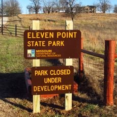
Eleven Point National Wild and Scenic River, Protected waterway in Mark Twain National Forest, Missouri

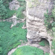
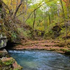
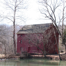
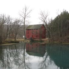
Eleven Point National Wild and Scenic River is a protected waterway flowing 44 miles through southern Missouri, featuring steep limestone bluffs, dense forests, and spring-fed tributaries. The river emerges from natural dolomite springs that maintain consistent water levels throughout the year.

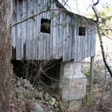
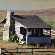
Congress designated this river as one of eight original National Wild and Scenic Rivers in 1968 to protect its natural features. Archaeological remains from the Archaic and Woodland periods indicate that Native American groups lived along its banks for centuries before modern protection.

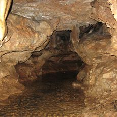
The river corridor contains multiple archaeological sites from Archaic and Woodland periods, revealing patterns of early Native American settlements along its banks.

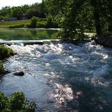
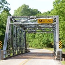
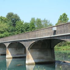
Multiple boat launch sites provide access for paddling with canoes and kayaks, as well as small motorboats with engines under 25 horsepower. The river remains navigable year-round and can be accessed from several convenient trailheads throughout the corridor.

Natural springs emerge from dolomite formations along the riverbank, contributing clear water that maintains consistent flow levels throughout all seasons.

The community of curious travelers

AroundUs brings together thousands of curated places, local tips, and hidden gems, enriched daily by 60,000 contributors worldwide.

Start exploring
Location
GPS coordinates
36.79490,-91.33240
Latest update
December 12, 2025 14:25
Around this place
Mammoth Spring
United States of America

Mammoth Spring

37.8 km
Grand Gulf State Park
United States of America

Grand Gulf State Park

39.5 km
Greer Spring
United States of America

Greer Spring

1.6 km
Mammoth Spring State Park
United States of America

Mammoth Spring State Park

37.9 km
Mammoth Spring State Park
United States of America

Mammoth Spring State Park

37.9 km
Eleven Point State Park
United States of America

Eleven Point State Park

24.3 km
Current River Cavern
United States of America

Current River Cavern

33.4 km
Alley Spring Roller Mill
United States of America

Alley Spring Roller Mill

41.2 km
AR 289 Bridge Over English Creek
United States of America

AR 289 Bridge Over English Creek

44.1 km
United States of America

Mount Zion Lodge Masonic Temple

46.8 km
Courthouse Square Historic District
United States of America

Courthouse Square Historic District

46.9 km
Walter Klepzig Mill and Farm
United States of America

Walter Klepzig Mill and Farm

38.6 km
Hillyard Cabin
United States of America

Hillyard Cabin

43.7 km
Spring River Bridge
United States of America

Spring River Bridge

39.3 km
Ripley County Jail, Sheriff's Office and Sheriff's Residence
United States of America

Ripley County Jail, Sheriff's Office and Sheriff's Residence

49.2 km
Big Spring Historic District
United States of America

Big Spring Historic District

34.7 km
Randolph Columbus Barrett House
United States of America

Randolph Columbus Barrett House

49.3 km
Rice-Upshaw House
United States of America

Rice-Upshaw House

46.1 km
Ripley County Courthouse
United States of America

Ripley County Courthouse

49.2 km
Saint Andrew's Episcopal Church
United States of America

Saint Andrew's Episcopal Church

37.9 km
Reed Log House
United States of America

Reed Log House

42.4 km
Ravenden Springs School
United States of America

Ravenden Springs School

54.4 km
United States of America

Yadkin Church

46.9 km
Looney-French House
United States of America

Looney-French House

48.1 km
T.H. Morris House
United States of America

T.H. Morris House

38.4 km
Alley Spring
United States of America

Alley Spring

41.2 km
Lightning Bowl
United States of America

Lightning Bowl

50.2 km
Carter County Courthouse
United States of America

Carter County Courthouse

36 km
Show the full map
Reviews
Share your experience

No review yet

Discussions
Start a discussion...

No discussion yet

« Eleven Point National Wild and Scenic River - Protected waterway in Mark Twain National Forest, Missouri » is provided by Around Us (aroundus.com). Images and texts are derived from Wikimedia project under a Creative Commons license. You are allowed to copy, distribute, and modify copies of this page, under the conditions set by the license, as long as this note is clearly visible.

Discover hidden gems everywhere you go!

From secret cafés to breathtaking viewpoints, skip the crowded tourist spots and find places that match your style. Our app makes it easy with voice search, smart filtering, route optimization, and insider tips from travelers worldwide. Download now for the complete mobile experience.

Around Us App Screenshot

A unique approach to discovering new places

Le Figaro

All the places worth exploring

France Info

A tailor-made excursion in just a few clicks

20 Minutes

Around Us
Travel Guide & Maps
Download

Send to your phone

QR Code
1

Open the camera app on your mobile.

2

Point at the QR code with your camera. A notification will appear.

3

Tap the notification to open the link.