Enable Location

We need your location to show you interesting places around you

Discover nearby places

Find interesting locations and hidden gems around you

Precise directions

Get accurate directions and distances to places

Your location is never shared with other users. It's only used when you tap the location button.

Andijan

Log in to your account

Start exploring — it's free

Trusted by 61,776 travelers worldwide

Continue with Google
Continue with Apple
or

We will send you a code to connect

By continuing, you accept our Terms and Conditions and our Privacy Policy

Check your inbox

We've sent a pincode in your inbox. Please enter the code below.

Andijan, Administrative center in Fergana Valley, Uzbekistan

Description

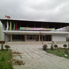
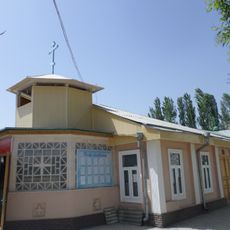
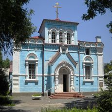
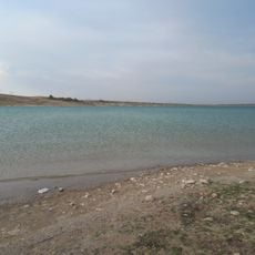
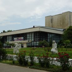
Andijan is an administrative capital in the southeastern part of the Fergana Valley in Uzbekistan. The settlement spreads across flat terrain with low residential neighborhoods, modern squares and several parks along the streets.

History

The settlement existed in the 7th century as a trading station on the Silk Road and developed over the centuries into an important regional center. In the early 16th century, the ruler who later founded the Mughal Empire in India was born here.

Culture

The city takes its name from the old trading post Andiyon mentioned in Persian sources. Many streets in the center today display murals and reliefs honoring local poets and scholars from the region.

Practical

The city center is easy to explore on foot, as most points of interest sit close together. During summer, temperatures can become very high, so a visit in the morning or late afternoon works well.

Did you know?

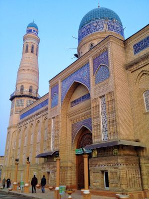
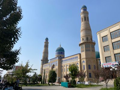
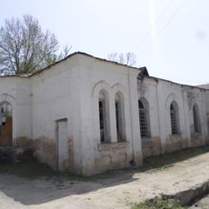
A series of earthquakes in 1902 destroyed many older structures and completely changed the urban appearance. This disaster left almost no medieval structures standing, while later buildings shaped the present appearance.

Location
Elevation above the sea
494 m
GPS coordinates
40.78335,72.35067
Latest update
December 13, 2025 17:40

AroundUs brings together thousands of curated places, local tips, and hidden gems, enriched daily by 60,000 contributors worldwide. Discover all places nearby (Andijan Region).

Around this place
Sulaiman-Too
Kyrgyzstan

Sulaiman-Too

46.2 km
Osh State Academic Uzbek Music and Drama Theater named after Babur
Kyrgyzstan

Osh State Academic Uzbek Music and Drama Theater named after Babur

46.3 km
National Historical and Archaeological Museum Complex Sulayman
Kyrgyzstan

National Historical and Archaeological Museum Complex Sulayman

46.3 km
Suyumbayev Stadion
Kyrgyzstan

Suyumbayev Stadion

48.2 km
Church in Andijan
Uzbekistan

Church in Andijan

3.2 km
Saint Michael Church
Kyrgyzstan

Saint Michael Church

48.6 km
Karkidon Reservoir
Kyrgyzstan

Karkidon Reservoir

43.6 km
Ajidaar-Unkyur
Kyrgyzstan

Ajidaar-Unkyur

52.3 km
Church of St. Nicholay Chudotvortsa in Andijan
Uzbekistan

Church of St. Nicholay Chudotvortsa in Andijan

3.1 km
Chapel of St. George in Andijan
Uzbekistan

Chapel of St. George in Andijan

3.9 km
Akbarobod natural monument
Uzbekistan

Akbarobod natural monument

44 km
Church of St. Sergiy Radonezhckogo in Andijan
Uzbekistan

Church of St. Sergiy Radonezhckogo in Andijan

2.6 km
Rodnik Kasym-Bek-Bulak
Kyrgyzstan

Rodnik Kasym-Bek-Bulak

48.6 km
Teshik-Tash-Bulak
Kyrgyzstan

Teshik-Tash-Bulak

45.5 km
Rodnik Kara-Bulak (tubud sa Kirgistan, Jalal-Abad oblast, lat 41,17, long 72,69)
Kyrgyzstan

Rodnik Kara-Bulak (tubud sa Kirgistan, Jalal-Abad oblast, lat 41,17, long 72,69)

51.3 km
Rodnik Say-Bulak
Kyrgyzstan

Rodnik Say-Bulak

50.4 km
Rodnik Iosh
Kyrgyzstan

Rodnik Iosh

47.9 km
Rodnik Dzhiyde-Bulak (tubud sa Kirgistan, Osh Oblasty, lat 40,32, long 72,48)
Kyrgyzstan

Rodnik Dzhiyde-Bulak (tubud sa Kirgistan, Osh Oblasty, lat 40,32, long 72,48)

52.4 km
Rodnik Toguz-Bulak (tubud sa Kirgistan, Osh Oblasty, lat 40,36, long 72,15)
Kyrgyzstan

Rodnik Toguz-Bulak (tubud sa Kirgistan, Osh Oblasty, lat 40,36, long 72,15)

50 km
Rodnik Toguz-Bulak (tubud sa Kirgistan, Osh Oblasty, lat 40,39, long 72,40)
Kyrgyzstan

Rodnik Toguz-Bulak (tubud sa Kirgistan, Osh Oblasty, lat 40,39, long 72,40)

44.1 km
Rodnik Dzhiyde-Bulak (tubud sa Kirgistan, Osh Oblasty, lat 40,40, long 72,23)
Kyrgyzstan

Rodnik Dzhiyde-Bulak (tubud sa Kirgistan, Osh Oblasty, lat 40,40, long 72,23)

43.4 km
Rodnik Merganbulak
Kyrgyzstan

Rodnik Merganbulak

40.2 km
Rodnik Kamysh-Bulak
Kyrgyzstan

Rodnik Kamysh-Bulak

50.8 km
Rudnik Ulugtagskiy
Kyrgyzstan

Rudnik Ulugtagskiy

45.5 km
Aryk Yangi
Kyrgyzstan

Aryk Yangi

40.6 km
Rodnik Kosh-Bulak
Kyrgyzstan

Rodnik Kosh-Bulak

51.9 km
Rodnik Kayragach-Bulak
Kyrgyzstan

Rodnik Kayragach-Bulak

47.2 km
Sultan Ibraimov Dramatic Theatre
Kyrgyzstan

Sultan Ibraimov Dramatic Theatre

48 km
Show the full map
« Andijan - Administrative center in Fergana Valley, Uzbekistan » is provided by Around Us (aroundus.com). Images and texts are derived from Wikimedia project under a Creative Commons license. You are allowed to copy, distribute, and modify copies of this page, under the conditions set by the license, as long as this note is clearly visible.

Discover hidden gems everywhere you go!

From secret cafés to breathtaking viewpoints, skip the crowded tourist spots and find places that match your style. Our app makes it easy with voice search, smart filtering, route optimization, and insider tips from travelers worldwide. Download now for the complete mobile experience.

Around Us App Screenshot

A unique approach to discovering new places

Le Figaro

All the places worth exploring

France Info

A tailor-made excursion in just a few clicks

20 Minutes

Around Us
Travel Guide & Maps
Download

Send to your phone

QR Code
1

Open the camera app on your mobile.

2

Point at the QR code with your camera. A notification will appear.

3

Tap the notification to open the link.