Enable Location

We need your location to show you interesting places around you

Discover nearby places

Find interesting locations and hidden gems around you

Precise directions

Get accurate directions and distances to places

Your location is never shared with other users. It's only used when you tap the location button.

Ciudad Guayana

Log in to your account

Start exploring — it's free

Trusted by 63,148 travelers worldwide

Continue with Google
Continue with Apple
or

We will send you a code to connect

By continuing, you accept our Terms and Conditions and our Privacy Policy

Check your inbox

We've sent a pincode in your inbox. Please enter the code below.

Ciudad Guayana
Discussion Reviews 4 Photos
98.1k Popularity

Ciudad Guayana, Administrative division in Bolivar State, Venezuela

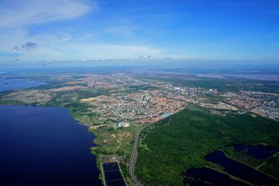
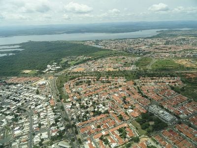
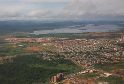
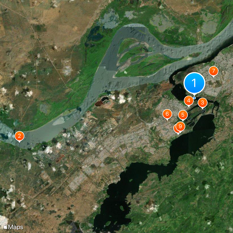
This urban settlement stretches along the southern shore of the Orinoco and divides into two main areas: San Félix to the east and Puerto Ordaz to the west. Both parts connect through wide avenues and extensive green spaces that interweave the industrial character of the region with residential neighborhoods.

The Venezuelan government founded this city in 1961 by merging San Félix and Puerto Ordaz to create a center for resource processing and heavy industry. During the following decades, thousands of workers from across the country and abroad moved here, permanently shaping the region.

This planned city was designed for international heavy industry specialists, which remains visible in the spacious residential quarters today. Many streets bear names recalling the companies and engineers who accompanied the city's development.

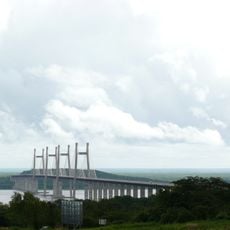
The international airport connects this place with other Venezuelan destinations, while the Orinoco forms a waterway to the Atlantic. Both sections can be reached via several bridges and expressways, though traffic may be heavy during rush hours.

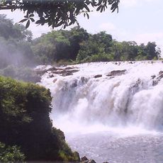
Several waterfalls lie within the city boundaries and flow through residential and commercial districts, including Cachamay and Llovizna Falls. These natural formations have been turned into public parks where locals picnic and walk on weekends.

The community of curious travelers

AroundUs brings together thousands of curated places, local tips, and hidden gems, enriched daily by 60,000 contributors worldwide.

Start exploring
Location
Inception
1961
Elevation above the sea
13 m
GPS coordinates
8.32238,-62.68966
Latest update
December 12, 2025 23:33
Reviews
Share your experience

No review yet

Discussions
Start a discussion...

No discussion yet

« Ciudad Guayana - Administrative division in Bolivar State, Venezuela » is provided by Around Us (aroundus.com). Images and texts are derived from Wikimedia project under a Creative Commons license. You are allowed to copy, distribute, and modify copies of this page, under the conditions set by the license, as long as this note is clearly visible.

Discover hidden gems everywhere you go!

From secret cafés to breathtaking viewpoints, skip the crowded tourist spots and find places that match your style. Our app makes it easy with voice search, smart filtering, route optimization, and insider tips from travelers worldwide. Download now for the complete mobile experience.

Around Us App Screenshot

A unique approach to discovering new places

Le Figaro

All the places worth exploring

France Info

A tailor-made excursion in just a few clicks

20 Minutes

Around Us
Travel Guide & Maps
Download

Send to your phone

QR Code
1

Open the camera app on your mobile.

2

Point at the QR code with your camera. A notification will appear.

3

Tap the notification to open the link.