Sơn La, provincial city of Vietnam
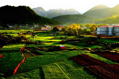
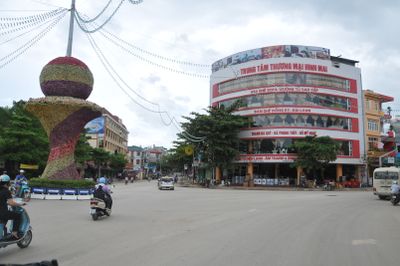
Sơn La is a provincial city in northwestern Vietnam located between hills and valleys, serving as the administrative center of Sơn La Province. The city is surrounded by green mountains and combines traditional architecture with modern buildings, while its streets contain small shops, local houses, and open spaces where people gather daily.
The city developed as an administrative center during the French colonial period, and the famous prison from that era documents the city's role in Vietnam's independence movement. The historic site with its stone walls and cells shows the history of the time when resistance fighters were held there.
Sơn La means "mountain land" and reflects both the geography and the lives of the people who inhabit it. The city is shaped by the traditions of several ethnic minorities, each with their own festivals, clothing styles, and food customs that remain visible in daily life.
The best time to visit is from February to April, when wild cherry blossoms bloom and weather is mild, and from September to November when the air is clear and cool. Travelers should bring appropriate clothing for cool temperatures since the city lies in the mountains and remains relatively cool year-round.
The city museum holds old texts written in Thai script and other artifacts that preserve the history of ethnic groups often overlooked when visiting only the famous sites. These lesser-known exhibits offer deeper insights into the daily lives and cultures of people who have lived there for generations.
The community of curious travelers
AroundUs brings together thousands of curated places, local tips, and hidden gems, enriched daily by 60,000 contributors worldwide.