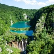
Ban Gioc–Detian Falls, Natural waterfall in Cao Bang, Vietnam.
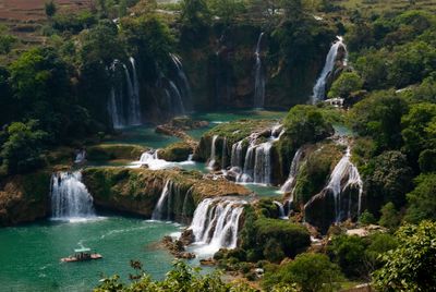
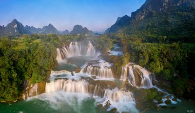
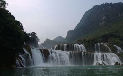
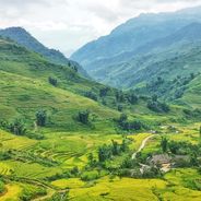
Ban Gioc–Detian Falls is a waterfall on the Quay Son River in Cao Bằng, Vietnam, extending 200 meters in width. The water drops 30 meters over several limestone tiers, while bamboo groves and rice terraces cover the surrounding slopes.
The falls have marked the natural boundary between Vietnam and China for centuries, with the border running through the middle of the cascades. Local communities on both sides shared the river for agriculture and trade for a long time.
Locals call the falls Ban Gioc on the Vietnamese side and Detian on the Chinese side. The border location makes this a place where two countries share the same landscape.
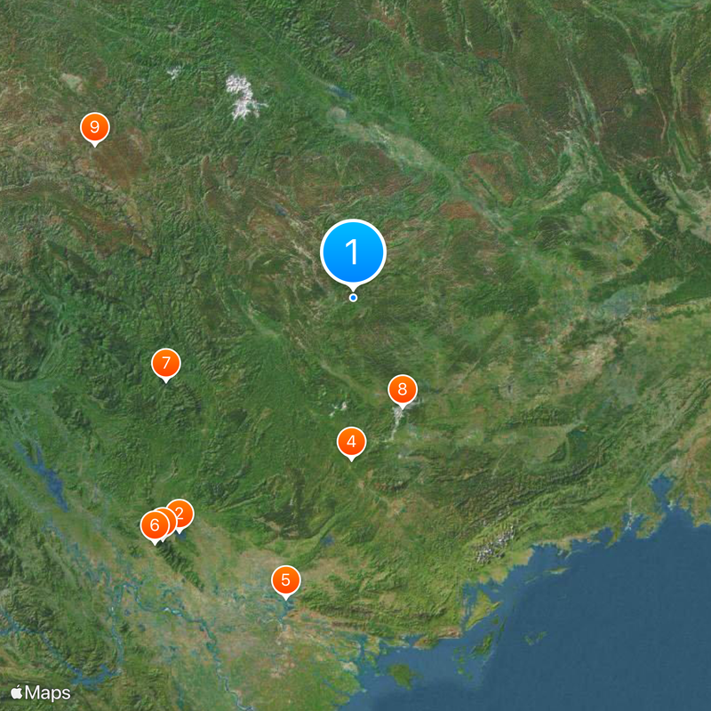
Visitors reach the falls by bus from Cao Bằng city, with the journey taking around four hours. October brings clear weather and strong flow, while the rainy season increases the volume.
The falls divide into three sections separated by rocky outcrops. The left section fills with water only during the rainy season and remains dry in other months.
Location: Cao Bằng
Elevation above the sea: 385 m
Height: 30 m
Width: 200 m
Part of: Quây Sơn River
GPS coordinates: 22.85639,106.72194
Latest update: December 5, 2025 22:23
Waterfalls draw you in through your senses. You hear the roar of falling water, feel the mist on your skin, and watch light dance across the spray. Many of the most powerful examples are found in places that stay relatively untouched, where reaching them is half the reward. These destinations give...
Vietnam extends more than 1,000 miles (1,600 kilometers) from mountain regions in the north to the Mekong Delta in the south, offering travelers a wide range of natural and historical sites beyond urban centers. The country includes Buddhist temples like Bai Dinh and Thien Mu Pagoda, cave systems...
Nui Coc Lake
177.3 km
Tam Đảo
187.5 km
Friendship Pass
98 km
Chùa Vĩnh Nghiêm
187.3 km
Tam Dao National Park
191.9 km
Ba Bể National Park
124.3 km
Rock Paintings of Hua Mountain
72.5 km
牡宜遗址
181.8 km
Nguom Ngao Cave
2.1 km
Tra Linh checkpoint
40.8 km
Ka Long Bridge
195.6 km
Mount Yen Tu
188.7 km
Guangxi Finance Plaza
170.1 km
Nanning Mosque
163.4 km
Longbang Port
40.9 km
Diwang International Commerce Center
168.7 km
Ky Cung Bridge
112 km
The Complex of Yen Tu Monuments and Landscape
198.1 km
Thanh Chuong Viet Palace
199.7 km
Yantan Dam
154.6 km
Vat Bridge
190.8 km
Cathedral of Our Lady of China
165.8 km
Église du Sacré-Cœur-de-Jésus de Nanning
165.8 km
Guangxi Zhuang Autonomous Region Museum
165.4 km
Nanning Bridge
169.1 km
Ha Giang provincial museum
178.3 km
Yongjiang Bridge
181.2 km
Nanning Yonghe Bridge
161.2 kmVisited this place? Tap the stars to rate it and share your experience / photos with the community! Try now! You can cancel it anytime.
Discover hidden gems everywhere you go!
From secret cafés to breathtaking viewpoints, skip the crowded tourist spots and find places that match your style. Our app makes it easy with voice search, smart filtering, route optimization, and insider tips from travelers worldwide. Download now for the complete mobile experience.
A unique approach to discovering new places❞
— Le Figaro
All the places worth exploring❞
— France Info
A tailor-made excursion in just a few clicks❞
— 20 Minutes