Sarlahi District, Administrative district in Madhesh Province, Nepal.
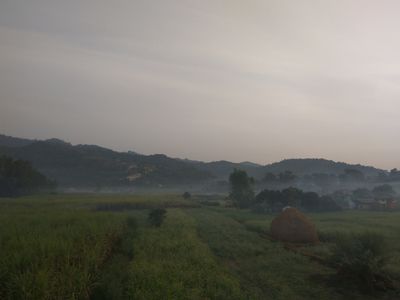
Sarlahi District is an administrative area in Madhesh Province that covers around 1,259 square kilometers of varied terrain, with Chure Hills rising in the north and flat Terai plains spreading southward. The district spans twenty municipalities and borders Bihar state in India to the south.
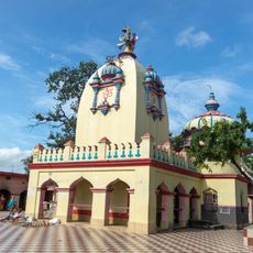
The district takes its name from the Sarla Devi temple located in Hempur village, which holds sacred meaning for local communities. This temple serves as a reference point for the area's religious roots and historical identity.
Hindu, Muslim, and Buddhist communities live together in the area, speaking Bajjika, Maithili, and Nepali as everyday languages. This mix of faiths and tongues shapes the rhythm of daily life across the twenty municipalities.
The district connects easily to neighboring areas like Rautahat, Mahottari, and Sindhuli, making travel between regions straightforward. The driest months offer the most reliable travel conditions across the district.
Lalbandi municipality is home to Nepal's largest Tropical Horticulture Center, where mangoes, litchis, tomatoes, and flowers are grown in significant quantities. These products supply markets across the country and drive much of the local economy.
The community of curious travelers
AroundUs brings together thousands of curated places, local tips, and hidden gems, enriched daily by 60,000 contributors worldwide.