Surkhet District, Administrative district in Karnali Province, Nepal
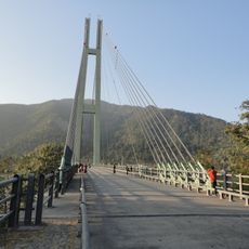
Surkhet District covers an area of about 2,489 square kilometers (961 square miles) in the mid-western region of Nepal, encompassing mountains, valleys, and river systems. The terrain varies from lower elevations with plains to higher forested hills that define the landscape.
This district was separated from the former Dailekh district as its own administrative unit and underwent major transformations afterward. These changes came following the armed conflict that concluded in 2008, which had deeply affected the region's development.
The region is home to communities that speak Nepali alongside Magar and Tharu languages. These different linguistic groups shape daily interactions and reflect the diverse heritage of the people living here.
The area is connected to other regions by the Ratna Highway and Karnali Highway for road access. A local airport also provides connections to major destinations for travelers seeking faster transportation options.
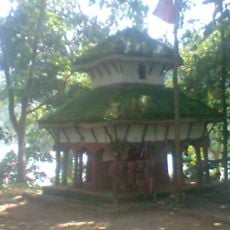
The Kakrebihar temple, built in the 12th century, features detailed stone carvings and Buddhist symbols throughout its structure. These artistic elements reveal the region's earlier significance as a religious center.
The community of curious travelers
AroundUs brings together thousands of curated places, local tips, and hidden gems, enriched daily by 60,000 contributors worldwide.