San Juanico Bridge, Steel truss bridge in Leyte Province, Philippines.
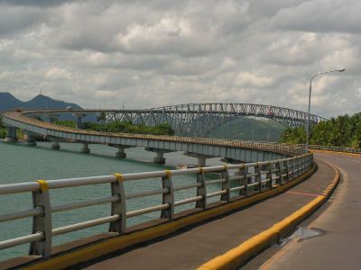
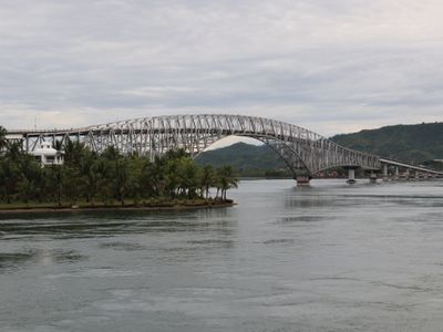
The San Juanico Bridge is a steel truss crossing that links two islands in the eastern Philippines, supported by concrete piers that rise from the water. Its main span features arched steel members forming a gateway above the shipping channel below.
Construction started in 1969 using loans from Japan and opened to traffic in 1973, creating the first fixed link between Leyte and Samar. Before its completion, ferries were the only way to cross the strait, making travel slower and dependent on weather.
The bridge functions as a central component of the Pan-Philippine Highway network, symbolizing the engineering achievements and infrastructure development of the Philippine nation.
Visitors can reach the crossing by taking public buses or jeepneys from Tacloban, with the ride lasting around ten minutes. It is best to cross during daylight when views of the sea and surrounding islands are clear.
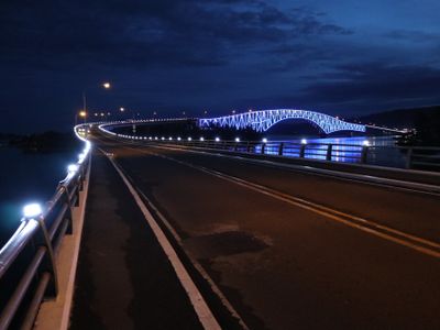
Around 30,000 LED lights are installed along the structure and change color in the evening, making the crossing visible from afar after sunset. This lighting turns the structure into a glowing landmark on the horizon of the region.
The community of curious travelers
AroundUs brings together thousands of curated places, local tips, and hidden gems, enriched daily by 60,000 contributors worldwide.