Chotar Sar, summit in Pakistan
Location: Federally Administered Tribal Areas
Elevation above the sea: 2,231 m
GPS coordinates: 32.18770,69.35960
Latest update: October 19, 2025 01:19

Forward Operating Base Chapman
139.8 km
Takht-e-Sulaiman
78.3 km
Gomal Zam Dam
50.2 km
Ghazni Minarets
176 km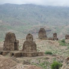
Kafir Kot
188.9 km
Citadel of Ghazni
175 km
Sikaram Sar
212.3 km
Palace of Sultan Mas'ud III
175.9 km
Band E Sardeh Dam
140.7 km
Forward Operating Base Arian
171.4 km
Thal Gumbad Mosque
172.1 km
Saeeda Mushtaq House Bhakkar
179.8 km
Akhtar's house, Zarin Killa, Takht-e-Nasrati
172.1 km
Saeeda Mushtaq House
178.3 km
Сарде 1967 دسرده بند۱۳۴۶
140.7 km
Saeeda Mushtaq House Bhakkar
178.3 km
Zahida Agro Farm
167.4 km
Delemela road
213.2 km
Shakardara road
213.3 km
Teri, Khyper Pakhtunkhwa, Pakistan
204.7 km
Chashma Jheel
199.8 km
Warana Wilayat Khail
175 km
Mamunh Khwarra
178.1 km
Rehman Dheri Site
139 km
Subakzai Lake Road by Kashif On Bike
131.6 km
Water Canal with up slope flow
200.8 km
Thall Fort
172.3 km
Work of art
50.4 kmReviews
Visited this place? Tap the stars to rate it and share your experience / photos with the community! Try now! You can cancel it anytime.
Discover hidden gems everywhere you go!
From secret cafés to breathtaking viewpoints, skip the crowded tourist spots and find places that match your style. Our app makes it easy with voice search, smart filtering, route optimization, and insider tips from travelers worldwide. Download now for the complete mobile experience.

A unique approach to discovering new places❞
— Le Figaro
All the places worth exploring❞
— France Info
A tailor-made excursion in just a few clicks❞
— 20 Minutes