Chest opened
+${chestReward.xp} XP
Explorer
NOUVEAU ×${chestReward.collectible.quantity}
tapez pour fermer

See the monuments around you in AR Open chests in the app

Around Us is built for your phone — point your camera at the streets and discover the monuments and places around you in augmented reality. Around Us is built for your phone — chests unlock when you walk, explore and capture nearby places.

•

Enable Location

We need your location to show you interesting places around you

Discover nearby places

Find interesting locations and hidden gems around you

Precise directions

Get accurate directions and distances to places

Your location is never shared with other users. It's only used when you tap the location button.

Yuribey Bridge

Log in to your account

Start exploring — it's free

Trusted by 94,536 travelers worldwide

Continue with Google
Continue with Apple
or

We will send you a code to connect

By continuing, you accept our Terms and Conditions and our Privacy Policy

Check your inbox

We've sent a pincode in your inbox. Please enter the code below.

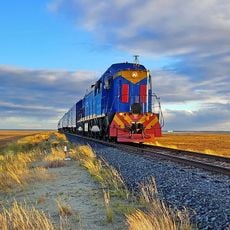
Yuribey Bridge, Railway bridge in Yamalo-Nenets Autonomous Okrug, Russia.

The Yuribey Bridge is a railway crossing over the Yuribey River built to handle the harsh Arctic environment. The structure consists of multiple steel spans designed to support heavy freight trains across the frozen landscape.

The bridge was built in 2008–2009 and opened to traffic in June 2009, with a formal opening ceremony on 24 September 2009. Media reported construction took 349 days. On 4 June 2009 the first passengers were presidential envoy Nikolai Vinnichenko, Yamal governor Yuri Neyolov and Gazpromtrans CEO Vyacheslav Tyurin. The crossing completed the Obskaya–Bovanenkovo line and opened the Bovanenkovo field.

The bridge carries the Obskaya–Bovanenkovo line, whose completion let Gazprom begin developing the Bovanenkovo oil and gas condensate field. Its opening ceremony took place on 24 September 2009, months after the first passengers crossed on 4 June 2009: presidential envoy Nikolai Vinnichenko, Yamal governor Yuri Neyolov and Gazpromtrans head Vyacheslav Tyurin.

The bridge carries the Obskaya–Bovanenkovo railway across the Yuribey floodplain; it is rail infrastructure with no pedestrian or road access. The nearest settlements lie far to the south, and the surrounding tundra has no visitor facilities. The structure is visible from a distance as a long line of steel trusses on low piers.

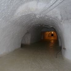
The bridge's supports are driven up to 40 meters deep into the permafrost and filled with reinforced concrete inside metal pipes. This engineering approach prevents ground thaw from destabilizing the structure, a constant challenge in the Arctic.

The community of curious travelers

AroundUs brings together thousands of curated places, local tips, and hidden gems, enriched daily by 94,536 contributors worldwide.

Start exploring
Inception
2009
Length
3,893 m
Part of
Obskaya–Bovanenkovo Line
GPS coordinates
68.92333,70.30972
Latest update
October 28, 2026 17:09
Around this place
Obskaya–Bovanenkovo Line
Russian Federation

Obskaya–Bovanenkovo Line

107.9 mi
Новопортовский мерзлотник
Russian Federation

Новопортовский мерзлотник

107.9 mi
Russian Federation

Священное место Хэхэ пэ (Священный камень)

100.1 mi
Russian Federation

Культовое место Ламзенто-сё

33.3 mi
Russian Federation

Святилище Сидяпелято

57.9 mi
Russian Federation

Святое место на левом берегу р. Сеяха

109.3 mi
Russian Federation

Священное место Хада пэ (Старушка камень)

105.3 mi
Russian Federation

Священное место Яля пя седа (Солнечного дерева сопка)

92.7 mi
Russian Federation

Священное место Харнак седа (Сопка-башмак)

80.8 mi
Russian Federation

Культовое место Тарезнзъяха-хэхэ

2.8 mi
Russian Federation

Святилище Няхаръяха

58.8 mi
Russian Federation

Ямальский кратер

87.7 mi
Russian Federation

Полуостров Ямал

103 mi
Russian Federation

Константинов камень

107.8 mi
Russian Federation

Первая скважина

109.2 mi
Russian Federation

Карьер 8

92 mi
Russian Federation

Семья белых медведей

109.1 mi
Russian Federation

Waterfall

112.7 mi
Russian Federation

Waterfall

113 mi
Russian Federation

Waterfall

113 mi
Russian Federation

Waterfall

112.4 mi
Russian Federation

Waterfall

113 mi
Russian Federation

Waterfall

112.4 mi
Russian Federation

Waterfall

112.4 mi
Russian Federation

Waterfall

112.4 mi
Russian Federation

Waterfall

112.4 mi
Russian Federation

Waterfall

112.4 mi
Russian Federation

Waterfall

112.4 mi
Show the full map
Reviews
Share your experience

No review yet

Discussions
Start a discussion...

No discussion yet

« Yuribey Bridge - Railway bridge in Yamalo-Nenets Autonomous Okrug, Russia » is provided by Around Us (aroundus.com). Images and texts are derived from Wikimedia project under a Creative Commons license. You are allowed to copy, distribute, and modify copies of this page, under the conditions set by the license, as long as this note is clearly visible.

Discover hidden gems everywhere you go!

From secret cafés to breathtaking viewpoints, skip the crowded tourist spots and find places that match your style. Our app makes it easy with voice search, smart filtering, route optimization, and insider tips from travelers worldwide. Download now for the complete mobile experience.

Around Us App Screenshot
❝

A unique approach to discovering new places❞

— Le Figaro

❝

All the places worth exploring❞

— France Info

❝

A tailor-made excursion in just a few clicks❞

— 20 Minutes

Around Us
Travel Guide & Maps
Download

Send to your phone

QR Code
1

Open the camera app on your mobile.

2

Point at the QR code with your camera. A notification will appear.

3

Tap the notification to open the link.