Enable Location

We need your location to show you interesting places around you

Discover nearby places

Find interesting locations and hidden gems around you

Precise directions

Get accurate directions and distances to places

Your location is never shared with other users. It's only used when you tap the location button.

Asha

Log in to your account

Start exploring — it's free

Trusted by 61,991 travelers worldwide

Continue with Google
Continue with Apple
or

We will send you a code to connect

By continuing, you accept our Terms and Conditions and our Privacy Policy

Check your inbox

We've sent a pincode in your inbox. Please enter the code below.

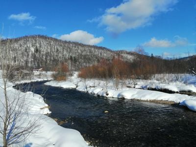
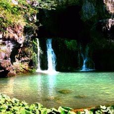
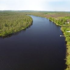
Asha, Protected river and natural monument in Chelyabinsk Oblast, Russia

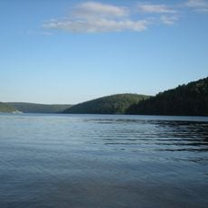
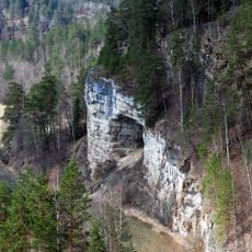
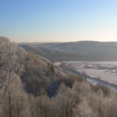
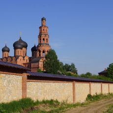
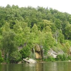
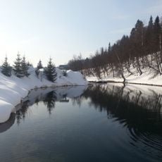
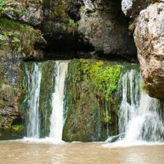
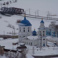
The Asha is a river and natural monument in Chelyabinsk Oblast that flows through mixed landscapes of forests, meadows, and fields. The waterway supports diverse wildlife and plants adapted to its regional climate and terrain.

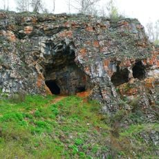
The Asha has served as an important water source for early settlers and farming throughout the Chelyabinsk region's history. Its ecological value eventually led to official protection status to preserve its natural character.

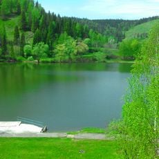
Local communities living along the Asha have developed a deep relationship with the river through everyday activities and traditional uses of its waters. The waterway remains central to how people in the region connect with and depend on their natural surroundings.

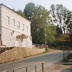
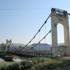
The river can be reached through several access points along its course with designated areas for nature watching and recreation. Visitors should wear appropriate footwear and respect local conservation rules.

The river holds the rare distinction of being both a protected waterway and an officially designated natural monument. This dual recognition highlights its special importance within Russia's conservation framework.

The community of curious travelers

AroundUs brings together thousands of curated places, local tips, and hidden gems, enriched daily by 60,000 contributors worldwide.

Start exploring
Location
Elevation above the sea
122 m
GPS coordinates
54.97778,57.18944
Latest update
December 14, 2025 11:20
Around this place
Pavlovka Reservoir
Russian Federation

Pavlovka Reservoir

65.7 km
Ignateva Cave
Russian Federation

Ignateva Cave

38.8 km
Mountain Yangantau
Russian Federation

Mountain Yangantau

69.8 km
Успенский Свято-Георгиевский монастырь
Russian Federation

Успенский Свято-Георгиевский монастырь

71.3 km
Atysh waterfall
Russian Federation

Atysh waterfall

47.3 km
Idrisovskaya Cave
Russian Federation

Idrisovskaya Cave

61.8 km
Russian Federation

Ufadagi Gastello yodgorligi

70.2 km
Church of the Icon of Ufa of Our Lady in Ufa
Russian Federation

Church of the Icon of Ufa of Our Lady in Ufa

71.1 km
Salawat Yulayev Museum
Russian Federation

Salawat Yulayev Museum

65.6 km
Абҙан шарлауығы
Russian Federation

Абҙан шарлауығы

67.2 km
Lake Upkany-Kul
Russian Federation

Lake Upkany-Kul

43.7 km
Simsky Pond
Russian Federation

Simsky Pond

31.6 km
Lake Sarva
Russian Federation

Lake Sarva

30 km
Krasivaya Polyana
Russian Federation

Krasivaya Polyana

59.4 km
Атиш (печера)
Russian Federation

Атиш (печера)

47.3 km
Заповедная пещера
Russian Federation

Заповедная пещера

47.3 km
Russian Federation

Likhachyovsky

68.9 km
Russian Federation

Knyazevsky

67 km
Sabakay
Russian Federation

Sabakay

68.3 km
«Каравелла» диңгеҙ музейы‎
Russian Federation

«Каравелла» диңгеҙ музейы‎

69.8 km
Zuyakovsky School of History Museum
Russian Federation

Zuyakovsky School of History Museum

64.8 km
Sukhaya Atya Cave
Russian Federation

Sukhaya Atya Cave

20.3 km
Church of the Entry of the Theotokos into the Temple (Minyar)
Russian Federation

Church of the Entry of the Theotokos into the Temple (Minyar)

26.2 km
Дом Белосельских-Белозерских (Катав-Ивановск)
Russian Federation

Дом Белосельских-Белозерских (Катав-Ивановск)

69.8 km
Церковь Иоанна Предтечи (Катав-Ивановск)
Russian Federation

Церковь Иоанна Предтечи (Катав-Ивановск)

69.8 km
Дом купцов Патриных (Усть-Катав)
Russian Federation

Дом купцов Патриных (Усть-Катав)

62.8 km
Дворец культуры вагоностроителей им. Т.Я. Белоконева (Усть-Катав)
Russian Federation

Дворец культуры вагоностроителей им. Т.Я. Белоконева (Усть-Катав)

63.2 km
Брянский мост (Усть-Катав)
Russian Federation

Брянский мост (Усть-Катав)

63.3 km
Show the full map
« Asha - Protected river and natural monument in Chelyabinsk Oblast, Russia » is provided by Around Us (aroundus.com). Images and texts are derived from Wikimedia project under a Creative Commons license. You are allowed to copy, distribute, and modify copies of this page, under the conditions set by the license, as long as this note is clearly visible.

Discover hidden gems everywhere you go!

From secret cafés to breathtaking viewpoints, skip the crowded tourist spots and find places that match your style. Our app makes it easy with voice search, smart filtering, route optimization, and insider tips from travelers worldwide. Download now for the complete mobile experience.

Around Us App Screenshot

A unique approach to discovering new places

Le Figaro

All the places worth exploring

France Info

A tailor-made excursion in just a few clicks

20 Minutes

Around Us
Travel Guide & Maps
Download

Send to your phone

QR Code
1

Open the camera app on your mobile.

2

Point at the QR code with your camera. A notification will appear.

3

Tap the notification to open the link.