Kambarsky Pond, reservoir in Udmurtia, Russia
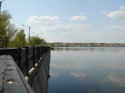
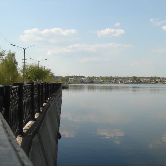
Kambarsky Pond is an artificial reservoir on the Kambarka River in Kambarka, Udmurt Republic, formed in 1767 by damming the river for the Kambarka ironworks. Its surface area is 4.0 km², length 5.5 km, maximum width 1.5 km, average depth 3.1 m and maximum depth 7.0 m at the dam. The full volume is 12.5 million m³, of which 5.1 million m³ is usable.
The pond was created in 1767 when the Kambarka River was dammed to supply water to the Kambarka ironworks. The reservoir lies 9 km from the river's mouth and holds 12.5 million m³ of water, 5.1 million m³ of it usable. Its average annual inflow at the hydroelectric node is 58.3 million m³.
The pond was created in 1767 by damming the Kambarka River for the Kambarka ironworks, and the town grew around this water body. Its name comes from the river it dams. The reservoir lies 9 km from the river's mouth and still shapes how the settlement is laid out around its 5.5 km length.
The pond lies 9 km from the mouth of the Kambarka River, with the dam at its southern end holding back the deepest water, up to 7 m. The shoreline is about 5.5 km long and 1.5 km across at its widest, so walking the full perimeter takes a few hours. Approach from the town centre of Kambarka; the water surface covers 4.0 km².
The pond lies 9 km from the mouth of the Kambarka River and holds 12.5 million m³ of water, of which 5.1 million m³ is usable; the mean annual runoff at the hydroelectric site is 58.3 million m³. Its greatest depth, 7.0 m, is reached at the dam, against an average of 3.1 m.
The community of curious travelers
AroundUs brings together thousands of curated places, local tips, and hidden gems, enriched daily by 94,374 contributors worldwide.