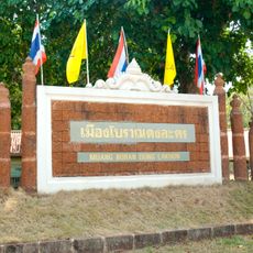
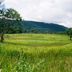
Ban Na, district in Nakhon Nayok province, Thailand
Location: Nakhon Nayok
Elevation above the sea: 13 m
GPS coordinates: 14.26667,101.06139
Latest update: March 17, 2025 08:04
Faculty of Medicine, Srinakharinwirot University
19.3 km
Dong Lakhon historical city
16.6 km
Wat Khao Cha Ngok
10.8 km
Wat Phra Phutthachai
24.8 km
Namtok Sam Lan National Park
21.7 km
Wat Pa Sawang Bun
18.3 km
Wat Khao Kaeo Worawihan
37.6 km
Wat Chulabhorn Wanaram
3.4 km
Wat Khiri Wan
23.3 km
Khao Rom
35.3 km
Wat Chang
1.1 km
Wat Yai Thakkhinaram
18.8 km
Nang Rong waterfall
29 km
Wat Kaeng Khanun
33.8 km
Wat Pho Nayok
17.7 km
Wat Khao Khok
9.7 km
Saraburi Stadium
36.4 km
Wat Khao Khuba
32.5 km
Wat Khao Thurian
18.4 km
Nakhon Nayok Provincial Administrative Organization Stadium
14 km
Nam Tok Sarika
21.4 km
Wat Khao Daeng
20.8 km
Wat Dao Rueang
36 km
Wat Nong No Nuea
33.1 km
Wat Huai Li
32.2 km
Wat Nong Nok Chum
36.1 km
Wat Nong No Tai
32.9 km
โค้ก เวิร์ล
35.2 kmReviews
Visited this place? Tap the stars to rate it and share your experience / photos with the community! Try now! You can cancel it anytime.
Discover hidden gems everywhere you go!
From secret cafés to breathtaking viewpoints, skip the crowded tourist spots and find places that match your style. Our app makes it easy with voice search, smart filtering, route optimization, and insider tips from travelers worldwide. Download now for the complete mobile experience.
A unique approach to discovering new places❞
— Le Figaro
All the places worth exploring❞
— France Info
A tailor-made excursion in just a few clicks❞
— 20 Minutes