Waterloo

Log in to your account

AroundUs is a community-driven map of interesting places, built by curious explorers like you. It grows with every review, story, and photo you share.
Connect to save your favorite spots, contribute locations, and create personalized routes.
Continue with Google
Continue with Apple
Continue with X
Continue with Facebook
Continue with email
By continuing, you accept our Terms and Conditions and our Privacy Policy
Create an account
Add to collection
Map
Suggest a change
Share

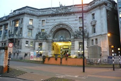
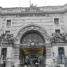
Waterloo, Administrative district in South Bank, London, United Kingdom.

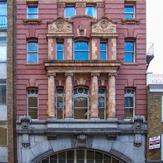
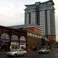
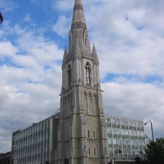
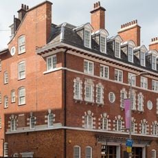
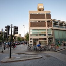
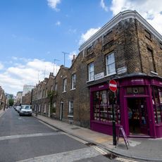
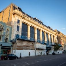
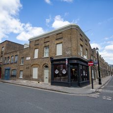
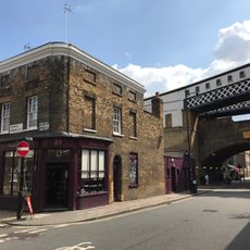
Waterloo is an area along the south bank of the Thames in South London, anchored by a major railway station and surrounded by theaters, concert halls, and art centers. The neighborhood contains a mix of Victorian-era buildings, modern cultural venues, and busy streets filled with shops, restaurants, and markets.

The area developed around Waterloo Bridge, which opened in the early 1800s and sparked growth from marshland into an urban district. The arrival of the railway in the mid-1800s transformed it into a major transportation hub that shaped the neighborhood we see today.

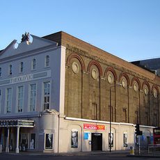
The theaters and arts centers here draw performers and audiences from across the city for plays, concerts, and exhibitions throughout the year. Walking through the neighborhood, you see creative spaces tucked between historic buildings, shaping how residents and visitors experience entertainment and culture.

The station connects to four Underground lines and many rail services to other parts of London and beyond, making arrival straightforward from almost anywhere. Most attractions in the area sit within walking distance of each other, and the streets near the river are flat and easy to navigate on foot.

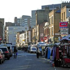
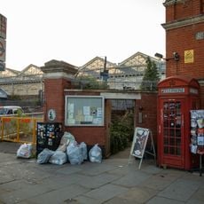
Lower Marsh Market operates with food vendors most days, but transforms on Saturdays when vintage sellers and local craftspeople take over with secondhand goods and handmade items. This weekly shift gives the same street two completely different characters depending on when you visit.

Location: London Borough of Lambeth

GPS coordinates: 51.50130,-0.11200

Latest update: December 7, 2025 09:23

Photos
Around this place
The Old Vic
United Kingdom

The Old Vic

202 m
London Necropolis railway station
United Kingdom

London Necropolis railway station

200 m
Century House, London
United Kingdom

Century House, London

313 m
National Windrush Monument
United Kingdom

National Windrush Monument

269 m
Union Jack Club
United Kingdom

Union Jack Club

269 m
The Old Vic Tunnels
United Kingdom

The Old Vic Tunnels

194 m
Lower Marsh
United Kingdom

Lower Marsh

66 m
St John's Church, Waterloo
United Kingdom

St John's Church, Waterloo

367 m
Canterbury Music Hall
United Kingdom

Canterbury Music Hall

263 m
Christ Church, Lambeth
United Kingdom

Christ Church, Lambeth

323 m
Lincoln Memorial Tower
United Kingdom

Lincoln Memorial Tower

313 m
Former Waterloo Road Fire Station
United Kingdom

Former Waterloo Road Fire Station

160 m
Waterloo Station (Victory Arch)
United Kingdom

Waterloo Station (Victory Arch)

302 m
Tomb (With Draped Urn) In Churchyard To North West Of Portico Of Church Of St John With All Saints
United Kingdom

Tomb (With Draped Urn) In Churchyard To North West Of Portico Of Church Of St John With All Saints

368 m
Edwards Family Tomb In Churchyard To North-West Portico Of Church Of St John With All Saints
United Kingdom

Edwards Family Tomb In Churchyard To North-West Portico Of Church Of St John With All Saints

361 m
South of the River
United Kingdom

South of the River

354 m
Royal National Theatre Studio
United Kingdom

Royal National Theatre Studio

240 m
26-42, Roupell Street Se1
United Kingdom

26-42, Roupell Street Se1

347 m
Peache Family Tomb In Church Yard To North West Of Portico Of Church Of St John With All Saints
United Kingdom

Peache Family Tomb In Church Yard To North West Of Portico Of Church Of St John With All Saints

370 m
5, Whichcote Street Se1
United Kingdom

5, Whichcote Street Se1

332 m
K2 Telephone Kiosk, Outside Station Gates
United Kingdom

K2 Telephone Kiosk, Outside Station Gates

122 m
War memorial at St John's Church, Waterloo
United Kingdom

War memorial at St John's Church, Waterloo

361 m
Memorial to the Battle of Waterloo
United Kingdom

Memorial to the Battle of Waterloo

221 m
Forecourt Walls To Church Of St John With All Saints
United Kingdom

Forecourt Walls To Church Of St John With All Saints

349 m
Facade Of Number 133 To 155
United Kingdom

Facade Of Number 133 To 155

222 m
Sharp Family Tomb In Churchyard To North West Of Portico Of Church Of St John With All Saints
United Kingdom

Sharp Family Tomb In Churchyard To North West Of Portico Of Church Of St John With All Saints

364 m
23, Cornwall Road Se1
United Kingdom

23, Cornwall Road Se1

366 m
22, Cornwall Road Se1
United Kingdom

22, Cornwall Road Se1

343 m
Show the full map
Reviews

Visited this place? Tap the stars to rate it and share your experience / photos with the community! Try now! You can cancel it anytime.

« Waterloo - Administrative district in South Bank, London, United Kingdom » is provided by Around Us (aroundus.com). Images and texts are derived from Wikimedia project under a Creative Commons license. You are allowed to copy, distribute, and modify copies of this page, under the conditions set by the license, as long as this note is clearly visible.

Discover hidden gems everywhere you go!

From secret cafés to breathtaking viewpoints, skip the crowded tourist spots and find places that match your style. Our app makes it easy with voice search, smart filtering, route optimization, and insider tips from travelers worldwide. Download now for the complete mobile experience.

Around Us App Screenshot

A unique approach to discovering new places

Le Figaro

All the places worth exploring

France Info

A tailor-made excursion in just a few clicks

20 Minutes