Enable Location

We need your location to show you interesting places around you

Discover nearby places

Find interesting locations and hidden gems around you

Precise directions

Get accurate directions and distances to places

Your location is never shared with other users. It's only used when you tap the location button.

Haverhill

Log in to your account

Start exploring — it's free

Trusted by 62,105 travelers worldwide

Continue with Google
Continue with Apple
or

We will send you a code to connect

By continuing, you accept our Terms and Conditions and our Privacy Policy

Check your inbox

We've sent a pincode in your inbox. Please enter the code below.

Haverhill, Industrial city in Essex County, Massachusetts, United States.

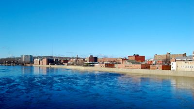
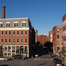
Haverhill is a city in Essex County, Massachusetts, spread along both banks of the Merrimack River. From the business district near the river, residential neighborhoods rise gently toward the surrounding hills, where streets lined with single-family homes and small parks shape the landscape.

Reverend John Ward and Puritan farmers founded the settlement in 1640, initially living from agriculture. In the late 19th and early 20th centuries, the community changed into a major center for shoe production.

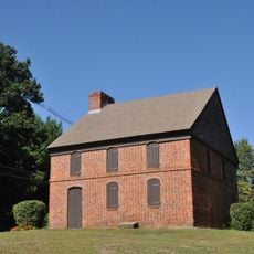
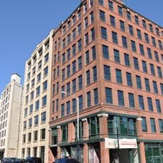
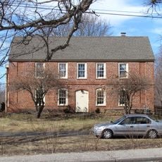
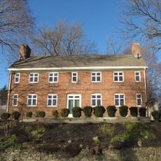
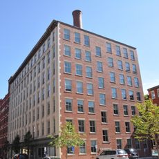
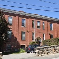
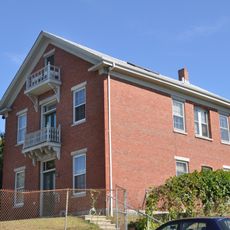
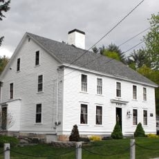
The name comes from Haverhill in Suffolk, England, a connection the early settlers brought from their homeland. In some riverside neighborhoods, you still see red brick factory buildings that now serve as apartments or small offices.

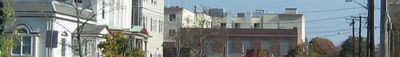
Regular bus routes connect residential areas with shopping centers and medical facilities across the city. The area around the riverfront is good for short walks, while the higher neighborhoods offer a wide view over the valley.

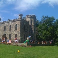
A Norman-style castle built from local stone in 1875 rises in the middle of a large public park. The building now serves as an event venue and starting point for walks through the wooded hills around it.

The community of curious travelers

AroundUs brings together thousands of curated places, local tips, and hidden gems, enriched daily by 60,000 contributors worldwide.

Start exploring
Location
Inception
1640
Elevation above the sea
20 m
GPS coordinates
42.78333,-71.08333
Latest update
December 13, 2025 17:06
Around this place
Winnekenni Castle
United States of America

Winnekenni Castle

1.7 km
Dustin House
United States of America

Dustin House

2.7 km
L.H. Hamel Leather Company Historic District
United States of America

L.H. Hamel Leather Company Historic District

830 m
United States of America

Buttonwoods Museum

1.9 km
Samuel Chase House
United States of America

Samuel Chase House

6.7 km
Rocks Village Historic District
United States of America

Rocks Village Historic District

7.2 km
Haverhill Historical Society Historic District
United States of America

Haverhill Historical Society Historic District

1.8 km
Ephraim Davis House
United States of America

Ephraim Davis House

6.9 km
Bradford Common Historic District
United States of America

Bradford Common Historic District

1.9 km
James E. Simpson House
United States of America

James E. Simpson House

8.5 km
Joseph Hardy House
United States of America

Joseph Hardy House

7.4 km
Hazen-Spiller House
United States of America

Hazen-Spiller House

5.6 km
Joseph Perkins House
United States of America

Joseph Perkins House

7.4 km
George Hopkinson House
United States of America

George Hopkinson House

4.7 km
Emerson House
United States of America

Emerson House

576 m
Winter Street School
United States of America

Winter Street School

620 m
Charles H. Hayes Building
United States of America

Charles H. Hayes Building

1 km
East Parish Meeting House
United States of America

East Parish Meeting House

4.5 km
Asie Swan House
United States of America

Asie Swan House

8.3 km
School Street School
United States of America

School Street School

1.3 km
Primrose Street Schoolhouse
United States of America

Primrose Street Schoolhouse

483 m
Washington Street Shoe District
United States of America

Washington Street Shoe District

1.1 km
The Museum of Printing
United States of America

The Museum of Printing

3.3 km
House at 136 Hampstead Street
United States of America

House at 136 Hampstead Street

7.5 km
Capt. Oliver Emerson Homestead
United States of America

Capt. Oliver Emerson Homestead

8 km
Hastings-Morse House
United States of America

Hastings-Morse House

5.6 km
Main Street Historic District
United States of America

Main Street Historic District

690 m
United States of America

Lower Pond

6.4 km
Show the full map
« Haverhill - Industrial city in Essex County, Massachusetts, United States » is provided by Around Us (aroundus.com). Images and texts are derived from Wikimedia project under a Creative Commons license. You are allowed to copy, distribute, and modify copies of this page, under the conditions set by the license, as long as this note is clearly visible.

Discover hidden gems everywhere you go!

From secret cafés to breathtaking viewpoints, skip the crowded tourist spots and find places that match your style. Our app makes it easy with voice search, smart filtering, route optimization, and insider tips from travelers worldwide. Download now for the complete mobile experience.

Around Us App Screenshot

A unique approach to discovering new places

Le Figaro

All the places worth exploring

France Info

A tailor-made excursion in just a few clicks

20 Minutes

Around Us
Travel Guide & Maps
Download

Send to your phone

QR Code
1

Open the camera app on your mobile.

2

Point at the QR code with your camera. A notification will appear.

3

Tap the notification to open the link.