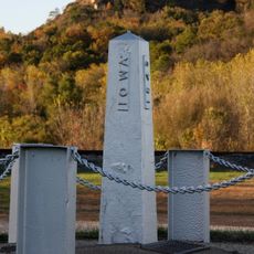
Allamakee County, Administrative county in northeastern Iowa, United States
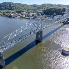
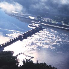
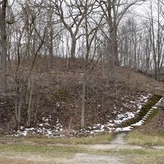
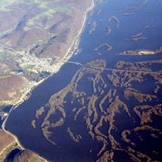
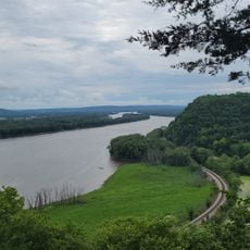
Allamakee County is an administrative county in northeastern Iowa covering approximately 659 square miles of terrain. Deep canyons cut through the landscape where rivers have carved into bedrock over thousands of years, especially along the Mississippi River boundary.
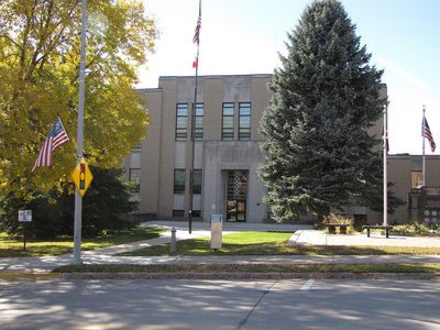
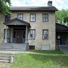
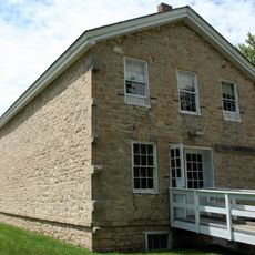
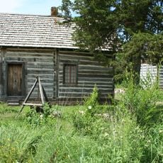
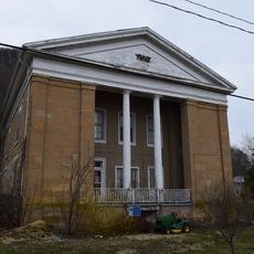
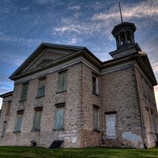
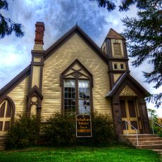
The county was established in 1847 and developed into an administrative center for northeastern Iowa. Its first courthouse from 1861 now operates as the Allamakee County Historical Museum, documenting the region's growth.
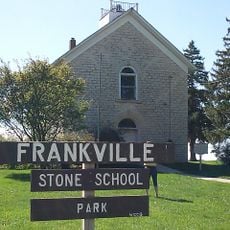
The area shows signs of ancient Native American settlements, with the Ho-Chunk and Dakota Sioux presence still visible in the landscape. Local communities maintain connections to these heritage sites today.
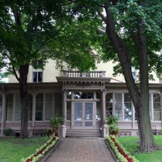
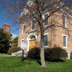
Waukon, the county seat, offers administrative services and visitor information. Most public offices operate during standard business hours, so plan your visit accordingly.
The area sits within the Driftless Area, a region untouched by glaciers during the last ice age. This geological distinction shaped the terrain and created the unusual rock formations visible throughout the landscape.
Location: Iowa
Inception: February 20, 1847
Capital city: Waukon
Shares border with: Houston County, Clayton County, Vernon County, Crawford County, Winneshiek County, Fayette County
Website: http://co.allamakee.ia.us
GPS coordinates: 43.28667,-91.37417
Latest update: December 7, 2025 20:20
Villa Louis
31.1 km
Black Hawk Bridge
15.6 km
Lock and Dam No. 9
23.4 km
Fish Farm Mounds State Preserve
20.3 km
Brisbois House
31.2 km
Astor Fur Warehouse
31.1 km
Allamakee County Court House
8.4 km
Old Allamakee County Courthouse
8.4 km
Big Lake
17.8 km
Upper Iowa River Bridge
16.5 km
Francois Vertefeuille House
29.1 km
Iron Post
25 km
Waterloo Ridge Lutheran Church
28.7 km
West Paint Creek Synod Evangelical Lutheran Church and Cemetery
3.1 km
Lansing Main Street Historic District
15.3 km
Red Bridge
17.8 km
Old Allamakee County Courthouse
15.2 km
Lansing Fisheries Building
15.4 km
Turner Hall
27.2 km
Lansing Stone School
14.9 km
Portland Prairie Methodist Episcopal Church
28.3 km
Frankville School
22.7 km
Effigy Mounds National Monument Visitor Center
26.8 kmThomas Reburn Polygonal Barn
23.6 km
Otto J. Hager House
8.4 km
G. Kerndt and Brothers Elevator and Warehouses, No. 11, No.12 and No. 13
15.4 km
G. Kerndt & Brothers Office Block
15.1 km
Old East Paint Creek Lutheran Church
6.3 kmVisited this place? Tap the stars to rate it and share your experience / photos with the community! Try now! You can cancel it anytime.
Discover hidden gems everywhere you go!
From secret cafés to breathtaking viewpoints, skip the crowded tourist spots and find places that match your style. Our app makes it easy with voice search, smart filtering, route optimization, and insider tips from travelers worldwide. Download now for the complete mobile experience.
A unique approach to discovering new places❞
— Le Figaro
All the places worth exploring❞
— France Info
A tailor-made excursion in just a few clicks❞
— 20 Minutes