Enable Location

We need your location to show you interesting places around you

Discover nearby places

Find interesting locations and hidden gems around you

Precise directions

Get accurate directions and distances to places

Your location is never shared with other users. It's only used when you tap the location button.

Cherokee County

Log in to your account

Start exploring — it's free

Trusted by 61,854 travelers worldwide

Continue with Google
Continue with Apple
or

We will send you a code to connect

By continuing, you accept our Terms and Conditions and our Privacy Policy

Check your inbox

We've sent a pincode in your inbox. Please enter the code below.

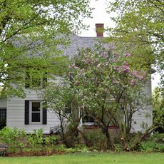
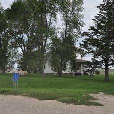
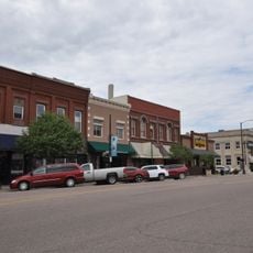
Cherokee County, Administrative division in Iowa, United States

Description

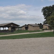
Cherokee County is an administrative division in northwest Iowa that covers an area of roughly 577 square miles. The region is connected by a network of highways and contains eight incorporated municipalities along with sixteen townships organized for local governance.

History

The county was officially established on January 15, 1851, and took its name from the Cherokee Native American tribe. Its creation was part of the broader development of the Iowa territory during the mid-19th century.

Culture

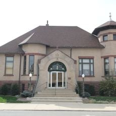
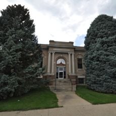
The county operates through sixteen distinct townships, each maintaining local governance structures and community organizations for its 11,658 residents.

Practical

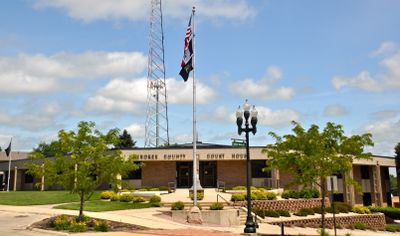
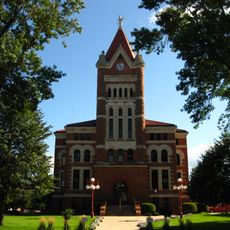
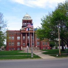
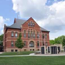
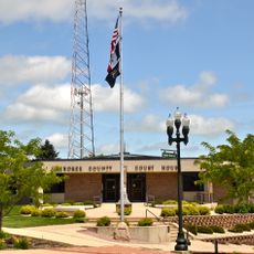
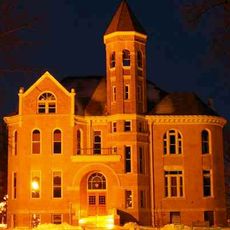
The county courthouse in Cherokee offers various administrative services and information to visitors. The building serves as the main hub for property assessments, financial audits, and environmental health matters affecting the area.

Did you know?

The territory maintains a population density of 20 people per square mile, with 96 percent of residents identifying as members of single racial groups.

Location
Inception
1851
Capital city
Cherokee
Shares border with
O'Brien County, Ida County, Sac County, Plymouth County, Clay County, Buena Vista County, Woodbury County, Sioux County
GPS coordinates
42.73472,-95.62417
Latest update
December 10, 2025 16:02

AroundUs brings together thousands of curated places, local tips, and hidden gems, enriched daily by 60,000 contributors worldwide. Discover all places nearby (Iowa).

Around this place
First Reformed Church
United States of America

First Reformed Church

46.9 km
Indian Village Site
United States of America

Indian Village Site

31.9 km
Carnegie Library
United States of America

Carnegie Library

53 km
Plymouth County Courthouse
United States of America

Plymouth County Courthouse

44.3 km
Sioux County Courthouse
United States of America

Sioux County Courthouse

46.4 km
Ida County Courthouse
United States of America

Ida County Courthouse

45.6 km
Clay County Courthouse
United States of America

Clay County Courthouse

59.7 km
Tonsfeldt Round Barn
United States of America

Tonsfeldt Round Barn

44.3 km
Sac County Courthouse
United States of America

Sac County Courthouse

62.4 km
Jesse J. and Mary F. Allee House
United States of America

Jesse J. and Mary F. Allee House

52.9 km
O'Brien County Courthouse
United States of America

O'Brien County Courthouse

39.2 km
Harker House
United States of America

Harker House

36.2 km
Buena Vista County Courthouse
United States of America

Buena Vista County Courthouse

36.2 km
Le Mars Municipal Park and Golf Course Historic District
United States of America

Le Mars Municipal Park and Golf Course Historic District

43.7 km
Storm Lake Public Library
United States of America

Storm Lake Public Library

36.2 km
Cherokee Public Library
United States of America

Cherokee Public Library

6.2 km
Cherokee County Courthouse
United States of America

Cherokee County Courthouse

5.8 km
Zwemer Hall, Northwestern College
United States of America

Zwemer Hall, Northwestern College

46 km
United States of America

Seven Oaks

62.4 km
Sac City Chicago and North Western Depot
United States of America

Sac City Chicago and North Western Depot

61.8 km
Alvin Bushnell Bell House
United States of America

Alvin Bushnell Bell House

45.2 km
Mill Creek Bridge
United States of America

Mill Creek Bridge

9.1 km
George and Lola Perkins House
United States of America

George and Lola Perkins House

62.4 km
Guy M. and Rose Gillette House
United States of America

Guy M. and Rose Gillette House

5.2 km
Reeves Farmstead Historic District
United States of America

Reeves Farmstead Historic District

45 km
Le Mars Downtown Commercial Historic District
United States of America

Le Mars Downtown Commercial Historic District

44.9 km
Lemuel C. and Mary Boughton House
United States of America

Lemuel C. and Mary Boughton House

5.6 km
Roy C. and Lena Seaman House
United States of America

Roy C. and Lena Seaman House

6.8 km
Show the full map
Administrative divisions
« Cherokee County - Administrative division in Iowa, United States » is provided by Around Us (aroundus.com). Images and texts are derived from Wikimedia project under a Creative Commons license. You are allowed to copy, distribute, and modify copies of this page, under the conditions set by the license, as long as this note is clearly visible.

Discover hidden gems everywhere you go!

From secret cafés to breathtaking viewpoints, skip the crowded tourist spots and find places that match your style. Our app makes it easy with voice search, smart filtering, route optimization, and insider tips from travelers worldwide. Download now for the complete mobile experience.

Around Us App Screenshot

A unique approach to discovering new places

Le Figaro

All the places worth exploring

France Info

A tailor-made excursion in just a few clicks

20 Minutes

Around Us
Travel Guide & Maps
Download

Send to your phone

QR Code
1

Open the camera app on your mobile.

2

Point at the QR code with your camera. A notification will appear.

3

Tap the notification to open the link.