Dodge County

Log in to your account

AroundUs is a community-driven map of interesting places, built by curious explorers like you. It grows with every review, story, and photo you share.
Connect to save your favorite spots, contribute locations, and create personalized routes.
By continuing, you accept our Terms and Conditions and our Privacy Policy
Add to collection
Map
Suggest a change
Share

Dodge County, Administrative county in southeastern Minnesota, US.

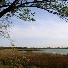
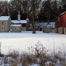
Dodge County is an administrative county in southeastern Minnesota characterized by rolling terrain and farming areas. The South Branch of the Middle Fork Zumbro River flows through the region, shaping its natural landscape.

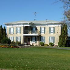
The county was established in 1858 and named after Henry Dodge, Wisconsin's governor. It grew into a center of agricultural settlement during the following decades.

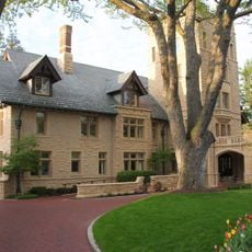
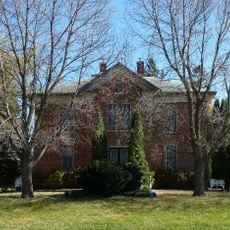
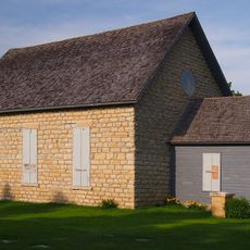
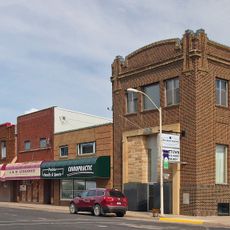
The county reflects its roots in German, Swedish, and Norwegian communities who settled here during the early 1900s. This heritage is visible in the churches that dot the area and in how residents maintain their local traditions.

The area is best explored by car, as sites and towns are spread across rolling countryside. Local administrative offices in the towns can help with information about public services and community resources.

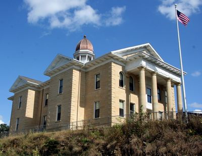
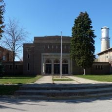
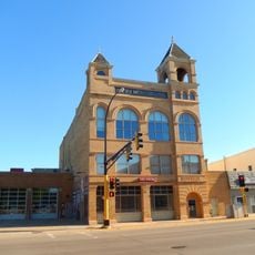
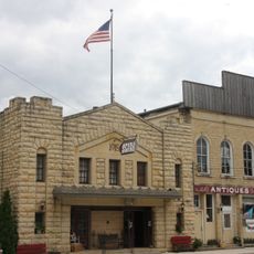
The courthouse in Mantorville was built in 1865 and remains Minnesota's oldest continuously used judicial building. This historic structure has served the community for more than 150 years without closure.

Location: Minnesota

Inception: February 20, 1855

Capital city: Mantorville

Shares border with: Goodhue County, Mower County, Olmsted County, Steele County, Rice County

Website: http://co.dodge.mn.us

GPS coordinates: 44.03000,-92.86000

Latest update: December 8, 2025 13:40

Photos
Around this place
Show the full map
IBM Rochester
United States of America

IBM Rochester

28.5 km
Plummer House
United States of America

Plummer House

30.5 km
National Farmers' Bank of Owatonna
United States of America

National Farmers' Bank of Owatonna

29.9 km
Mayo Building
United States of America

Mayo Building

31.5 km
Guggenheim Building
United States of America

Guggenheim Building

31.5 km
Minnesota State Public School for Dependent and Neglected Children
United States of America

Minnesota State Public School for Dependent and Neglected Children

31 km
James McBean Residence
United States of America

James McBean Residence

29.5 km
Thomas Keys Residence
United States of America

Thomas Keys Residence

29.9 km
Co-Cathedral of St. John the Evangelist
United States of America

Co-Cathedral of St. John the Evangelist

31.3 km
A. H. Bulbulian Residence
United States of America

A. H. Bulbulian Residence

30 km
Pill Hill, Rochester, Minnesota
United States of America

Pill Hill, Rochester, Minnesota

30.8 km
Dr. William J. Mayo House
United States of America

Dr. William J. Mayo House

31.2 km
Rice Lake State Park
United States of America

Rice Lake State Park

17.1 km
Opus Imaging Research Building
United States of America

Opus Imaging Research Building

31.3 km
Kasson Public School
United States of America

Kasson Public School

8.6 km
George Stoppel Farmstead
United States of America

George Stoppel Farmstead

28.1 km
Perry Nelson House
United States of America

Perry Nelson House

12.9 km
Steele County Courthouse
United States of America

Steele County Courthouse

29.8 km
Owatonna Public Library
United States of America

Owatonna Public Library

29.7 km
Ole Carlson House
United States of America

Ole Carlson House

15.5 km
Dr. John H. Adair House
United States of America

Dr. John H. Adair House

29.5 km
Owatonna City and Firemen's Hall
United States of America

Owatonna City and Firemen's Hall

29.9 km
Hauge Lutheran Church
United States of America

Hauge Lutheran Church

28.2 km
Kasson Municipal Building
United States of America

Kasson Municipal Building

8.8 km
Ezra Abbott House
United States of America

Ezra Abbott House

29.4 km
Blooming Prairie Commercial Historic District
United States of America

Blooming Prairie Commercial Historic District

23.8 km
Spark
United States of America

Spark

30.7 km
Mantorville Historic District
United States of America

Mantorville Historic District

9.3 km
Show the full map
Reviews

Visited this place? Tap the stars to rate it and share your experience / photos with the community! Try now! You can cancel it anytime.

« Dodge County - Administrative county in southeastern Minnesota, US » is provided by Around Us (aroundus.com). Images and texts are derived from Wikimedia project under a Creative Commons license. You are allowed to copy, distribute, and modify copies of this page, under the conditions set by the license, as long as this note is clearly visible.

Discover hidden gems everywhere you go!

From secret cafés to breathtaking viewpoints, skip the crowded tourist spots and find places that match your style. Our app makes it easy with voice search, smart filtering, route optimization, and insider tips from travelers worldwide. Download now for the complete mobile experience.

Around Us App Screenshot

A unique approach to discovering new places

Le Figaro

All the places worth exploring

France Info

A tailor-made excursion in just a few clicks

20 Minutes