Benson County

Log in to your account

AroundUs is a community-driven map of interesting places, built by curious explorers like you. It grows with every review, story, and photo you share.
Connect to save your favorite spots, contribute locations, and create personalized routes.
Continue with Google
Continue with Apple
Continue with X
Continue with Facebook
Continue with email
By continuing, you accept our Terms and Conditions and our Privacy Policy
Create an account
Add to collection
Map
Suggest a change
Share

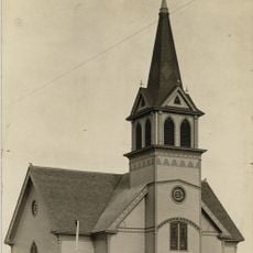
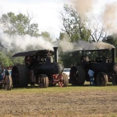
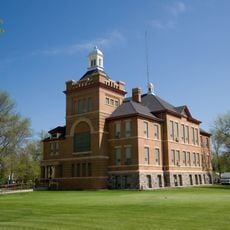
Benson County, County in North Dakota, United States

Benson County is an administrative region in northern North Dakota that spreads across rolling terrain dotted with lakes and waterways. The eastern boundary features Devils Lake, which dominates the landscape and creates a distinct water feature across the area.

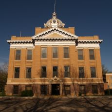
Benson County was established in 1883 by the Dakota Territory legislature and named after Bertil W. Benson, a territorial legislator of that era. This founding created an official administrative division in the northern part of what would become the state of North Dakota.

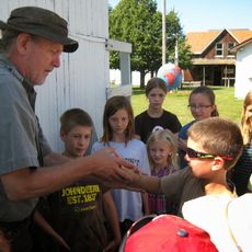
The Spirit Lake Indian Reservation shapes daily life and traditions visible throughout the county, creating a multicultural community where different cultures interact and coexist. Local events and gathering places reflect this blend of traditions that residents share.

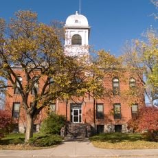
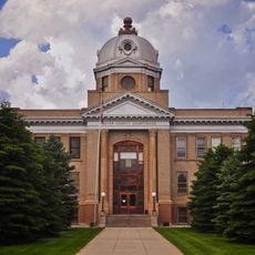
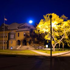
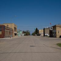
The county government is based in Minnewaukan, where offices operate on weekdays to serve residents. The region is organized into nine municipalities that collectively manage the administrative and service needs of the population.

Within the county boundaries lie three protected natural areas: Buffalo Lake National Wildlife Refuge, Grahams Island State Park, and White Horse Hill National Game Preserve. These reserves offer visitors chances to experience local wildlife and natural habitats firsthand.

Location: North Dakota

Inception: June 4, 1884

Capital city: Minnewaukan

Shares border with: Towner County, Ramsey County, Nelson County, Eddy County, Wells County, Pierce County

Website: https://bensoncountynd.com

GPS coordinates: 48.07000,-99.36000

Latest update: December 10, 2025 15:58

Photos
Around this place
Fort Totten State Historic Site
United States of America

Fort Totten State Historic Site

29.2 km
Vang Evangelical Lutheran Church
United States of America

Vang Evangelical Lutheran Church

50.9 km
United States of America

Johnson Lake National Wildlife Refuge

75.9 km
St. Catherine's Church
United States of America

St. Catherine's Church

88.6 km
Viking Lutheran Church
United States of America

Viking Lutheran Church

25.1 km
Central North Dakota Steam Thresher's Reunion
United States of America

Central North Dakota Steam Thresher's Reunion

46.9 km
Benson County Courthouse
United States of America

Benson County Courthouse

8.2 km
Eddy County Courthouse
United States of America

Eddy County Courthouse

46.5 km
Central High School
United States of America

Central High School

37.5 km
U.S. Post Office and Courthouse
United States of America

U.S. Post Office and Courthouse

37.6 km
St. Mary's Academy
United States of America

St. Mary's Academy

38.4 km
Ramsey County Sheriff's House
United States of America

Ramsey County Sheriff's House

37.5 km
United States of America

Urbain Cote Round Barn

70.5 km
Rugby Post Office
United States of America

Rugby Post Office

57.7 km
Devils Lake Carnegie Library
United States of America

Devils Lake Carnegie Library

37.5 km
Westminster Presbyterian Church
United States of America

Westminster Presbyterian Church

37.6 km
Newport Apartments
United States of America

Newport Apartments

38.7 km
Pierce County Courthouse
United States of America

Pierce County Courthouse

57.4 km
New Rockford Post Office
United States of America

New Rockford Post Office

46.4 km
Towner County Courthouse
United States of America

Towner County Courthouse

48.5 km
Devils Lake Masonic Temple
United States of America

Devils Lake Masonic Temple

41.2 km
Thomas Nichols Putnam House
United States of America

Thomas Nichols Putnam House

71.4 km
Foster County Courthouse
United States of America

Foster County Courthouse

70.7 km
United States of America

Episcopal Church of the Advent and Guild Hall

37.6 km
Wells County Courthouse
United States of America

Wells County Courthouse

50.9 km
Bangs-Wineman Block
United States of America

Bangs-Wineman Block

37.6 km
Tofthagen Library and Museum
United States of America

Tofthagen Library and Museum

75.6 km
Prairie Village Museum
United States of America

Prairie Village Museum

56.6 km
Show the full map
Reviews

Visited this place? Tap the stars to rate it and share your experience / photos with the community! Try now! You can cancel it anytime.

Administrative divisions
« Benson County - County in North Dakota, United States » is provided by Around Us (aroundus.com). Images and texts are derived from Wikimedia project under a Creative Commons license. You are allowed to copy, distribute, and modify copies of this page, under the conditions set by the license, as long as this note is clearly visible.

Discover hidden gems everywhere you go!

From secret cafés to breathtaking viewpoints, skip the crowded tourist spots and find places that match your style. Our app makes it easy with voice search, smart filtering, route optimization, and insider tips from travelers worldwide. Download now for the complete mobile experience.

Around Us App Screenshot

A unique approach to discovering new places

Le Figaro

All the places worth exploring

France Info

A tailor-made excursion in just a few clicks

20 Minutes