Cass County

Log in to your account

AroundUs is a community-driven map of interesting places, built by curious explorers like you. It grows with every review, story, and photo you share.
Connect to save your favorite spots, contribute locations, and create personalized routes.
Continue with Google
Continue with Apple
Continue with X
Continue with Facebook
Continue with email
By continuing, you accept our Terms and Conditions and our Privacy Policy
Create an account
Add to collection
Map
Suggest a change
Share

Cass County, Administrative division in southwestern Michigan, US

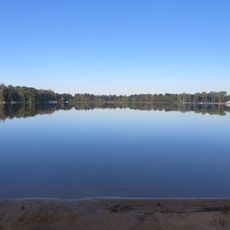
Cass County is an administrative division in southwestern Michigan near the borders with Indiana and Ohio. The area is characterized by small towns, farmland, and lakes, with Dowagiac and Cassopolis serving as its main communities.

The county was established in 1829 and named after Lewis Cass, Michigan's territorial governor. Early development relied on farming and industrial operations such as the Dowagiac Creek mill.

The region attracted many Black families after 1840, supported by Quaker communities who offered land and built a foundation for diversity. This settlement pattern shaped how the area developed its social character.

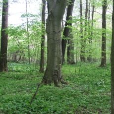
The best time to visit is spring through early fall when the weather is mild and natural areas are accessible. Visitors should have a car, as the area is sparsely populated and public transportation is limited.

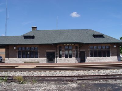
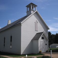
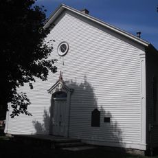
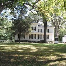
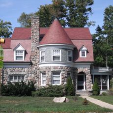
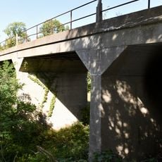
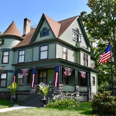
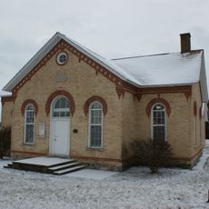
Twenty-six sites across the area are listed on the National Register of Historic Places, documenting significant architectural and cultural treasures. These landmarks tell stories of early settlers, craftsmanship, and the region's social development.

Location: Michigan

Inception: 1829

Capital city: Cassopolis

Shares border with: Berrien County, Elkhart County, Van Buren County, St. Joseph County, Kalamazoo County

Website: http://casscountymi.org

GPS coordinates: 41.91000,-85.99000

Latest update: December 22, 2025 20:31

Photos
Around this place
YMCA Camp Eberhart
United States of America

YMCA Camp Eberhart

19.7 km
United States of America

Newton Woods

11.1 km
First Methodist Episcopal Church of Pokagon
United States of America

First Methodist Episcopal Church of Pokagon

15.2 km
Dowagiac Woods
United States of America

Dowagiac Woods

17.5 km
Smith's Chapel
United States of America

Smith's Chapel

20.4 km
George Newton House
United States of America

George Newton House

11.5 km
Carroll Jones House
United States of America

Carroll Jones House

19.4 km
Crystal Springs Street–Dowagiac River Bridge
United States of America

Crystal Springs Street–Dowagiac River Bridge

18 km
G. W. Jones House
United States of America

G. W. Jones House

19.4 km
Thomson Road–Air Line Railroad Bridge
United States of America

Thomson Road–Air Line Railroad Bridge

17.1 km
Criffield-Whiteley House
United States of America

Criffield-Whiteley House

13.4 km
United States of America

Rudolphi Wildlife Refuge

11.5 km
Mason District Number 5 Schoolhouse
United States of America

Mason District Number 5 Schoolhouse

16.8 km
United States of America

Spirit Springs Sanctuary

20.4 km
Pleasant Lake East Beach
United States of America

Pleasant Lake East Beach

14.4 km
United States of America

Park Shore Golf Course

1.6 km
United States of America

Diamond Lake Golf Club

83 m
United States of America

Dowagiac Elk's Golf Course

12 km
United States of America

Hampshire Country Club

12.4 km
United States of America

Spruce Ridge Golf Club

10.8 km
United States of America

Indian Lake Hills Golf Course

21.6 km
United States of America

Four Lakes Country Club

13.1 km
United States of America

Elkhart County CVB

19.5 km
United States of America

Lake of the Woods

22.2 km
United States of America

Scenic viewpoint

17.1 km
United States of America

Scenic viewpoint

17.9 km
United States of America

Dark Sky Viewing Area

11.2 km
United States of America

Tourist attraction, vehicle

22.8 km
Show the full map
Reviews

Visited this place? Tap the stars to rate it and share your experience / photos with the community! Try now! You can cancel it anytime.

« Cass County - Administrative division in southwestern Michigan, US » is provided by Around Us (aroundus.com). Images and texts are derived from Wikimedia project under a Creative Commons license. You are allowed to copy, distribute, and modify copies of this page, under the conditions set by the license, as long as this note is clearly visible.

Discover hidden gems everywhere you go!

From secret cafés to breathtaking viewpoints, skip the crowded tourist spots and find places that match your style. Our app makes it easy with voice search, smart filtering, route optimization, and insider tips from travelers worldwide. Download now for the complete mobile experience.

Around Us App Screenshot

A unique approach to discovering new places

Le Figaro

All the places worth exploring

France Info

A tailor-made excursion in just a few clicks

20 Minutes