Clinton County

Log in to your account

AroundUs is a community-driven map of interesting places, built by curious explorers like you. It grows with every review, story, and photo you share.
Connect to save your favorite spots, contribute locations, and create personalized routes.
By continuing, you accept our Terms and Conditions and our Privacy Policy
Add to collection
Map
Suggest a change
Share

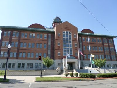
Clinton County, Administrative county in central Michigan, United States.

Clinton County is an administrative region in central Michigan covering approximately 575 square miles (1,490 square kilometers). The area includes several cities and municipalities, among them St. Johns and portions of East Lansing.

The Michigan Legislature created Clinton County in 1831, naming it after prominent political figure DeWitt Clinton. The region achieved its complete organizational structure by 1839.

The Clinton County government maintains regular board meetings and public forums that shape local policies and foster community participation throughout the region.

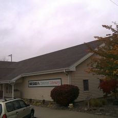
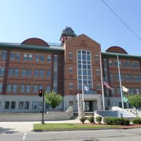
County services are accessed through the main office in St. Johns, with additional facilities located across various townships and municipalities. Interstate 69 crosses the southern section, providing convenient access to the wider region.

Interstate 69 crosses the southern section of Clinton County, connecting the region to the Capital Region International Airport and surrounding transportation networks.

Location: Michigan

Inception: 1831

Capital city: St. Johns

Shares border with: Gratiot County, Eaton County, Ingham County, Shiawassee County, Ionia County, Montcalm County

Website: http://clinton-county.org

GPS coordinates: 42.94000,-84.61000

Latest update: December 7, 2025 10:03

Photos
Around this place
Show the full map
Sleepy Hollow State Park
United States of America

Sleepy Hollow State Park

16.1 km
Dodge Mansion
United States of America

Dodge Mansion

21.6 km
Michigan Wetland Management District
United States of America

Michigan Wetland Management District

21.3 km
Old Town
United States of America

Old Town

22 km
Grist Mill Bridge, Dam and Mill Site
United States of America

Grist Mill Bridge, Dam and Mill Site

23.6 km
St. Mary Church
United States of America

St. Mary Church

22.4 km
First Baptist Church
United States of America

First Baptist Church

23.2 km
First Congregational Church of Ovid
United States of America

First Congregational Church of Ovid

20.8 km
East Ward School
United States of America

East Ward School

8.5 km
Stony Creek Bridge
United States of America

Stony Creek Bridge

3.7 km
Union School
United States of America

Union School

7.6 km
Central Methodist Episcopal Church
United States of America

Central Methodist Episcopal Church

23.3 km
Christman Building
United States of America

Christman Building

23.3 km
Franklin Avenue Presbyterian Church
United States of America

Franklin Avenue Presbyterian Church

21.9 km
Portland First Congregational Church
United States of America

Portland First Congregational Church

21.3 km
Brown-Price House
United States of America

Brown-Price House

22.2 km
Lansing Civil Air Patrol Quonset Huts
United States of America

Lansing Civil Air Patrol Quonset Huts

18.3 km
Genesee Street School
United States of America

Genesee Street School

22.7 km
Smith-Turner House
United States of America

Smith-Turner House

21.9 km
Saint John's Church Historical Marker
United States of America

Saint John's Church Historical Marker

8.3 km
St. Johns Cinema
United States of America

St. Johns Cinema

9.1 km
Lansing Mall Cinema
United States of America

Lansing Mall Cinema

21.9 km
Gunnisonville United Methodist Church Historical Marker
United States of America

Gunnisonville United Methodist Church Historical Marker

15.9 km
Saint Johns
United States of America

Saint Johns

8 km
Clinton Theater
United States of America

Clinton Theater

8 km
Paine-Gillam-Scott House Historical Marker
United States of America

Paine-Gillam-Scott House Historical Marker

7.9 km
Briggs Public Library
United States of America

Briggs Public Library

8.3 km
Lake Ovid
United States of America

Lake Ovid

16.3 km
Show the full map
Reviews

Visited this place? Tap the stars to rate it and share your experience / photos with the community! Try now! You can cancel it anytime.

Administrative divisions
« Clinton County - Administrative county in central Michigan, United States » is provided by Around Us (aroundus.com). Images and texts are derived from Wikimedia project under a Creative Commons license. You are allowed to copy, distribute, and modify copies of this page, under the conditions set by the license, as long as this note is clearly visible.

Discover hidden gems everywhere you go!

From secret cafés to breathtaking viewpoints, skip the crowded tourist spots and find places that match your style. Our app makes it easy with voice search, smart filtering, route optimization, and insider tips from travelers worldwide. Download now for the complete mobile experience.

Around Us App Screenshot

A unique approach to discovering new places

Le Figaro

All the places worth exploring

France Info

A tailor-made excursion in just a few clicks

20 Minutes