Aitkin County

Log in to your account

AroundUs is a community-driven map of interesting places, built by curious explorers like you. It grows with every review, story, and photo you share.
Connect to save your favorite spots, contribute locations, and create personalized routes.
Continue with Google
Continue with Apple
Continue with X
Continue with Facebook
Continue with email
By continuing, you accept our Terms and Conditions and our Privacy Policy
Create an account
Add to collection
Map
Suggest a change
Share

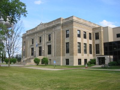
Aitkin County, Administrative division in Minnesota, US

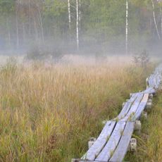
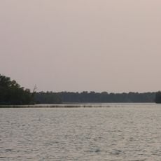
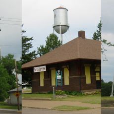
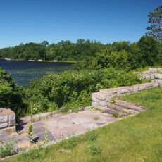
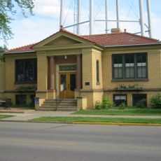
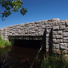
Aitkin County is an administrative division in northern Minnesota containing hundreds of lakes and waterways throughout its terrain. The region includes several towns and rural communities that make up the county's landscape.

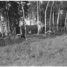
The county was established on June 30, 1871, during a period of settlement and resource development in northern Minnesota. Economic growth shifted from timber and farming toward broader regional development over time.

The annual Fish House Parade shows how communities here celebrate their connection to water and fishing traditions. This event reflects how central these activities are to the identity of people living throughout the region.

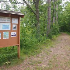
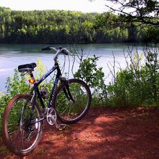
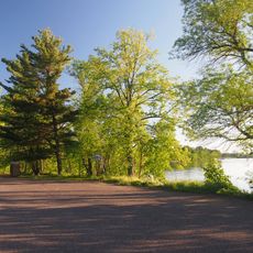
The region is most accessible during warmer months when lakes are ice-free and outdoor activities are easiest to enjoy. Visitors should know that rural areas require travel between locations, and services are not available everywhere.

The county manages an extensive network of waterways that requires specialized boat patrols and water rescue teams across the area. This large-scale system makes water safety and navigation key operational concerns for local authorities.

Location: Minnesota

Inception: June 30, 1871

Capital city: Aitkin

Shares border with: Itasca County, St. Louis County, Carlton County, Pine County, Kanabec County, Mille Lacs County, Crow Wing County, Cass County

Website: http://co.aitkin.mn.us

GPS coordinates: 46.61000,-93.41000

Latest update: December 7, 2025 19:25

Photos
Around this place
Milford Mine
United States of America

Milford Mine

43.7 km
Savanna Portage State Park
United States of America

Savanna Portage State Park

31.9 km
Cuyuna Country State Recreation Area
United States of America

Cuyuna Country State Recreation Area

45.5 km
Mille Lacs National Wildlife Refuge
United States of America

Mille Lacs National Wildlife Refuge

51 km
Rice Lake National Wildlife Refuge
United States of America

Rice Lake National Wildlife Refuge

10.4 km
Mille Lacs Indian Museum
United States of America

Mille Lacs Indian Museum

54.4 km
Savanna State Forest
United States of America

Savanna State Forest

27.9 km
Aitkin County Courthouse and Jail
United States of America

Aitkin County Courthouse and Jail

24.5 km
Bethlehem Lutheran Church
United States of America

Bethlehem Lutheran Church

21.7 km
Deerwood Auditorium
United States of America

Deerwood Auditorium

40.4 km
Patrick Casey House
United States of America

Patrick Casey House

24.3 km
Cuyuna Iron Range Municipally-Owned Elevated Metal Water Tanks
United States of America

Cuyuna Iron Range Municipally-Owned Elevated Metal Water Tanks

43.7 km
Kenney Lake Overlook
United States of America

Kenney Lake Overlook

45.7 km
Aitkin Carnegie Library
United States of America

Aitkin Carnegie Library

24.4 km
Pine-Hickory Lakes Roadside Parking Area
United States of America

Pine-Hickory Lakes Roadside Parking Area

31.2 km
Arthyde Stone House
United States of America

Arthyde Stone House

37.6 km
Potter/Casey Company Building
United States of America

Potter/Casey Company Building

24.3 km
Ironton Sintering Plant Complex
United States of America

Ironton Sintering Plant Complex

45.2 km
St. Alban's Bay Culvert
United States of America

St. Alban's Bay Culvert

48.9 km
Bridge No. 3355-Kathio Township
United States of America

Bridge No. 3355-Kathio Township

52.9 km
Mille Lacs Indian Museum
United States of America

Mille Lacs Indian Museum

55.1 km
Solana State Forest
United States of America

Solana State Forest

35.4 km
Rialto Theatre
United States of America

Rialto Theatre

24.2 km
White Pine Lookout Tower
United States of America

White Pine Lookout Tower

34 km
Quadna Fire Tower
United States of America

Quadna Fire Tower

41.5 km
Sandy Lake Lookout Tower
United States of America

Sandy Lake Lookout Tower

18.1 km
Emily Lookout Tower
United States of America

Emily Lookout Tower

40.7 km
Ball Bluff Lookout Tower
United States of America

Ball Bluff Lookout Tower

38.7 km
Show the full map
Reviews

Visited this place? Tap the stars to rate it and share your experience / photos with the community! Try now! You can cancel it anytime.

« Aitkin County - Administrative division in Minnesota, US » is provided by Around Us (aroundus.com). Images and texts are derived from Wikimedia project under a Creative Commons license. You are allowed to copy, distribute, and modify copies of this page, under the conditions set by the license, as long as this note is clearly visible.

Discover hidden gems everywhere you go!

From secret cafés to breathtaking viewpoints, skip the crowded tourist spots and find places that match your style. Our app makes it easy with voice search, smart filtering, route optimization, and insider tips from travelers worldwide. Download now for the complete mobile experience.

Around Us App Screenshot

A unique approach to discovering new places

Le Figaro

All the places worth exploring

France Info

A tailor-made excursion in just a few clicks

20 Minutes