Enable Location

We need your location to show you interesting places around you

Discover nearby places

Find interesting locations and hidden gems around you

Precise directions

Get accurate directions and distances to places

Your location is never shared with other users. It's only used when you tap the location button.

Cuyuna Country State Recreation Area

Log in to your account

Start exploring — it's free

Trusted by 65,063 travelers worldwide

Continue with Google
Continue with Apple
or

We will send you a code to connect

By continuing, you accept our Terms and Conditions and our Privacy Policy

Check your inbox

We've sent a pincode in your inbox. Please enter the code below.

Cuyuna Country State Recreation Area
Discussion Reviews 1 Photos
3.6k Popularity

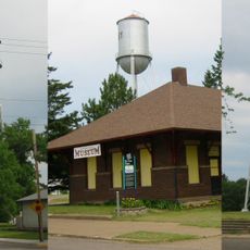
Cuyuna Country State Recreation Area, State recreation area in Crow Wing County, Minnesota.

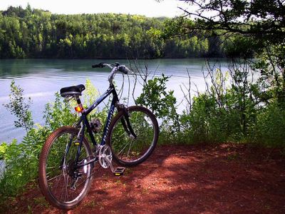
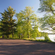
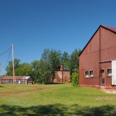
Cuyuna Country State Recreation Area is a state recreation area in Crow Wing County, Minnesota, built on the grounds of former iron ore mining. It offers a large network of trails designed primarily for mountain biking, alongside several mine pit lakes scattered across the land.

The land was part of the Cuyuna Iron Range, a major iron ore mining district that operated through much of the 20th century. After mining stopped, the site was converted into a state recreation area in 1993.

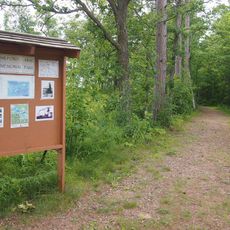
Mountain bikers of all levels ride trails sorted by difficulty, and this has built a strong community around the sport over the years. The area draws groups and families who come together to cycle through open natural surroundings.

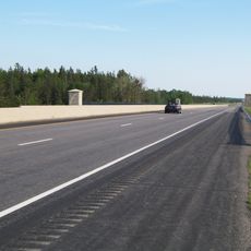
A Minnesota State Park vehicle permit is required to enter and can be bought online or at the entrance. Some trails close during deer hunting season in early to mid-November, so it is worth checking current conditions before you go.

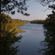
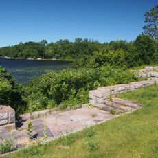
The Portsmouth Mine Pit Lake formed in an abandoned mining pit and is considered the deepest lake in Minnesota. It sits right in the middle of what was once an active industrial site, which makes its clear water all the more unexpected.

The community of curious travelers

AroundUs brings together thousands of curated places, local tips, and hidden gems, enriched daily by 60,000 contributors worldwide.

Start exploring
Location
Inception
1993
Address
307 3rd Street, Ironton, MN 56455
Phone
GPS coordinates
46.48940,-93.97750
Latest update
March 3, 2026 14:00
Around this place
Paul Bunyan Land
United States of America

Paul Bunyan Land

15.9 km
Milford Mine
United States of America

Milford Mine

5.1 km
Crow Wing State Park
United States of America

Crow Wing State Park

36.5 km
Brainerd Water Tower
United States of America

Brainerd Water Tower

22.4 km
Crow Wing County Courthouse and Jail
United States of America

Crow Wing County Courthouse and Jail

22.9 km
Brainerd Public Library
United States of America

Brainerd Public Library

22.4 km
Aitkin County Courthouse and Jail
United States of America

Aitkin County Courthouse and Jail

21 km
Wilford H. Fawcett House
United States of America

Wilford H. Fawcett House

20.9 km
Bethlehem Lutheran Church
United States of America

Bethlehem Lutheran Church

27.7 km
Deerwood Auditorium
United States of America

Deerwood Auditorium

6.2 km
Franklin Junior High School
United States of America

Franklin Junior High School

22 km
Patrick Casey House
United States of America

Patrick Casey House

21.4 km
Cuyuna Iron Range Municipally-Owned Elevated Metal Water Tanks
United States of America

Cuyuna Iron Range Municipally-Owned Elevated Metal Water Tanks

2.1 km
Kenney Lake Overlook
United States of America

Kenney Lake Overlook

20.8 km
Aitkin Carnegie Library
United States of America

Aitkin Carnegie Library

21.1 km
Parker Building
United States of America

Parker Building

22.6 km
Pine-Hickory Lakes Roadside Parking Area
United States of America

Pine-Hickory Lakes Roadside Parking Area

19.1 km
Minnesota Highway 371 Bridge
United States of America

Minnesota Highway 371 Bridge

29.7 km
Cole Memorial Building
United States of America

Cole Memorial Building

28.7 km
Potter/Casey Company Building
United States of America

Potter/Casey Company Building

21.3 km
Washington Street Bridge
United States of America

Washington Street Bridge

23.1 km
Ironton Sintering Plant Complex
United States of America

Ironton Sintering Plant Complex

276 m
St. Alban's Bay Culvert
United States of America

St. Alban's Bay Culvert

26.7 km
Bridge No. 3355-Kathio Township
United States of America

Bridge No. 3355-Kathio Township

33.6 km
Pequot Fire Lookout Tower
United States of America

Pequot Fire Lookout Tower

27.6 km
Rialto Theatre
United States of America

Rialto Theatre

21.3 km
Northern Pacific Railroad Shops Historic District
United States of America

Northern Pacific Railroad Shops Historic District

21.6 km
Emily Lookout Tower
United States of America

Emily Lookout Tower

21.5 km
Show the full map
Reviews
Share your experience

No review yet

Discussions
Start a discussion...

No discussion yet

« Cuyuna Country State Recreation Area - State recreation area in Crow Wing County, Minnesota » is provided by Around Us (aroundus.com). Images and texts are derived from Wikimedia project under a Creative Commons license. You are allowed to copy, distribute, and modify copies of this page, under the conditions set by the license, as long as this note is clearly visible.

Discover hidden gems everywhere you go!

From secret cafés to breathtaking viewpoints, skip the crowded tourist spots and find places that match your style. Our app makes it easy with voice search, smart filtering, route optimization, and insider tips from travelers worldwide. Download now for the complete mobile experience.

Around Us App Screenshot

A unique approach to discovering new places

Le Figaro

All the places worth exploring

France Info

A tailor-made excursion in just a few clicks

20 Minutes

Around Us
Travel Guide & Maps
Download

Send to your phone

QR Code
1

Open the camera app on your mobile.

2

Point at the QR code with your camera. A notification will appear.

3

Tap the notification to open the link.