Crow Wing State Park

Log in to your account

AroundUs is a community-driven map of interesting places, built by curious explorers like you. It grows with every review, story, and photo you share.
Connect to save your favorite spots, contribute locations, and create personalized routes.
Continue with Google
Continue with Apple
Continue with X
Continue with Facebook
Continue with email
By continuing, you accept our Terms and Conditions and our Privacy Policy
Create an account
Add to collection
Map
Suggest a change
Share

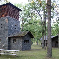
Crow Wing State Park, State park and archaeological site in central Minnesota, United States.

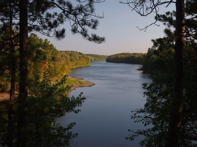
Crow Wing State Park sits where the Mississippi and Crow Wing Rivers meet in central Minnesota, covering a large forested area with multiple ecosystems. The terrain includes river bottomland, mature woods, and more open spaces that shift across the grounds.

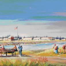
The area became a major hub for fur trading in the 1800s, drawing people from different backgrounds to settle and work. Protection as a state park came later to preserve the archaeological remains and historical significance of this riverside community.

The site holds meaning for Dakota communities and early European settlers who built their lives here. Visitors walking through the park can sense this shared history in the landscape itself.

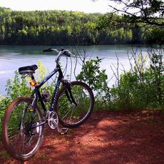
The park provides camping areas for different needs and hiking paths that run through the woods and open areas. Bring sturdy shoes and be prepared for changing weather, especially near the rivers where paths can be muddy.

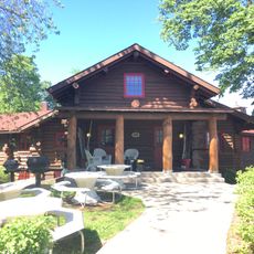
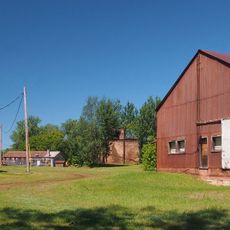
One building from the original 1849 settlement still stands on the grounds today, making it a rare survivor from that era. This trading house serves as a tangible connection to the people who lived and worked here over 170 years ago.

Location: Crow Wing County

Location: Morrison County

Location: Cass County

Inception: 1959

Website: https://dnr.state.mn.us/state_parks/park.html?id=spk00139

GPS coordinates: 46.27220,-94.33330

Latest update: December 11, 2025 11:06

Photos
Around this place
Paul Bunyan Land
United States of America

Paul Bunyan Land

24.8 km
Charles A. Lindbergh State Park
United States of America

Charles A. Lindbergh State Park

35.2 km
Fort Ripley
United States of America

Fort Ripley

11.2 km
Cuyuna Country State Recreation Area
United States of America

Cuyuna Country State Recreation Area

36.5 km
Minnesota Military Museum
United States of America

Minnesota Military Museum

21.3 km
Brainerd Water Tower
United States of America

Brainerd Water Tower

14.1 km
Crow Wing County Courthouse and Jail
United States of America

Crow Wing County Courthouse and Jail

13.6 km
Brainerd Public Library
United States of America

Brainerd Public Library

14.1 km
Wilford H. Fawcett House
United States of America

Wilford H. Fawcett House

36.7 km
Church of Our Savior-Episcopal
United States of America

Church of Our Savior-Episcopal

33 km
Camp Ripley Bridge
United States of America

Camp Ripley Bridge

22 km
Franklin Junior High School
United States of America

Franklin Junior High School

14.4 km
Charles A. Weyerhaeuser and Musser Houses
United States of America

Charles A. Weyerhaeuser and Musser Houses

33.6 km
Almond A. White House
United States of America

Almond A. White House

24.7 km
Burton-Rosenmeier House
United States of America

Burton-Rosenmeier House

33.6 km
Parker Building
United States of America

Parker Building

13.9 km
Minnesota Highway 371 Bridge
United States of America

Minnesota Highway 371 Bridge

6.8 km
Morrison County Courthouse
United States of America

Morrison County Courthouse

33.1 km
Cole Memorial Building
United States of America

Cole Memorial Building

36.9 km
Pine Tree Lumber Company Office Building
United States of America

Pine Tree Lumber Company Office Building

32.1 km
Washington Street Bridge
United States of America

Washington Street Bridge

13.4 km
Little Falls Carnegie Library
United States of America

Little Falls Carnegie Library

33 km
Ironton Sintering Plant Complex
United States of America

Ironton Sintering Plant Complex

36.7 km
Little Falls Commercial Historic District
United States of America

Little Falls Commercial Historic District

33 km
Charles A. Lindbergh State Park WPA/Rustic Style Historic Resources
United States of America

Charles A. Lindbergh State Park WPA/Rustic Style Historic Resources

35.3 km
Charles Lindbergh House and Museum
United States of America

Charles Lindbergh House and Museum

35 km
Minnesota Fishing Museum
United States of America

Minnesota Fishing Museum

33 km
Northern Pacific Railroad Shops Historic District
United States of America

Northern Pacific Railroad Shops Historic District

14.9 km
Show the full map
Reviews

Visited this place? Tap the stars to rate it and share your experience / photos with the community! Try now! You can cancel it anytime.

« Crow Wing State Park - State park and archaeological site in central Minnesota, United States » is provided by Around Us (aroundus.com). Images and texts are derived from Wikimedia project under a Creative Commons license. You are allowed to copy, distribute, and modify copies of this page, under the conditions set by the license, as long as this note is clearly visible.

Discover hidden gems everywhere you go!

From secret cafés to breathtaking viewpoints, skip the crowded tourist spots and find places that match your style. Our app makes it easy with voice search, smart filtering, route optimization, and insider tips from travelers worldwide. Download now for the complete mobile experience.

Around Us App Screenshot

A unique approach to discovering new places

Le Figaro

All the places worth exploring

France Info

A tailor-made excursion in just a few clicks

20 Minutes