Cass County

Log in to your account

AroundUs is a community-driven map of interesting places, built by curious explorers like you. It grows with every review, story, and photo you share.
Connect to save your favorite spots, contribute locations, and create personalized routes.
By continuing, you accept our Terms and Conditions and our Privacy Policy
Add to collection
Map
Suggest a change
Share

Cass County, Administrative division in central Minnesota, United States

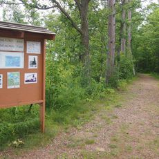
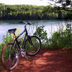
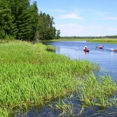
Cass County is an administrative area in central Minnesota with forested rolling terrain and numerous lakes scattered throughout the landscape. Walker serves as the county seat and houses the main administrative offices.

The Minnesota Territory legislature established the county in 1851 and named it after a prominent political figure. Settlement and economic development followed in subsequent decades.

The Leech Lake Indian Reservation is a living center of Ojibwe traditions and customs within the county. Visitors can observe how these practices remain woven into the daily life and events of the community.

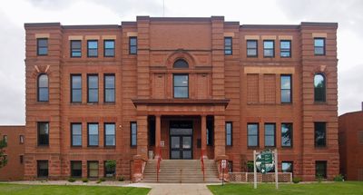
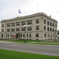
Visitors can reach county offices in Walker for administrative inquiries, and public meetings are open to interested parties. It helps to check ahead for meeting schedules and office hours before planning a visit.

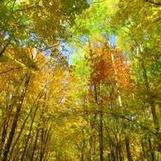
The region experiences dramatic temperature swings between very cold and very hot periods throughout the year. These shifts shape how residents adapt to the changing seasons.

Location: Minnesota

Inception: March 31, 1851

Capital city: Walker

Shares border with: Hubbard County, Aitkin County, Crow Wing County, Morrison County, Itasca County, Todd County, Wadena County, Beltrami County

Website: http://co.cass.mn.us

GPS coordinates: 46.95000,-94.32000

Latest update: December 7, 2025 19:23

Photos
Around this place
Lake Winnibigoshish
United States of America

Lake Winnibigoshish

56.7 km
Paul Bunyan Land
United States of America

Paul Bunyan Land

70.1 km
Milford Mine
United States of America

Milford Mine

53.4 km
Cuyuna Country State Recreation Area
United States of America

Cuyuna Country State Recreation Area

57.6 km
The Big Fish
United States of America

The Big Fish

44.9 km
Brainerd Water Tower
United States of America

Brainerd Water Tower

66.5 km
Schoolcraft State Park
United States of America

Schoolcraft State Park

49.9 km
Bowstring State Forest
United States of America

Bowstring State Forest

54.9 km
Crow Wing County Courthouse and Jail
United States of America

Crow Wing County Courthouse and Jail

66.8 km
Brainerd Public Library
United States of America

Brainerd Public Library

66.5 km
Badoura State Forest
United States of America

Badoura State Forest

32.3 km
Wilford H. Fawcett House
United States of America

Wilford H. Fawcett House

41 km
Deerwood Auditorium
United States of America

Deerwood Auditorium

61.8 km
Franklin Junior High School
United States of America

Franklin Junior High School

66.4 km
Almond A. White House
United States of America

Almond A. White House

72.6 km
Cuyuna Iron Range Municipally-Owned Elevated Metal Water Tanks
United States of America

Cuyuna Iron Range Municipally-Owned Elevated Metal Water Tanks

59 km
Kenney Lake Overlook
United States of America

Kenney Lake Overlook

78.3 km
Parker Building
United States of America

Parker Building

66.8 km
Minnesota Highway 371 Bridge
United States of America

Minnesota Highway 371 Bridge

71 km
Cole Memorial Building
United States of America

Cole Memorial Building

38.6 km
Washington Street Bridge
United States of America

Washington Street Bridge

66.4 km
Ironton Sintering Plant Complex
United States of America

Ironton Sintering Plant Complex

57.7 km
Remer State Forest
United States of America

Remer State Forest

42.5 km
Pequot Fire Lookout Tower
United States of America

Pequot Fire Lookout Tower

38.6 km
Sandtrap Golf Course
United States of America

Sandtrap Golf Course

52.6 km
Northern Pacific Railroad Shops Historic District
United States of America

Northern Pacific Railroad Shops Historic District

66.7 km
Draper Lookout Tower
United States of America

Draper Lookout Tower

30.2 km
Cuba Hill Lookout Tower
United States of America

Cuba Hill Lookout Tower

45.5 km
Show the full map
Reviews

Visited this place? Tap the stars to rate it and share your experience / photos with the community! Try now! You can cancel it anytime.

« Cass County - Administrative division in central Minnesota, United States » is provided by Around Us (aroundus.com). Images and texts are derived from Wikimedia project under a Creative Commons license. You are allowed to copy, distribute, and modify copies of this page, under the conditions set by the license, as long as this note is clearly visible.

Discover hidden gems everywhere you go!

From secret cafés to breathtaking viewpoints, skip the crowded tourist spots and find places that match your style. Our app makes it easy with voice search, smart filtering, route optimization, and insider tips from travelers worldwide. Download now for the complete mobile experience.

Around Us App Screenshot

A unique approach to discovering new places

Le Figaro

All the places worth exploring

France Info

A tailor-made excursion in just a few clicks

20 Minutes